June 8-14, 2026
Temperature
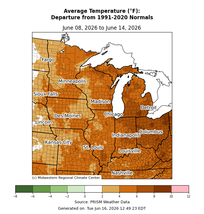
Average temperatures were above normal for the entire region (Figure 1). Departures ranged from 2-6°F above normal west of the Mississippi River to as much as 10°F above normal across eastern areas.
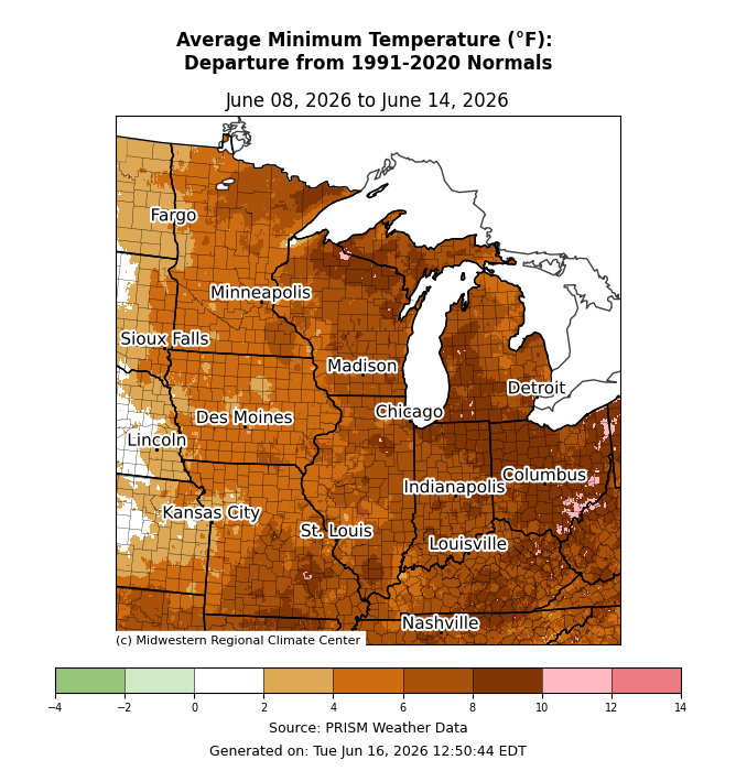
Minimum temperatures were above normal by up to 12°F across eastern Ohio (Figure 2). All locations east of the Mississippi River 5-10°F above normal. Much of Iowa, northern Missouri, and Minnesota were 3-6°F above normal for the week.
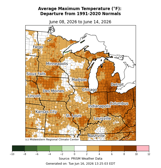
Maximum temperatures were 4-8°F above normal across eastern Indiana, Michigan, and Ohio (Figure 3). Much of the rest of the region was near to only slightly above normal by 2-4°F.
Precipitation/Drought
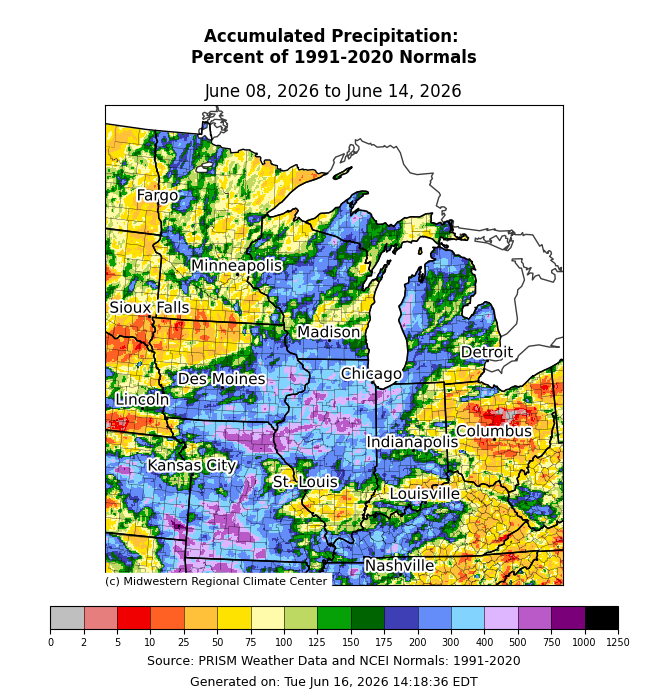
Precipitation was above normal for a large swath of the region including Missouri, southern/eastern Iowa, Illinois, Northwest Indiana, Michigan, and Wisconsin (Figure 4). In some of the aforementioned locations, precipitation was at least 300 percent of normal, occasionally exceeding 400-500 percent. In northwestern Iowa and Ohio, precipitation was lackluster, with less than 50 percent of normal observed in some areas.
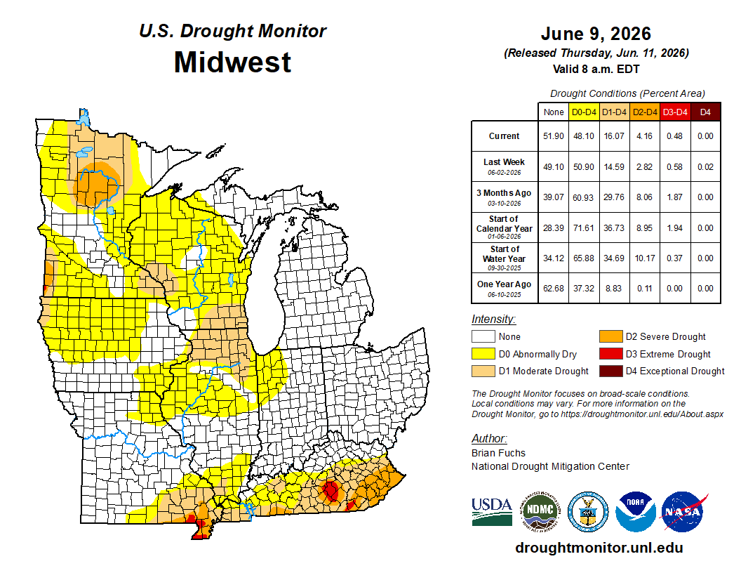
From June 2 to June 9, drought conditions changed minimally. The largest change was less than 3 percent removal of D0 (abnormally dry), which happened mostly over Illinois (Figure 5). There were slight expansions of less than 2 percent across the D1 (moderate drought) and D2 (severe drought) categories, mainly across northern Minnesota. There was a slight decrease in D4 (extreme drought) in Kentucky.
June 10-11 Severe Weather
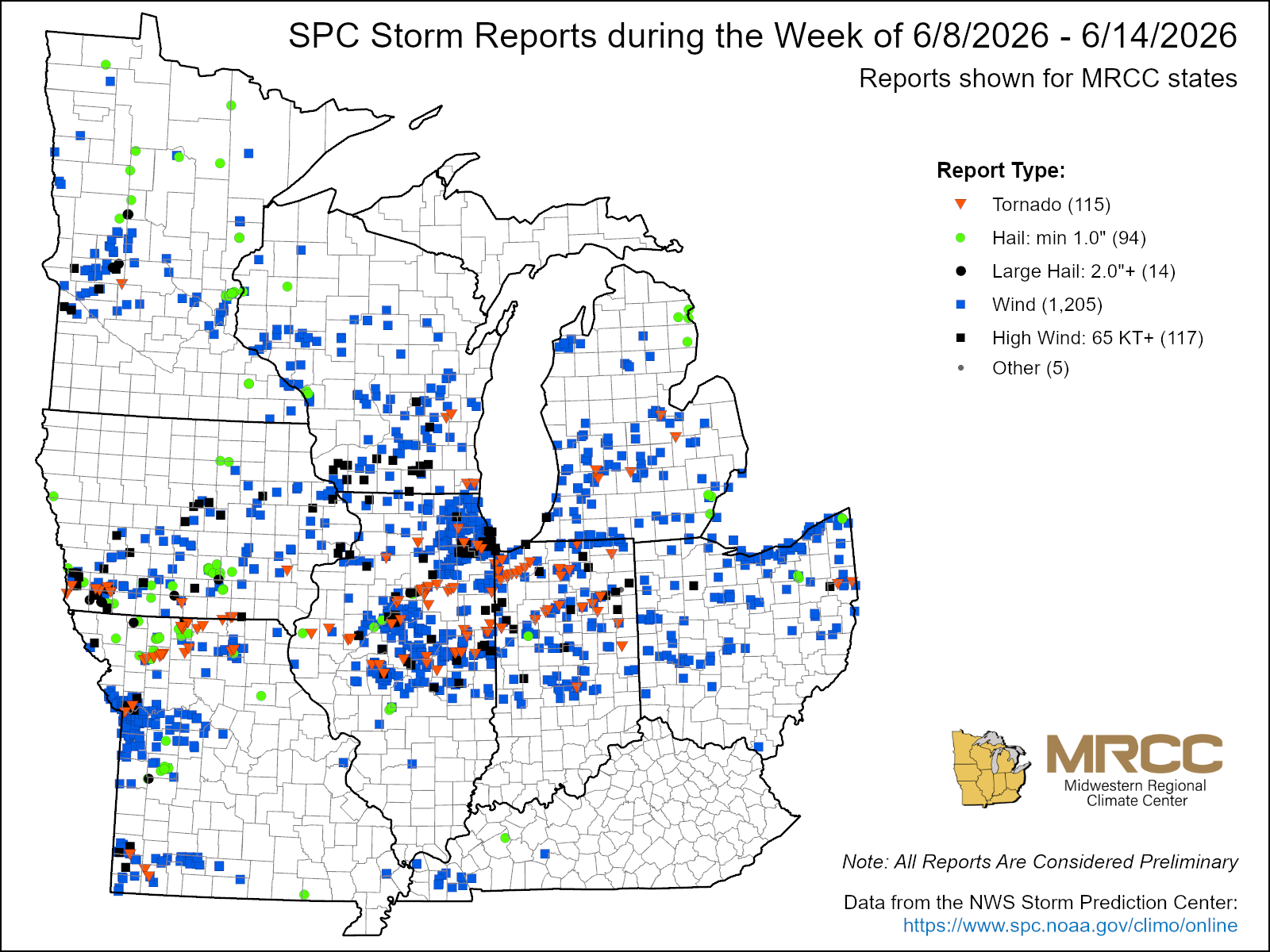
This was one of the most active weeks of the year thus far, with well over 1,000 storm reports in every state of the region (Figure 6). 1,205 reports were made for wind alone, but there were also 101 tornado reports and 92 hail reports. The vast majority of these storm reports were made as a result of storms moving through the region June 10-11. On June 10, tennis ball-sized hail was reported across Minnesota, and 80-90 mph straight-line wind gusts were reported in Wisconsin. These winds were the result of a confirmed derecho that swept through northern Illinois and northern Indiana.
More storms occurred on June 10, though these were discrete cells that produced several strong tornadoes. The National Weather Service (NWS) in Northern Indiana reported at least 13 confirmed tornadoes ranging from EF0 to EF3 strength. This included a long-track EF3 with estimated peak winds of 165 mph that spent 22 miles on the ground. This tornado tracked across Lake, Porter, and LaPorte counties, tearing down high-tension power trusses in its path. The NWS Central Illinois Weather Forecast Office similarly confirmed 12 tornadoes between June 10 and June 11, ranging from EF0 to EF3. In Illinois, 2 tornadoes rose to EF3 strength, one of which had estimated peak winds of 145 mph and caused 7 injuries in Livingston County.