June 1-7, 2026
June 1-7, 2026
Temperature
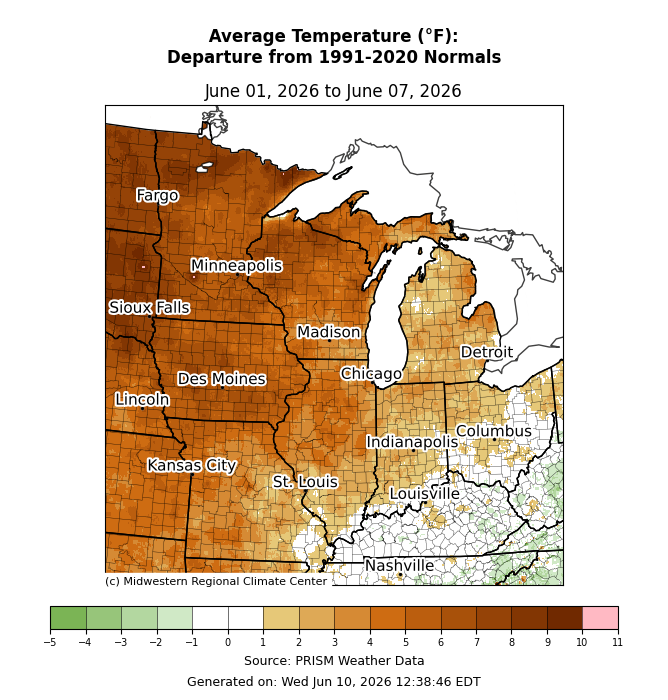
Average temperatures were mostly above normal, particularly to the north and west (Figure 1). Across Iowa, Minnesota, and Wisconsin, temperatures averaged 5-10°F above normal. Heading south and east, average temperatures were mainly 3-6°F above normal across Illinois, Michigan, and Missouri. Average temperatures were 1-3°F above normal across Indiana and Ohio, while temperatures were near normal along and south of the Ohio River in Kentucky.
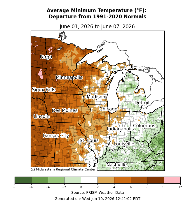
Minimum temperatures were above normal by 4-8°F for most areas west of the Mississippi River (Figure 2). Across Illinois and Wisconsin, minimum temperatures were 2-6°F above normal. Across Indiana, minimum temperatures were near normal. Across Lower Michigan, eastern Ohio, and Kentucky, minimum temperatures were slightly below normal by 1-3°F.
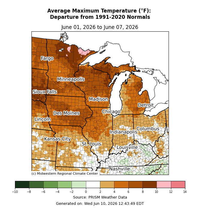
Maximum temperatures were 4-8°F above normal for much of the Upper Midwest (Figure 3). Some parts of far northern Minnesota were up to 10-12°F above normal. Maximum temperatures were near normal along and south of the Ohio River.
Precipitation/Drought
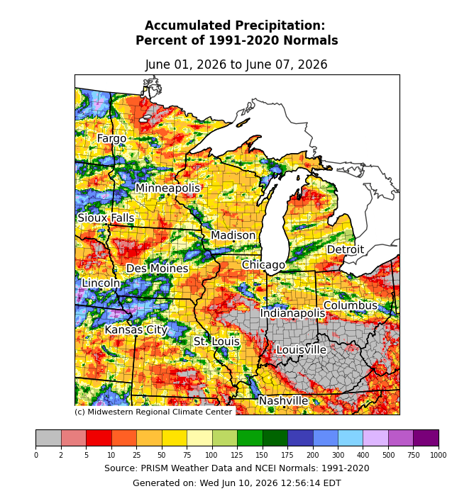
Precipitation was generally below normal, with parts of the Ohio River Basin receiving no precipitation (Figure 4). Some isolated pockets received heavy precipitation from scattered thunderstorms, particularly across northwestern Missouri and central Minnesota, which brought observed precipitation into the 200 percent of normal range. Elsewhere, precipitation was limited and scattershot, with less than 50 percent of normal precipitation for much of the region.
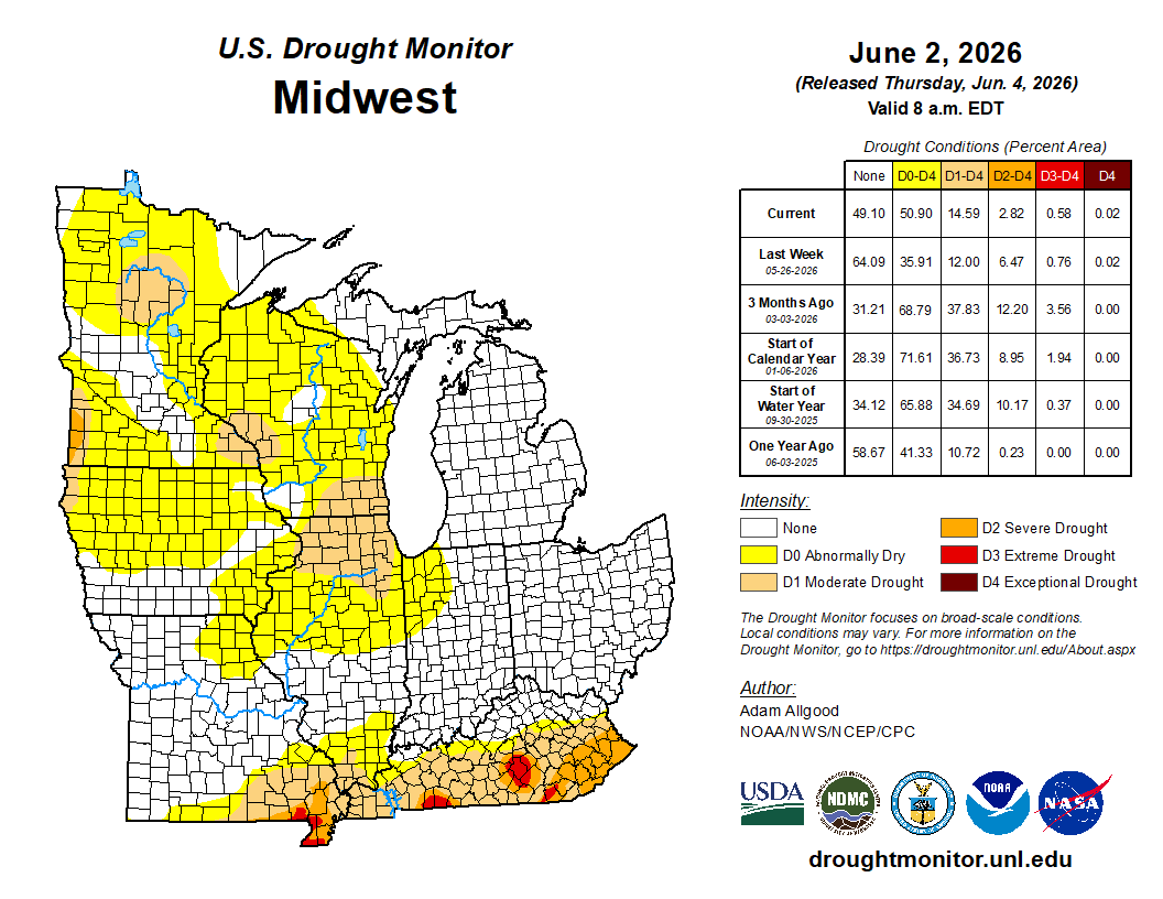
There were both improvements and degradations across various categories and locations this week (Figure 5). In Kentucky and southern Missouri, conditions improved in the D1 (moderate drought) and D2 (severe drought) categories. In northern Illinois, D0 (abnormally dry) and D1 were expanded. Similar degradations were made across Iowa, Minnesota, and Wisconsin.
Severe Weather
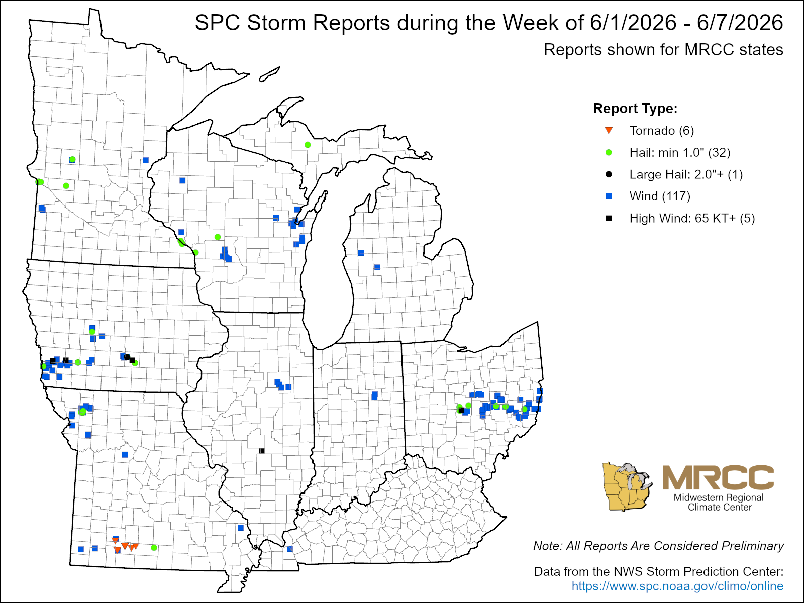
There were over 100 storm reports this week, with 117 specifically defined as wind reports (Figure 6). Many of these occurred as part of a squall line that moved across Ohio on June 6. There were also 6 tornado reports from the same outbreak, which ultimately became 6 confirmed EF1 tornadoes with estimated peak winds between 90-110 mph.