May 8-14, 2026
Temperature
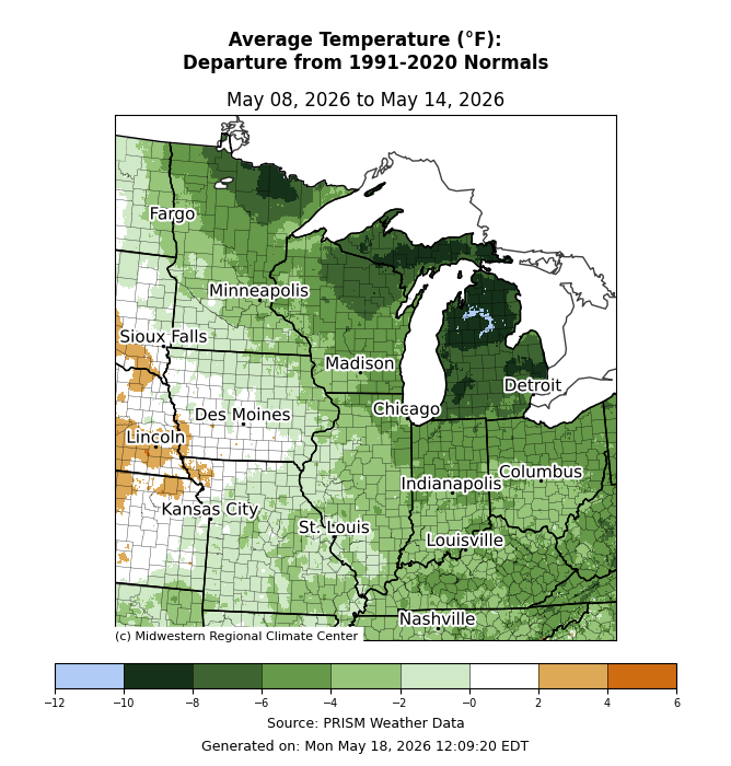
Average temperatures were below normal across much of the region (Figure 1). The Upper Midwest observed average temperatures up to 10°F below normal. Departures were slightly more across northern Lower Michigan. Heading south, temperatures were less anomalous, with average temperatures 2-6°F below normal. West of the Mississippi River in Iowa and northern Missouri, average temperatures were near to slightly below normal for the week.
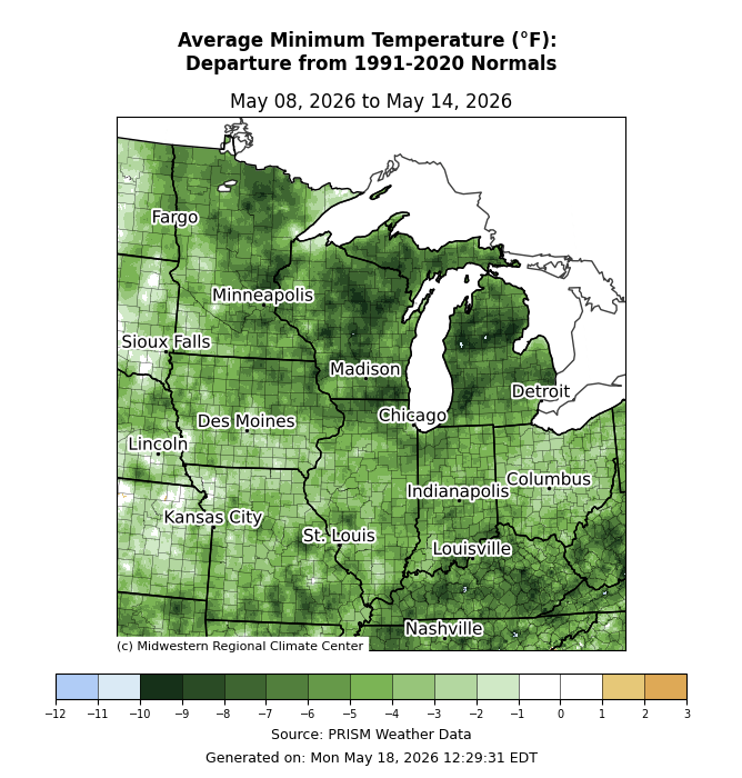
Minimum temperatures averaged below normal (Figure 2). Anomalies were most pronounced across Kentucky, southern Missouri, and the Upper Midwest, where minimum temperatures were 5-10°F below normal.
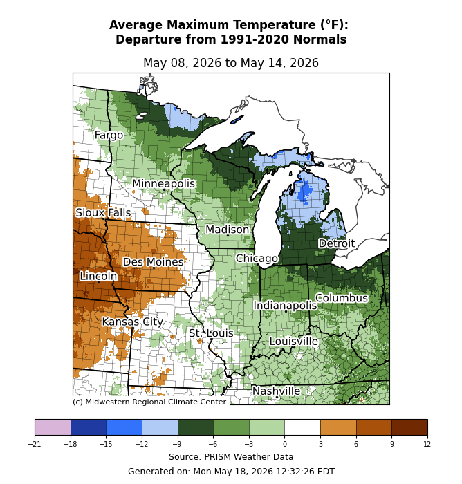
Maximum temperatures were most below normal across the Upper Midwest (Figure 3). More specifically, maximum temperatures were over 10°F below normal across northern Lower Michigan, Michigan’s Upper Peninsula, and northern Minnesota. Across Indiana and Ohio, maximum temperatures were generally 2-6°F below normal. West of the Mississippi River in Iowa, Missouri, and southern Minnesota, maximum temperatures were near to above normal by 3-6°F.
Precipitation/Drought
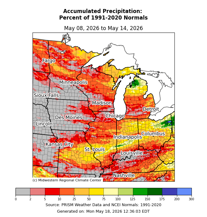
Precipitation was lackluster, with little to no precipitation west of the Mississippi River (Figure 4). Across the eastern and northern portions of the region, precipitation remained mostly below normal, with less than 40 percent of normal for much of Illinois, Indiana, Kentucky, southern Michigan, and southern Ohio. There were pockets of near- to slightly above-normal precipitation across eastern Ohio and northern Lower Michigan.
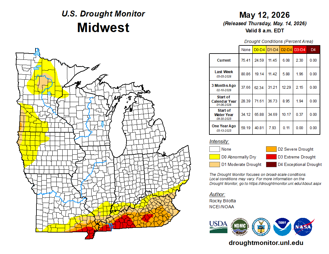
From May 5 to May 12, drought remained largely unchanged across the region (Figure 5). D0 conditions (abnormally dry) had the largest expansion from 19 to 24 percent coverage, with most of that occurring across Minnesota and western Iowa. Slight increases in D2 (severe drought) and D3 (extreme drought) were observed over Kentucky.
Severe Weather
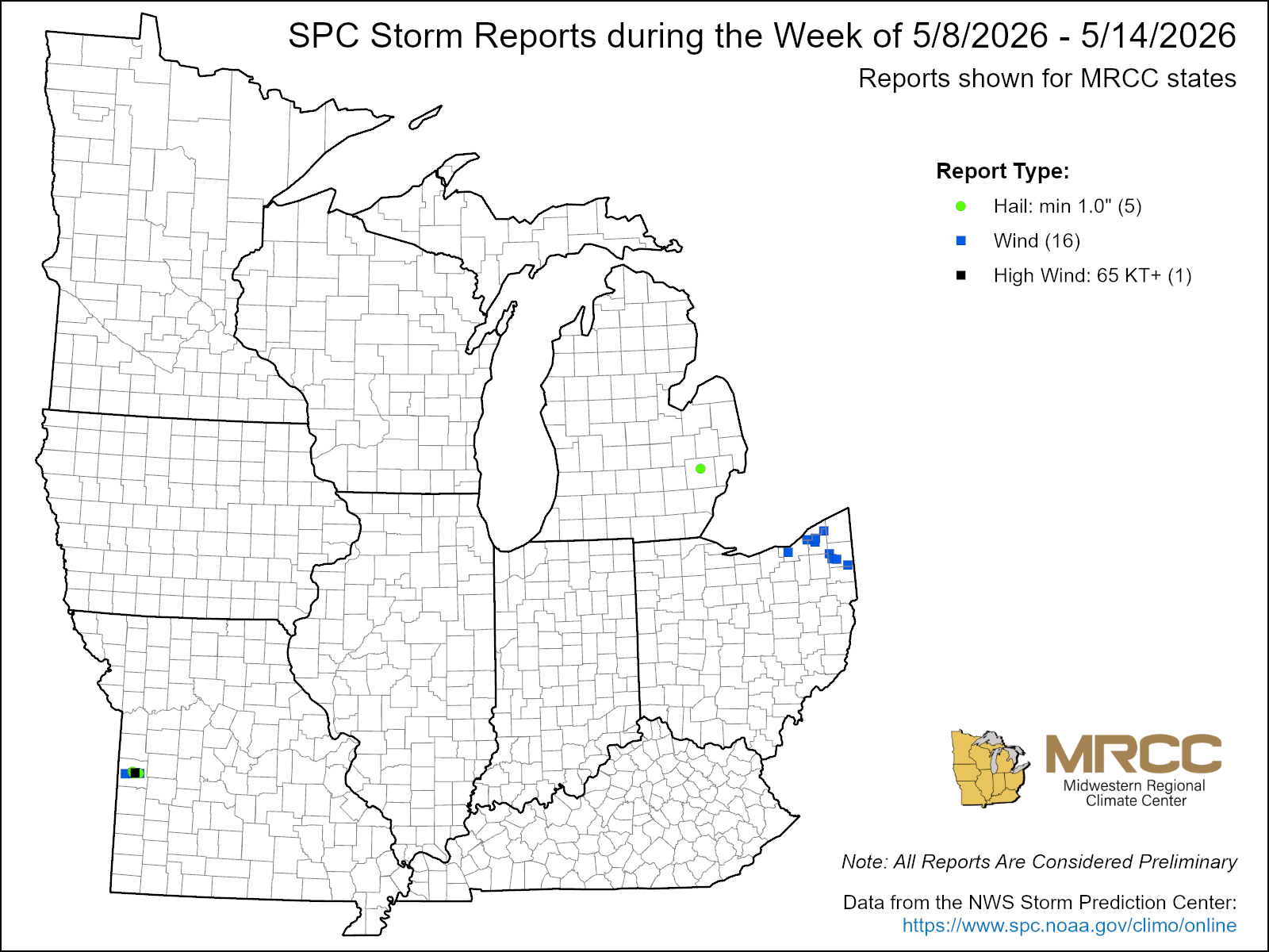
There was minimal severe weather this week with 16 wind reports, 1 high wind report, and 5 hail reports (Figure 6). Several wind reports occurred when a cluster of storms moved across Cleveland, Ohio. Gusts reached 60 mph, causing downed trees and power lines.