May 1-7, 2026
Temperature
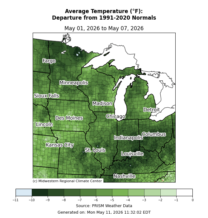
The first week of May was below normal for the entire region (Figure 1). Much of the region was at least 5°F below normal for the week. For many locations, it was the coldest start to May in at least 10 years. In International Falls, Minnesota, this week ranked the 6th coldest first week of May since records began in 1897.
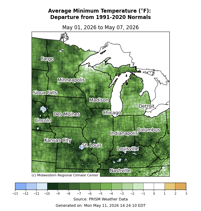
Minimum temperatures averaged 5-10°F below normal (Figure 2). Isolated areas in Kentucky and Missouri observed minimum temperatures that averaged more than 10°F below normal. Some locations along the Lake Superior shore observed near-normal minimum temperatures.
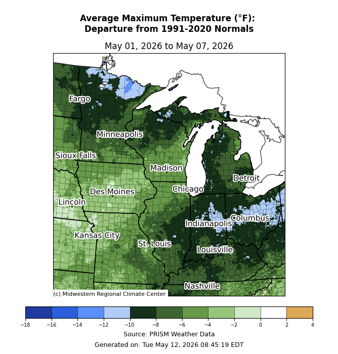
Maximum temperatures were below normal by varying magnitudes (Figure 3). Across northern Minnesota and central Indiana to the Ohio/Pennsylvania border, maximum temperatures were up to 10-12°F below normal. For much of the region, maximum temperatures were generally 5-10°F below normal. Across Iowa and northwestern Missouri, maximum temperatures were 2-4°F below normal. In International Falls, the temperature rose to only 36°F on May 5, marking the coldest maximum temperature in May since 2013.
Precipitation/Drought
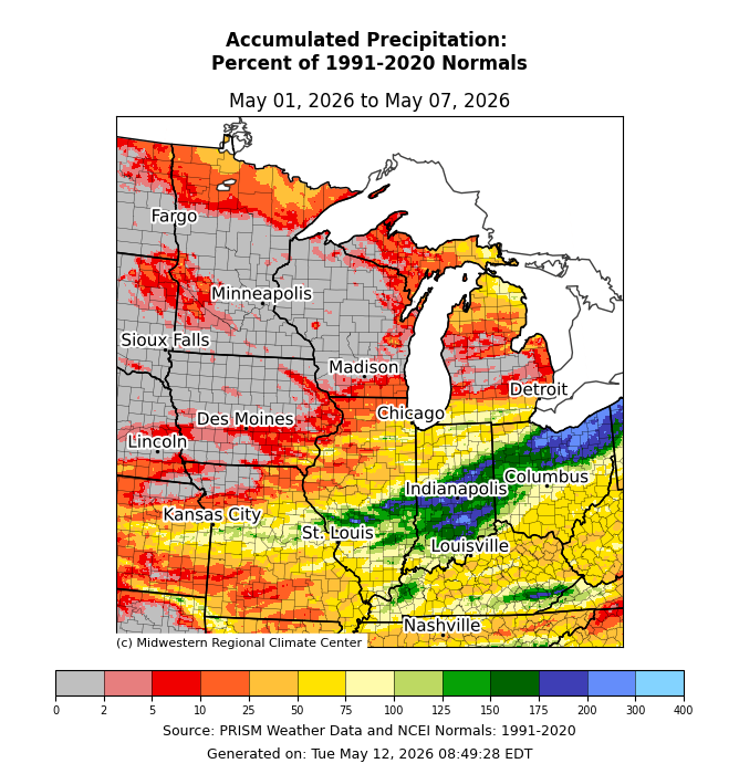
Across the Upper Midwest, there was little to no precipitation (Figure 4). Much of Illinois, Kentucky, and Missouri observed precipitation that was 25-75 percent of normal. Across the southern half of Indiana and northern Ohio, precipitation was generally above normal.
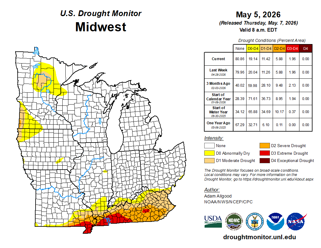
From April 28 to May 5, drought conditions were virtually unchanged (Figure 5). Minor changes were made across the D0 (abnormally dry) and D1 (moderate drought) categories.
Severe Weather
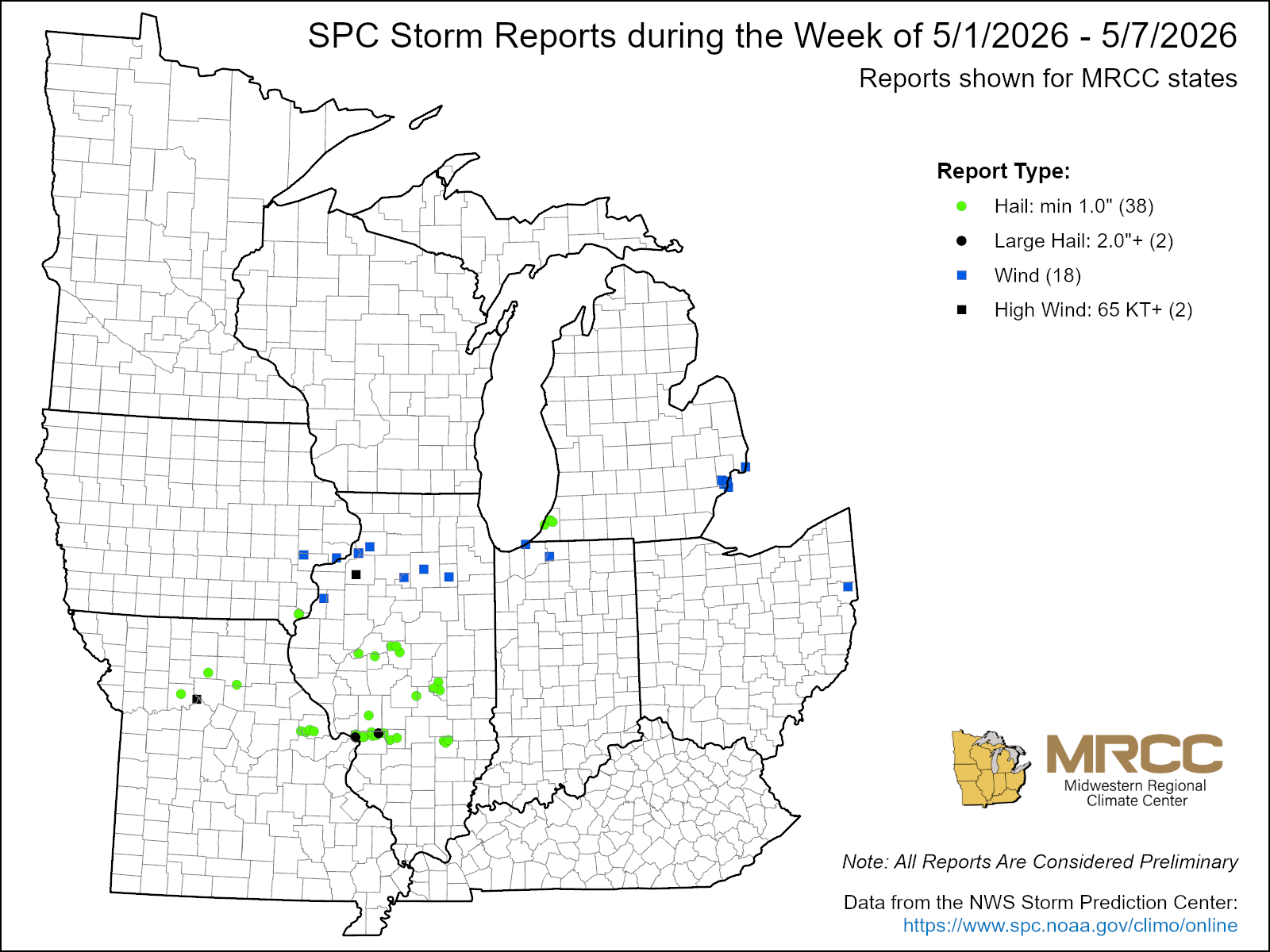
There were fewer than 100 storm reports this week (Figure 6). There were 38 hail reports and 18 wind reports. Most of these occurred during an outbreak on April 4, which brought wind and hail to Illinois and Missouri.