April 15-21, 2026
Temperature
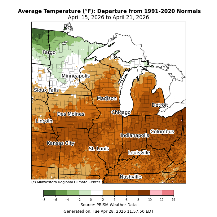
Average temperatures were above normal for much of the region, generally by 4-8°F (Figure 1). Across Minnesota and Michigan’s UP, average temperatures were near normal, and even slightly below normal across northern Minnesota.
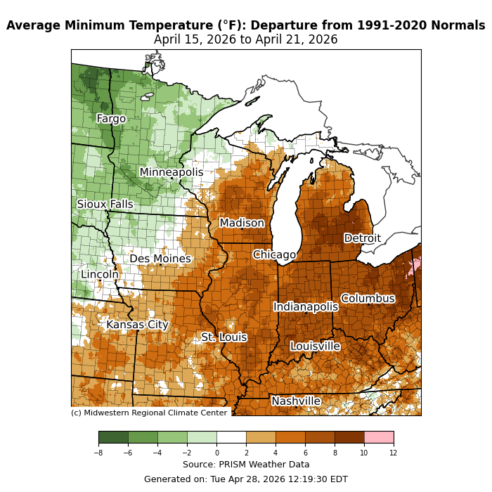
Minimum temperatures were most above normal to the east (Figure 2). Much of Indiana, Lower Michigan, and Ohio observed minimum temperatures 6-10°F below normal. Anomalies were less pronounced heading north and west. Minimum temperatures averaged below normal across Minnesota and northwestern Iowa.
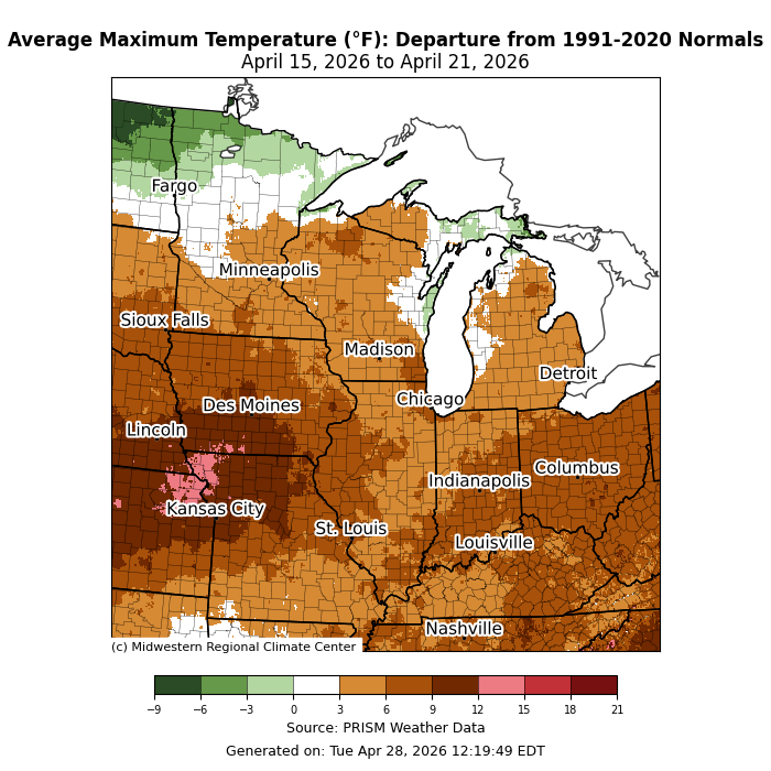
Maximum temperatures were above normal almost everywhere (Figure 3). Across much of the Upper Midwest, maximum temperatures were 3-6°F above normal. Across the Ohio Valley, they were 6-9°F above normal, while southern Iowa and northern Missouri were as much as 12°F above normal in spots.
Precipitation/Drought
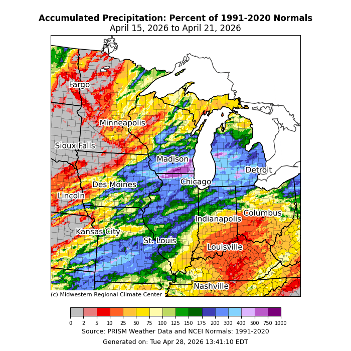
Precipitation was scattered across the region this week. For much of Missouri, Illinois, eastern Iowa, southern Wisconsin, northern Indiana, and Lower Michigan, precipitation was at least 200 percent of normal (Figure 4). Over southern Wisconsin, precipitation was over 500 percent of normal in spots. In Burlington, Wisconsin, 4.08 inches of precipitation fell on April 18, marking the 5th-wettest single-day since records began there in 1948. Jackson, Michigan, observed 2.30 inches of precipitation on April 15, which was the 3rd wettest April day on record since records began in 1944.
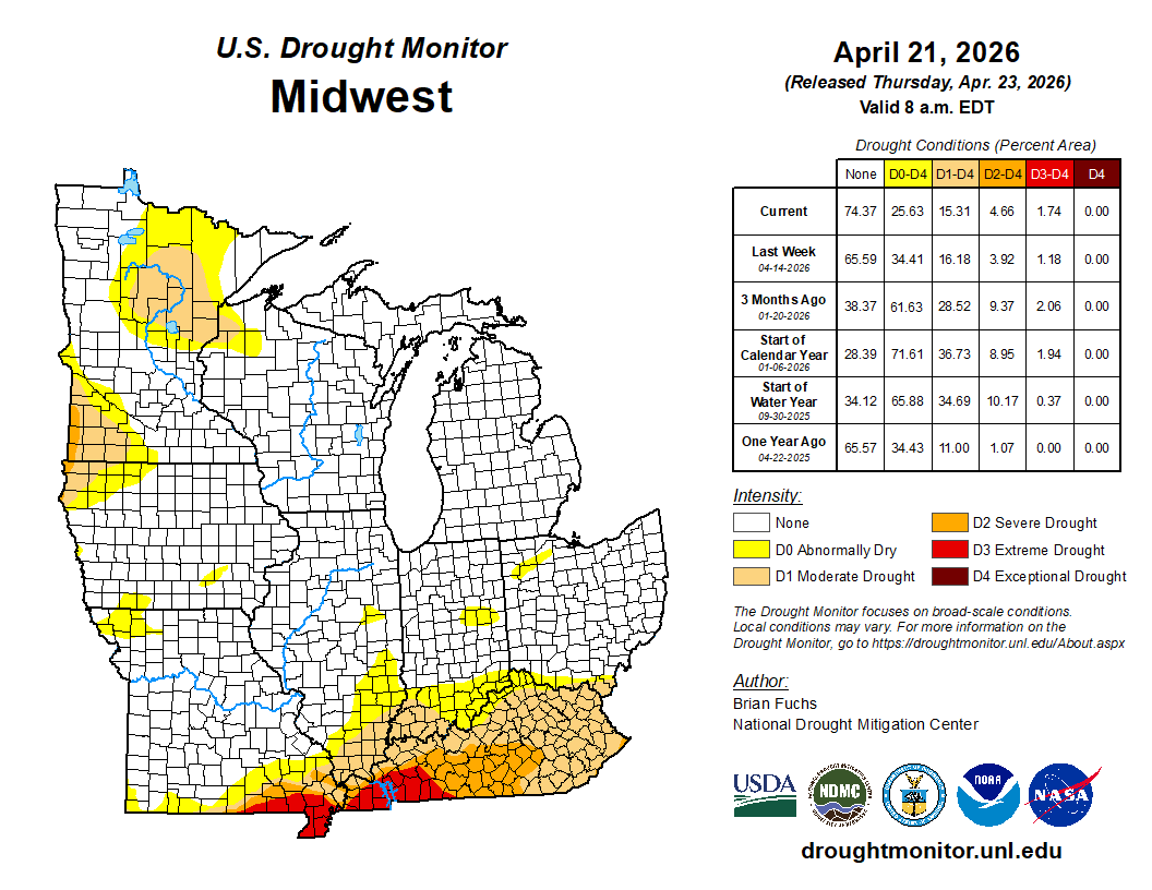
Drought conditions remained largely unchanged from April 14 to April 21. There were minor changes across all drought categories (Figure 5). There was an 8 percent decrease in abnormally dry (D0) conditions across the region.
Severe Weather
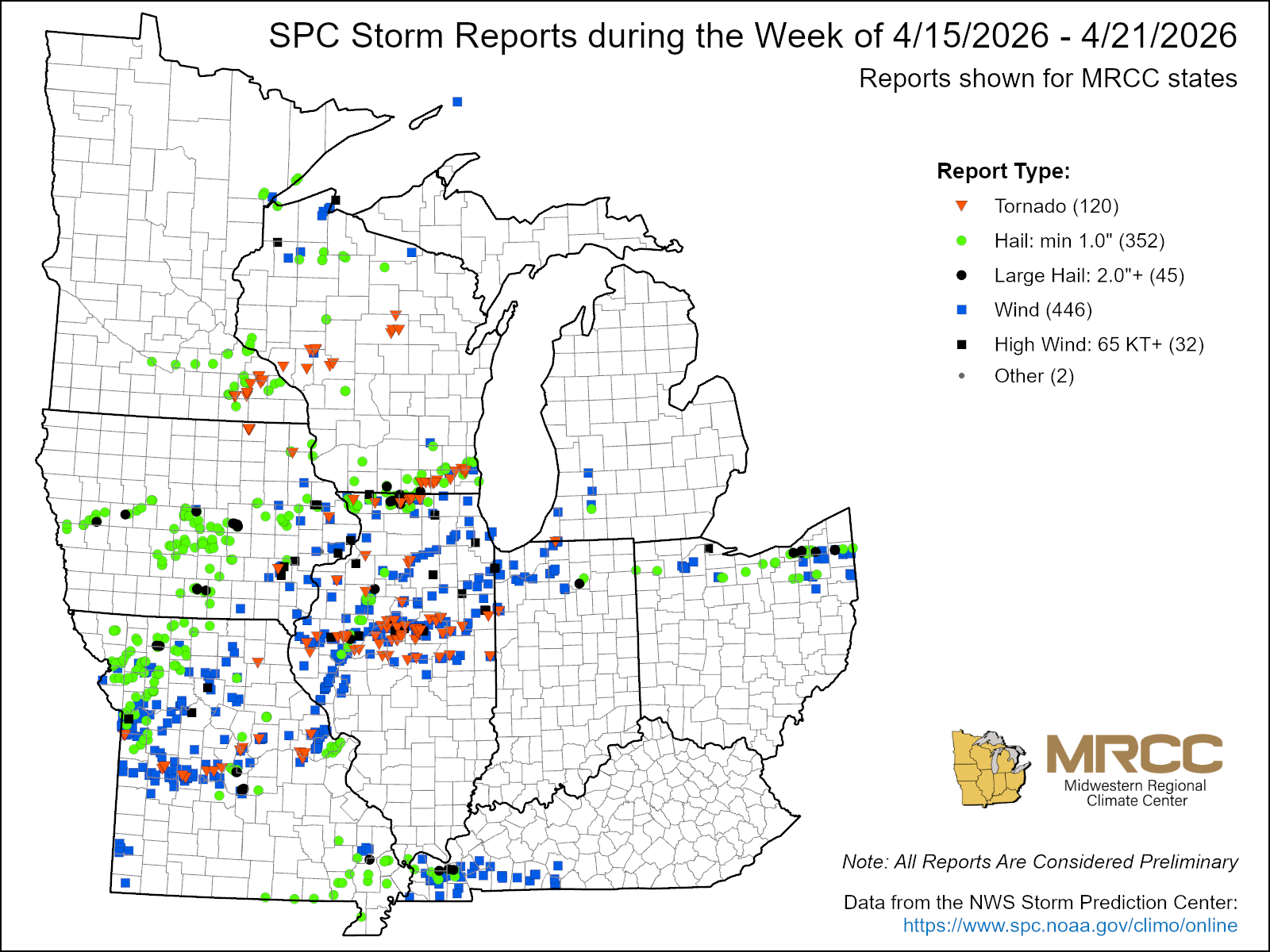
There were over 900 storm reports this week, including 352 hail reports, 446 wind reports, and 120 tornado reports (Figure 6). Some severe weather occurred on April 15 and 16, specifically large 2-3 inch hail in Iowa, Missouri, and northern Ohio. On April 15, 1 injury occurred in Daviess County, Missouri, when large hail triggered a car accident. On April 16, straight-line winds caused 1 injury in Christian County, Kentucky, when a tree was blown down onto a house.
The vast majority of storm reports this week occurred on April 17. A prolific severe weather outbreak occurred across Missouri, Iowa, Illinois, southern Wisconsin, and southeastern Minnesota. As of April 21, at least 80 tornadoes were confirmed by NWS damage surveys. Across the NWS Central Illinois forecast area, 34 tornadoes occurred alone. Five tornadoes rose to EF2 strength, and 24 were rated EF1. The NWS Chicago office confirmed that 12 tornadoes touched down across their forecast area, including one that rose to EF2 strength with winds of 115 mph. In the Quad Cities area, 8 tornadoes were confirmed, including a high-end EF2 tornado with peak winds of 130 mph that may have had multiple vortices. In Buffalo County, Wisconsin, a tornado rose to EF3 strength with winds of 140 mph.