March 15-21, 2026
Temperatures
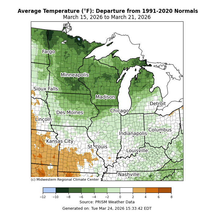
Temperatures were varied across the region. Average temperatures were above normal across southwestern Missouri by 2-4°F for the week (Figure 1). Across the Upper Midwest, average temperatures for the week were as much as 6-8°F below normal. The region’s midsection from Illinois eastward into Ohio was near to slightly below normal for the week.
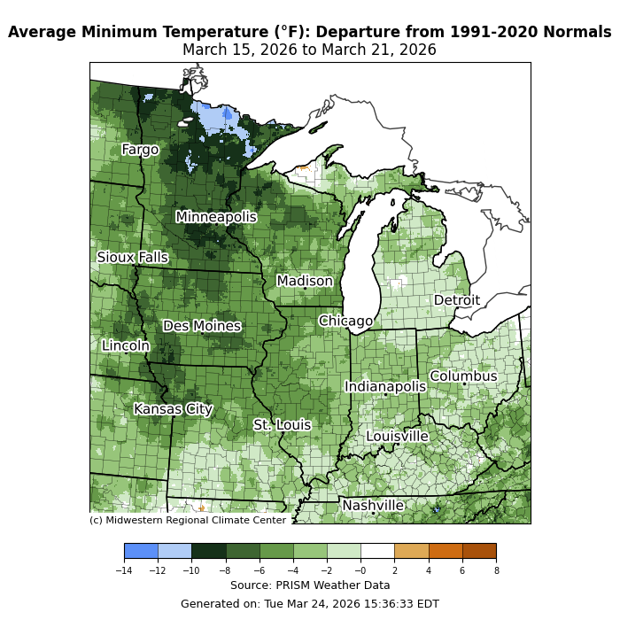
Minimum temperatures were mostly below normal. Departures were greatest across northern Minnesota, where minimum temperatures were over 10°F below normal (Figure 2). Across Indiana, Kentucky, Michigan, and Ohio, minimum temperatures were generally 1-4°F below normal.
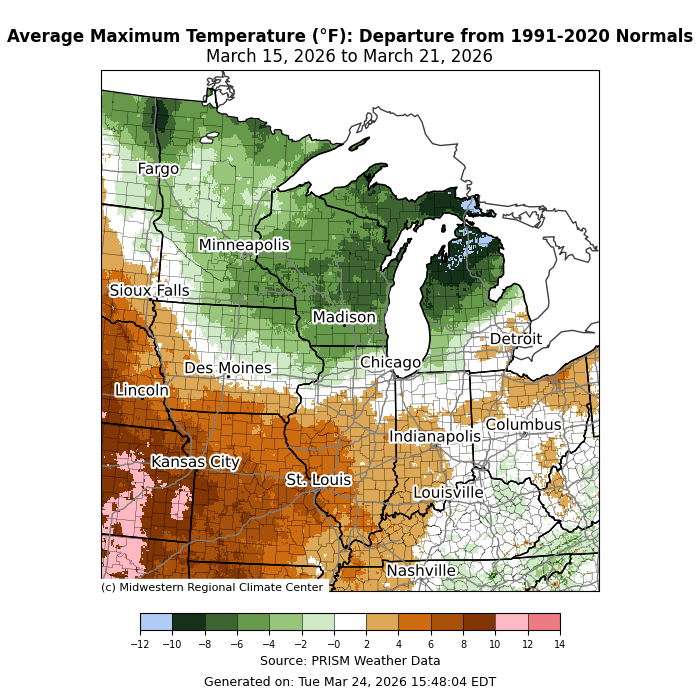
Maximum temperatures were above normal for many locations south of I-80 (Figure 3). More specifically, maximum temperatures averaged up to 10°F above normal for the week across parts of western Missouri. North of I-80, maximum temperatures were below normal by 3-6°F, though parts of northern Michigan were up to 10°F below normal.
Record High Temperatures on March 21
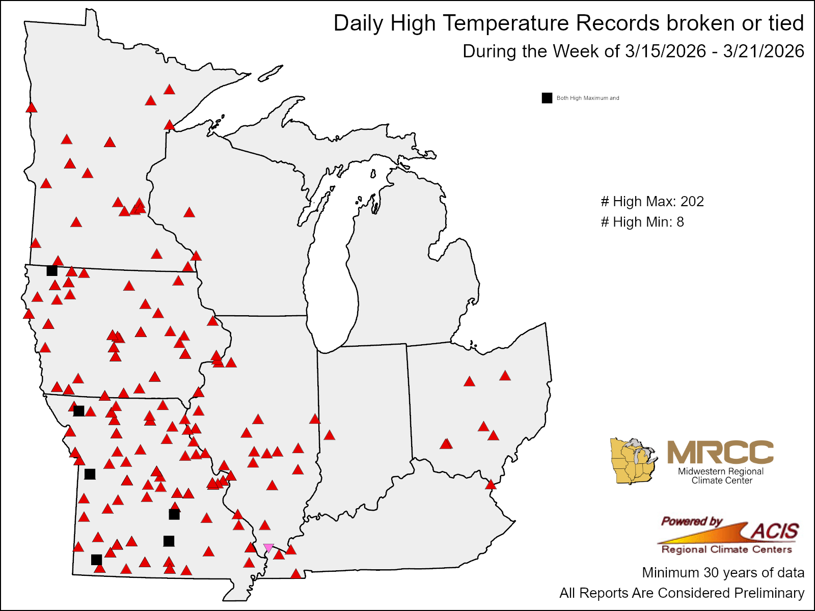
A warm front lifting across the Midwest on March 21 resulted in some of the warmest March temperatures on record. There were over 200 record high maximum temperature records set across the Midwest this week (Figure 4). Much of the region saw temperatures in the 70s, already pushing 20-30°F above normal at many observing locations. However, the most anomalous heat was west of the Mississippi River, where temperatures rose well into the 90s. Sioux City, Iowa, recorded a temperature of 95°F, which was 45°F above normal and the warmest temperature recorded in March in Sioux City since records began in 1889. In Kansas City, Missouri, the temperature rose to 93°F, which was 35°F above normal and the warmest temperature ever observed in March in Kansas City since records began in 1888. In Des Moines, Iowa, a maximum temperature of 91°F tied the previous all-time maximum temperature record for March. In Cedar Rapids, Iowa, a temperature of 89°F was 40°F above normal and the warmest temperature recorded in March since records began there in 1893.
Precipitation/Drought
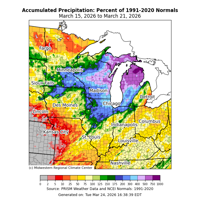
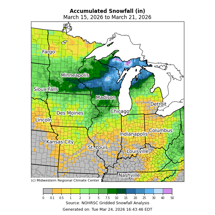
Precipitation was most heavily concentrated across the Upper Midwest, particularly Wisconsin and Michigan, where it was over 500 percent of normal in spots (Figure 5). Across western Missouri, precipitation was near zero to 10 percent of normal. The area from Missouri eastward into Ohio received nearly 50 percent of normal precipitation. Across the Upper Midwest, precipitation largely fell as snow, with up to 40 inches of snow in snowbelt locations along Michigan’s Upper Peninsula (Figure 6). In Marquette, Michigan, 21.7 inches of snow fell, making it the second-largest single-day snowfall in March since records began in 1961.
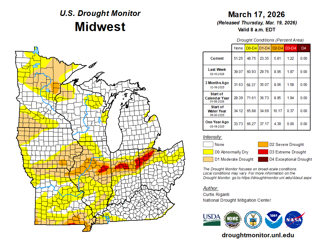
Drought conditions diminished across the region from March 10 to March 17 (Figure 7). D0 conditions (abnormally dry) now cover less than half the region, down from over 60 percent just one week prior. D1 (moderate drought) decreased by over 6 percent, mostly over Illinois and Missouri, while D2 (severe drought) decreased by over 2 percent across central Illinois.
March 15 Tornadoes
A severe weather outbreak on March 15 spawned several EF0 and EF1 tornadoes across Illinois, Kentucky, and Missouri. The tornado with the longest path was an EF1 just southwest of Louisville, Kentucky. This tornado spent 43.8 miles on the ground with estimated peak winds of 110 mph. Not far from Caneyville, Kentucky, the tornado struck 3 head of cattle that were killed, leaving behind nearly $7,000 in damages. The next-longest tornado was an EF1 in Illinois that spent 13.6 miles on the ground between Montgomery and Christian counties, with estimated peak winds of 98 mph.