December 22-31, 2015
Midwest Weekly Highlights - December 22-31, 2015
Warm End to a Very Warm December
Well-above-normal temperatures continued through the last ten days of 2015, with the eastern half of the region experiencing average temperatures 10-20°F above normal
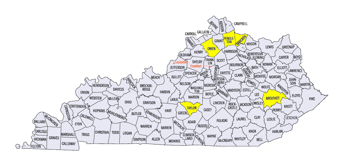
(Figure 1). The warmest areas were in eastern Ohio and Kentucky, where temperatures reached as high as 25°F above normal. Maximum temperatures averaged well above normal in the eastern half of the region, with 50s and 60s common across the lower Ohio Valley (Figure 2). Record maximum temperatures were set in Jackson, KY in Breathitt County, on December 26 (68°F) and December 27 (77°F) while many other sites in the eastern-third of Kentucky were in the upper 70s
(Figure 3). The warm temperatures across the region during the period were just the far westward appendage of warmth that spread across the entire eastern half of the U.S.
(Figure 4).
Torrential Rain and Heavy Snow Brings a Wild Ending to 2015
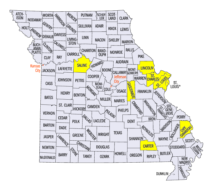
Multiple major winter storms moved across the Midwest during the final ten days of 2015, bringing heavy rain and snow. Over five inches of precipitation fell across the southern halves of Missouri and Illinois and in western Kentucky (Figure 5). Locally higher amounts were common in east-central Missouri and southern Illinois, where eight or more inches of precipitation fell between December 26-29 alone (Figure 6). Some of the wettest areas were in St. Louis and St. Charles counties in Missouri, as flooding occurred due to more than 10 inches of precipitation over the period. A large portion of central Missouri through south-central Illinois had more than eight times the normal amount of precipitation for the period, with all but northern Minnesota and the U.P. of Michigan receiving more than twice the normal amount (Figure 7).
Heavy snow was also common across Iowa, southern Minnesota, Wisconsin and the U.P. of Michigan during the period (Figure 8). Eight or more inches were common across northern Iowa through central Wisconsin, with the Green Bay, WI area receiving upwards of 12 inches
(Figure 9). In most cases, the heavy snowfall was more than twice the normal amount, while parts of Iowa had more than three to four times the normal amount (Figure 10).
Historic Winter Storm Slams the Midwest
A powerful winter storm pummeled the Midwest on December 26-29, bringing torrential rain and heavy snow across the region. A low pressure system surged east from the Rockies on December 26 before stalling over Kansas and Oklahoma. A stationary boundary also trailed to the east of the low, bringing moderate to heavy rain across Missouri, Illinois, Indiana and Ohio (Figure 11). The stationary boundary stalled through the morning of December 27 before the main low pressure system gained strength in eastern Texas. The system then moved north on December 28, bringing more heavy rain to Missouri and the southern Midwest, while heavy snow fell across northern Iowa, southern Minnesota, Wisconsin and northern Michigan through the morning of December 29 (Figure 12). While heavy snow certainly had an impact on the region, what made this winter storm one of the most impactful in recent memory was the historic flooding that occurred in Missouri and Illinois (see below).
Major Flooding in Missouri and Illinois
The torrential rain on December 26-29 brought moderate to major flooding to parts of Illinois and Missouri, as well as moderate flooding to parts of Kentucky and Indiana. Soaking rain throughout December coupled with above-normal temperatures helped saturate unfrozen soils in the Midwest, leaving the region vulnerable to a flooding event. With heavy rain falling over multiple days in Missouri through central Illinois and western Kentucky, the Illinois, Mississippi and Missouri Rivers and their tributaries experienced record-breaking flooding as over 150 gauges reached flood stage in the Midwest, leaving many areas underwater and leading to at least 25 deaths.
Illinois
Many rivers in Illinois reached flood stage from the heavy rain. Areas of the Illinois River experienced moderate to major flooding from Ottawa, IL in LaSalle County through the confluence at the Mississippi River. Major flooding occurred at Havana (Figure 13), Beardstown (Figure 14), LaGrange (Figure 15), Meredosia (Figure 16), Valley City (Figure 17) and Hardin (Figure 18) along the Illinois River. Most of these flood gauges had near-record to record major flooding just six months earlier in late June/early July. Many of these gauges crested in the first days of the New Year.
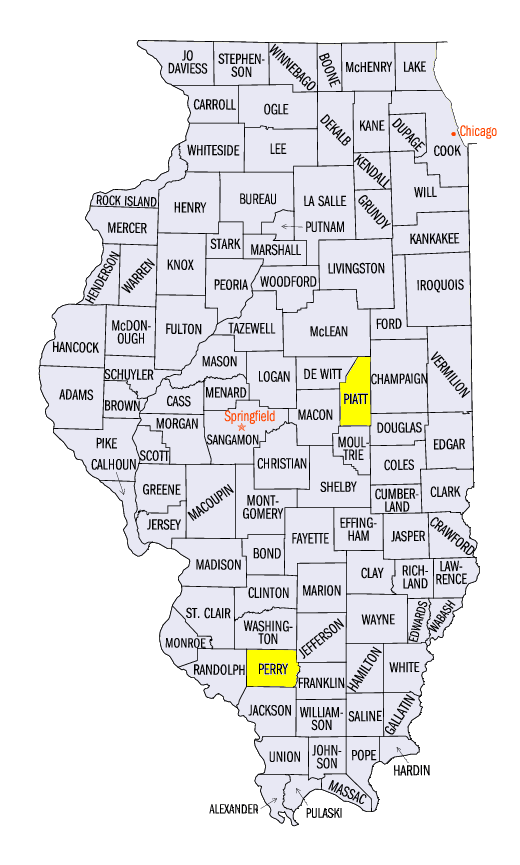
Other rivers in Illinois also reached moderate to major flooding. The Sangamon River from Monticello, IL in Piatt County through the confluence at the Illinois River east of Springfield, IL dealt with moderate flooding. The Little Wabash River at Clay City, IL and the Skillet Fork River at Wayne City, IL reached major flooding and approached record high crests. Rivers such as the La Moine River, Vermillion River, Kaskaskia, Embarras, and Big Muddy River all had at least one gauge with moderate flooding, while many more were in flood stage.
Missouri
Some of the worst flooding occurred in Missouri, with areas along the Meramec River in east-central Missouri hit the hardest. Rainfall amounts of 9.00-11.00 inches in St. Louis and St. Charles County, MO were common over a three-day period, bringing river gauges to record high crests. Flood gauges at Pacific (Figure 19), Eureka (Figure 21), Valley Park (Figure 1) and Arnold (Figure 22) on the Meramec River all had record or near-record high crests. Major flooding also occurred along the river in Sullivan, MO. The historic flooding inundated cities, and caused raw sewage to flow into the river as sewage treatment plants were forced to shut down for safety reasons. Major flooding was also found on the Missouri River from Gasconade through Hermann in Gasconade County, MO, while moderate flooding also occurred on the Blackwater River in Saline County, MO. Stretches of I-44 and I-55 were closed in eastern Missouri as water covered the road. The Missouri Department of Transportation closed more than 200 roads in the state, with many of them along the Meramec River.
More information from Missouri’s flooding can be found from the NWS St. Louis and NWS Springfield, MO webpages.
Mississippi River
Major flooding was common along the Mississippi River from Winfield in Lincoln County, MO through Cape Girardeau in Cape Girardeau County, MO. The river at St. Louis had its highest crest since the historic flood of 1993, and its third highest crest on record late in the day on December 31 (Figure 23). Further south, a near-record to record high crest occurred at Chester, MO (Figure 24), with record high crests at Cape Girardeau, MO (Figure 25), and Thebes, IL (Figure 26). Moderate to major flooding was forecasted downstream in the first days of the New Year, with flood concerns rising through Louisiana.
The flooding across the region brought back memories of historic floods across the Midwest, including the floods of 1993, 2008 and 2011. Read more about these floods on our Living With Weather: Floods page as well as on our page about the 1913 historic flood.
Rare December Severe Weather Brings Tornadoes, High Winds
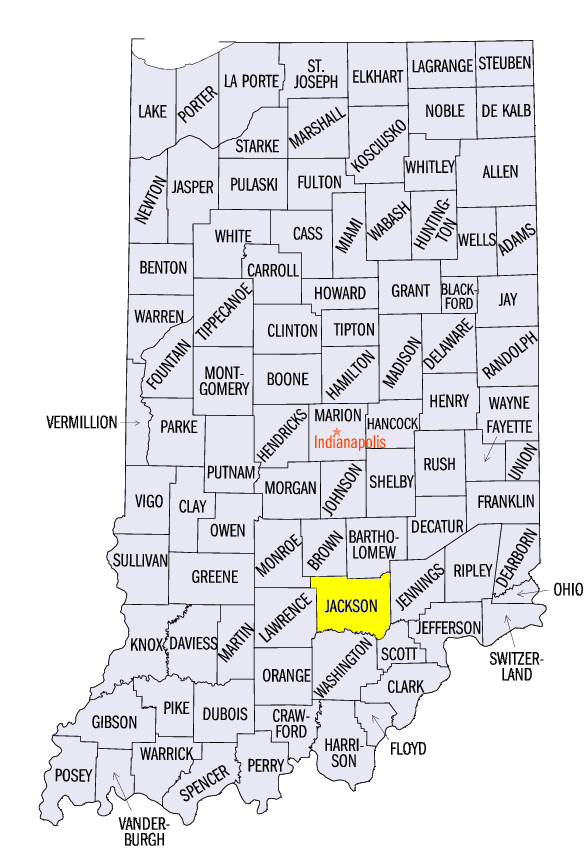
An unusual winter storm on December 23 caused heavy rain, strong winds and tornadoes across Illinois, Indiana, Kentucky and southeast Missouri (Figure 27). This rare severe weather event began in the early morning hours of the day as a line of thunderstorms developed in central Missouri, prompting tornado watches (Figure 28). The line moved into central Illinois, western Kentucky and western Indiana by the early afternoon hours, causing widespread wind damage. A 69-mph gust was recorded at Seymour, IN in Jackson County, while a Kentucky Mesonet station in Owenton in Owen County also measured a 75-mph wind gust. A National Weather Service Storm Survey found that 90-100 mph winds likely caused damage to barns near Black Gnat, KY in Taylor County.
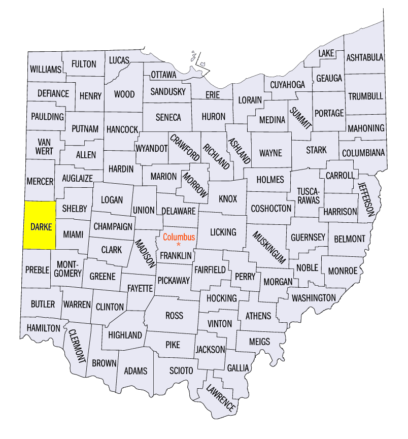
Tornadoes were also found along the line of thunderstorms in Missouri, Illinois, Indiana and Ohio. An EF-1 tornado tracked near Chilton, MO in Carter County and near Pinckneyville, IL in Perry County. An EF-1 tornado was also found near Falmouth, KY in Pendleton County, and an EF-0 tornado touched down near Arcanum, OH in Darke County. Fortunately, no fatalities occurred from these storms in the Midwest region.
-BJP-