September 15-21, 2015
Midwest Weekly Highlights - September 15-21, 2015
Five Pleasant and Two Wet Days
Except for the two day period where heavy rain fell in the central Midwest through the mornings of September 18
and 19 (Figure 1), it was a dry fall week for many in the region (Figure 2). Most of Missouri, southern Illinois, Kentucky and Ohio recorded well below normal precipitation, with parts of Kentucky staying completely dry for the week
(Figure 3). Western Minnesota also was quite dry, with areas receiving less than a quarter of the normal precipitation for the period (Figure 4). Rainfall through the morning of those two days on September 18 and 19 did leave a mark on eastern Iowa, southern Wisconsin, northern Illinois and northern Indiana, however. These areas all received more than twice the normal amount of precipitation for the period with parts of southeast Wisconsin and far northern Illinois having triple the normal amount. Southeast Minnesota and northwest Wisconsin also had pockets of well above normal precipitation.
Early Autumn Warmth
Above normal temperatures returned to the region after a cooler second week of September. Average temperatures for the week were in the 60s across the region
(Figure 5). Temperatures were the most above normal in the far northern reaches of the region, with northern Minnesota and the U.P. of Michigan 6-9°F above normal for the period (Figure 6). Temperatures in the Ohio Valley were closer to normal, with parts of Kentucky a degree or two below normal. High temperatures were mainly in the 70s to lower 80s
(Figure 7), which was above normal for almost the entire region (Figure 8).
Severe Thunderstorms September 17-18
The two days where rainfall was prevalent across the Midwest also produced severe thunderstorms across Iowa, Illinois and northern Indiana
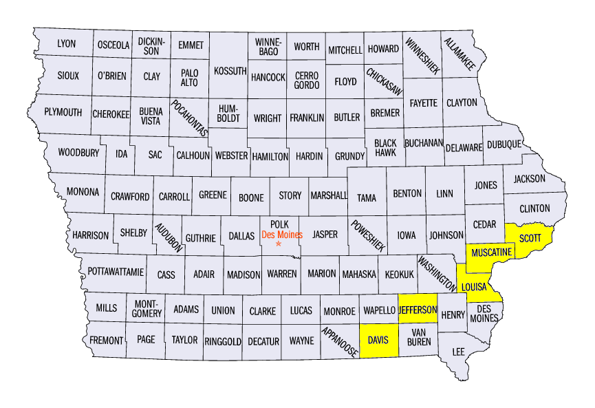
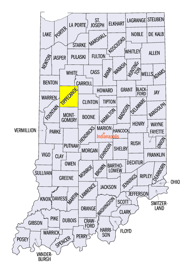
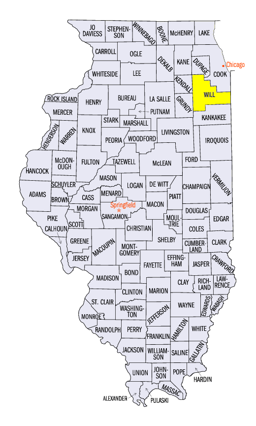
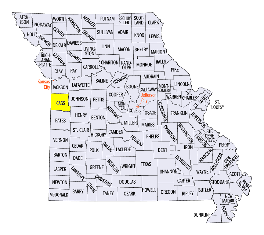
(Figure 9). A hail storm tracked over southeast Iowa on September 17, leaving 1-2 inch hail on the ground in Davis, Scott, Jefferson, Louisa and Muscatine Counties. A few wind reports happened to the east in northern Illinois and far southern Wisconsin. A strong windstorm on September 18 had sustained wind speeds of 59 mph in Tippecanoe County, IN, with wind gusts estimated up to 80. Tornadoes were also reported in Will County, IL and Cass County, MO on that day, but only minor damage was reported.
Harvest Season Beginning
After the toils of a very wet summer brought crop conditions down for corn across the central Midwest, farmers have begun to harvest their corn crop for the season. Across the southern half of the region, dry weather prompted more days for harvesting fieldwork according to the latest NASS weekly report (Figure 10). Kentucky and Missouri are the furthest along so far at 35 and 27 percent respectively, yet both states are around ten percent below the five year average for the harvest. It may still be a while in Wisconsin and Michigan before harvest begins as both states reported less than 30 percent of the corn crop as mature (Figure 12). While both states had corn planted ahead of the five year average this spring, both are behind the five year average when it comes to mature plants. Below normal precipitation has been forecasted for the rest of September (Figure 12), which may aid in drying out the corn stalk and continuing the harvest in the southern Midwest.
-BJP-