July 22-31, 2015
Midwest Weekly Highlights - July 22-31, 2015
Many Dry Out, Iowa Deluged
The first truly dry period of the summer for some areas dried out the Great Lakes area to end July (Figure 1). Very little to no precipitation fell across eastern Wisconsin, western Michigan and northern Indiana, causing departures of over an inch below normal (Figure 2). Many other areas were more than a half inch below normal for the period, such as Ohio, eastern Kentucky, central Illinois and west-central Missouri.
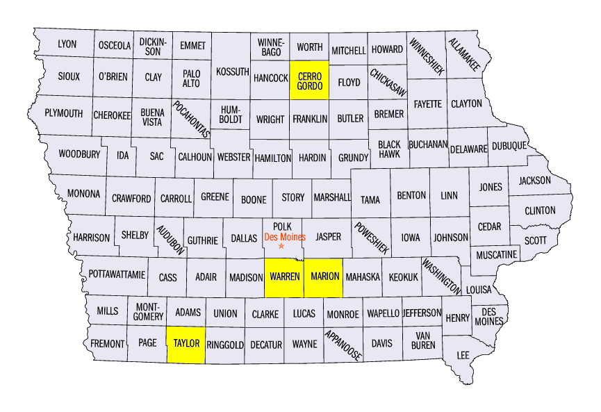
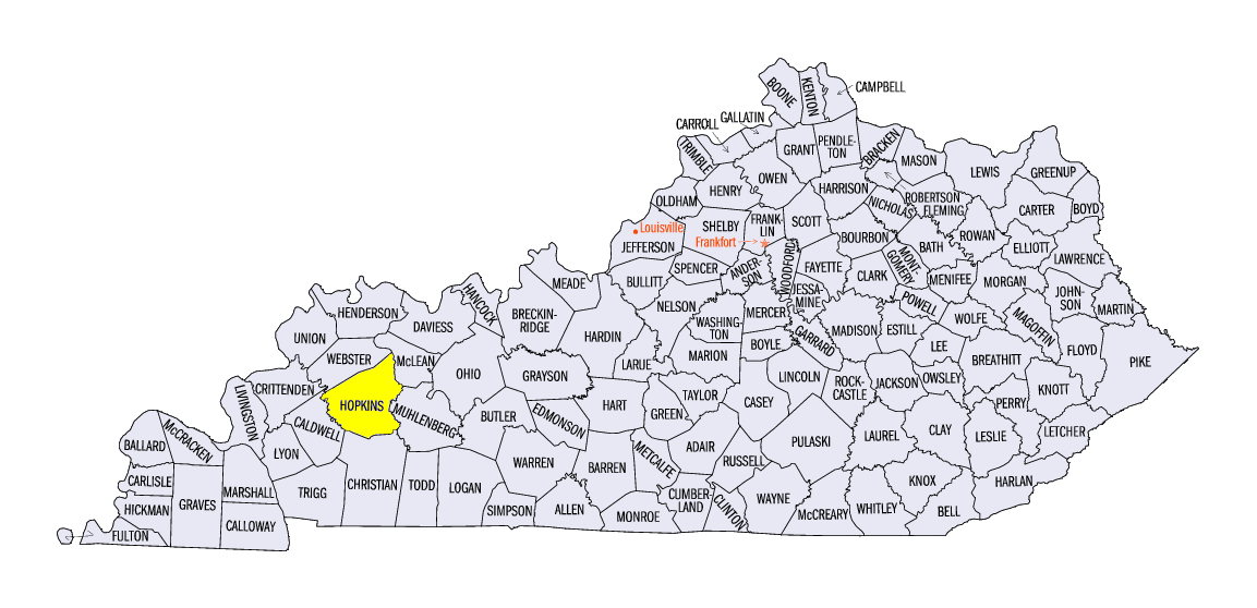
However, heavy rain was still a factor across Iowa, Minnesota and western Kentucky. Iowa was hit particularly hard over the period, with 4-6 inches of precipitation in many areas, and locally higher amounts were reported. The Mason City airport in Cerro Gordo County saw 4.13 inches through the morning of July 24. July 29
(Figure 3) brought 4.26 inches to Bedford in Taylor County and 4.40 inches to Knoxville in Marion County. The heaviest one day amounts for the period were seen in Warren County on that same day. Three separate stations in Indianola reported more than five inches of precipitation, with the highest at 5.88 inches. A CoCoRaHS observer near Hartford recorded 5.85 inches while another near Norwalk had 6.32 inches. Meanwhile, sites in Minnesota saw over 3 inches in the early morning hours on July 24 and the Madisonville, KY station in Hopkins County had 4.71 inches through the morning of July 29.
Warmer Temperatures
Above normal temperatures were common across the Midwest this week as northern Minnesota, Wisconsin and Michigan experienced temperatures 3-6 degrees above normal (Figure 4). Average temperatures were mainly in the 70s, with a few lower 80s in southern Missouri (Figure 5). Most of Missouri was above normal, with departures of 1-4 degrees from normal. Iowa, Illinois, Indiana, Kentucky and Ohio were all near normal, with some areas a few degrees above normal.
Severe Weather Quiets
A very active severe weather season quieted to end July across the region (Figure 6). Some strong thunderstorms brought wind damage to parts of northern Minnesota on July 23, with storms in Iowa and Missouri causing more damage on July 24. A brief landspout tornado was reported in Watonwan County, MN that day as well. A cluster of wind reports also occurred in south-central Iowa on July 29 from another round of storms. Only a few other storm reports were seen during the rest of the period.
Flood Waters Quickly Receding
Dry conditions in most of Illinois and Indiana to end July helped river stages rapidly fall along the Illinois and Wabash Rivers. From July 24 through July 31, the Illinois River dropped three feet at LaGrange, Meredosia & Valley City, ending major flooding at those sites. At Havana, IL, the river dropped four feet while the river dropped a full five feet at Beardstown, IL. Despite these rapid river stage falls, minor and moderate flooding was still occurring at these sites. Minor flooding also continues along most of the Wabash River south of Lafayette, IN and along parts of the Missouri River in Missouri.
-BJP-