July 1-7, 2015
Midwest Weekly Highlights - July 1-7, 2015
Wet Weather Continues
Above normal precipitation continued to affect about half of the region to start July (Figure 1), leading to flash flooding in many areas. Kentucky, Missouri, southern Minnesota and northwest Wisconsin were hit the hardest, with precipitation totals in the 3-6 inch range (Figure 2). Western and southern Missouri saw 2-5 inches above normal, while most of Kentucky was 3-4 inches above normal. In many cases, this was 3-5 times more than normal for this week (Figure 3). Southern Minnesota and northwest Wisconsin had 1-3 inches above normal, with most of that precipitation coming overnight on July 5-6 (Figure 4).
Thankfully, below normal precipitation fell across the states that broke records for June precipitation. Central Illinois, Indiana and Ohio all received below normal precipitation. Most of Iowa, southern Wisconsin, northern Minnesota and Michigan also skewed below normal. However, all of these areas were within one inch of normal for the period.
Cool Start to July
Powerful weather systems for the first week of July brought cooler air into the Midwest, resulting in below normal temperatures across most of the region (Figure 5). The coolest areas were in Iowa and southern Minnesota, where temperatures were 4-6°F below normal. Temperatures in western Ohio were also cool at 3-5°F below normal. The below normal temperatures were largely due to well below normal high temperatures across the region from increased cloud cover and daytime rain
(Figure 6). High temperatures of 5-9°F below normal were common in Iowa and eastern Kentucky. Only a small area of northern Minnesota had slightly above normal high temperatures for the week.
Smoke in the Air
Wildfires in Canada and Alaska led to a high amount of smoke in the air for several weeks across the Midwest. Northwest winds caused this smoke to sink southward from Canada and left a hazy appearance in the sky across Minnesota, northern Wisconsin and northern Iowa. The extent of the smoke went as far south as northern Missouri, Illinois and Indiana. At night, the moon was a reddish hue in some locations as the dense smoke refracted some light from the moon’s glow. Air quality alerts were issued across Wisconsin on July 7 as sinking air behind a cold front brought smoke particles to the surface. More smoke could move into the Midwest as these wildfires continue to burn.
Flash Flooding
While most of Ohio, Indiana and Illinois dried out some from their record setting June precipitation, flash flooding took its toll on Minnesota, western Wisconsin and Missouri to start July. Heavy rain fell across the Twin Cities area on July 6, dumping 2-4 inches of rain in the metro area. Spots just east of the border in Wisconsin received even higher amounts. The River Falls, WI cooperative site recorded 6.67 inches of rain over a two day period from July 6-7, with 5.36 inches coming before 8 a.m. on July 6.
Heavy rain in Indiana, Kentucky, and Missouri also brought flash flooding to some areas on July 6-7 (Figure 7, (Figure 8) through morning of the next day. The Indianapolis, IN airport received 4.43 inches of precipitation while a site in McDonald County, MO received 3.81 inches. Heavy rain also fell in the Paducah, KY area where the Barkley Regional Airport received 3.42 inches of rain.
Flooded Rivers Slowly Receding
After a drier week along the Illinois and Mississippi Rivers, flood waters slowly receded from their crests. However, the Illinois River was still in major flood stage from Havana through Valley City, IL. Moderate flooding occurred along the Mississippi River between St. Louis, MO and Cape Girardeau, IL, but river stages north of St. Louis fell below flood stage. Minor flooding also continued along most of the Wabash River in Indiana. Another week of wet weather was forecasted for the southern half of the region (Figure 9), which may raise river levels in the coming week.
Severe Weather Cools Off
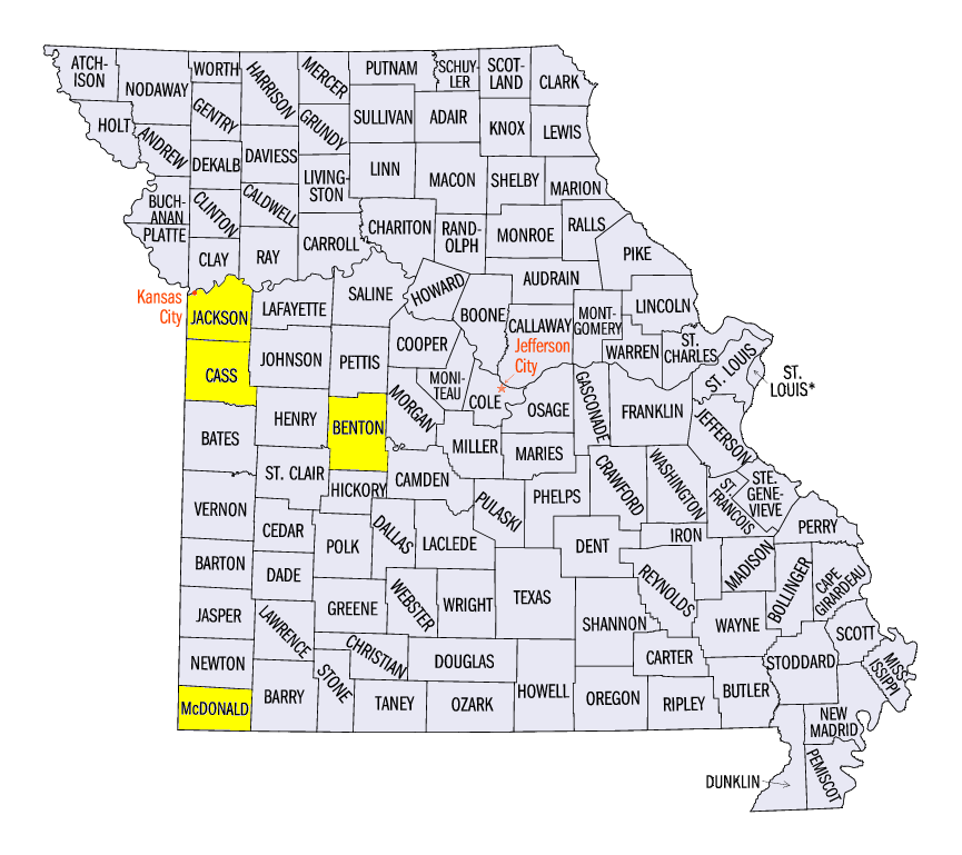
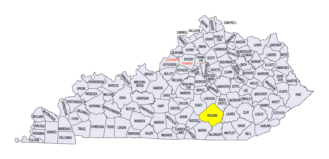
While severe weather roared through the Midwest in the month of June, fewer storm reports were seen across the region in the first week of July (Figure 10). The worst day for severe weather was on July 1 where strong winds and multiple tornadoes moved through Missouri. EF-0 and EF-1 tornadoes were observed in Jackson, Cass, Benton and Maries Counties in Missouri while an EF-0 tornado touched down in Pulaski County, KY. A few storms in northern Minnesota dropped large hail up to 2.50 inches with damaging winds on July 5, while a somewhat weak line of thunderstorms caused multiple small tornadoes in northwest Wisconsin on July 6. A line of thunderstorms also caused wind damage in central Kentucky on July 7. No severe weather reports came in on July 3-4 in the Midwest, breaking a significant stretch of days with at least one storm report in the nine-state region. July 3 was the first day without a storm report since June 1, with July 3-4 the first two day stretch of days without a report since May 22-23.
-BJP-