June 22-30, 2015
Midwest Weekly Highlights - June 22-30, 2015
June Ends As Wet As It Started
The month of June wrapped up with yet another week of above normal precipitation across central portions of the Midwest (Figure 1). Three to six inches of rainfall fell across portions of southeastern Iowa, northeastern Missouri, central Illinois and Indiana, and northern Ohio. Locally heavier amounts were found in south-central Iowa and northeast Missouri, where up to 8 inches of rain fell for the week. A Co-op observer in Marion County, IA reported 7.25 inches of rain during the 24 hour period ending at 8:00AM on June 25th alone, while many more observers saw 4-6 inches on that day alone.
The heavy rainfall across the central Midwest caused departures of over an inch above normal precipitation for the period across most of the central Midwest, with the areas hit the hardest 3-5 inches above normal (Figure 2). Some areas of the region did experience slightly below normal precipitation, however. Parts of northern Minnesota and Michigan, western Iowa and southern Missouri skewed less than an inch below normal.
Seasonal But Cool Temperatures
Another week of near but slightly below normal temperatures were common across the region as rain continued to fall
(Figure 3). The entire region was within 5 degrees of normal for the period. Temperatures, however, skewed mostly to the cool side, especially across the central portions of the region, where temperatures were 2-5 degrees below normal. Only the far southern portions of Missouri and northwest Minnesota saw temperatures a few degrees above normal.
Severe Weather Continues to Wreak Havoc
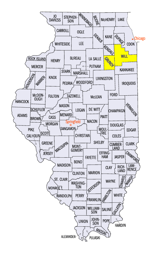
Yet another active week of severe weather brought many storm reports to the Midwest (Figure 4). After a derecho went through Iowa and Wisconsin during the morning hours of June 22 (read more in last week’s Climate Watch), a cyclical supercell dropped multiple tornadoes across northern Illinois during the evening and overnight hours. The worst of these tornadoes caused EF-3 damage in Coal City, IL as it passed through Grundy and Will Counties, IL. In total, 12 tornadoes were confirmed by the NWS-Chicago Romeoville, with eight of them at EF-1 strength. After a few relatively quiet days on June 23-24, a large swath of wind damage was seen across northern and central Missouri through eastern Kentucky on June 25. The energy behind these storms shifted east on June 26th, causing widespread wind damage in Kentucky and southern Ohio.
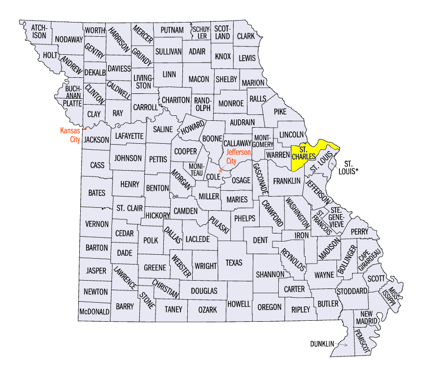
Another calm day came on June 27th ahead of an interesting night of weather in the St. Louis area. An EF-2 supercell tornado touched down just north of St. Peters in St. Charles County, MO shortly after 8 p.m. CDT. This supercell continued towards downtown St. Louis while a Major League Baseball game between the Cardinals and Cubs was being played. Thankfully, the cell lost strength as a sold-out crowd gathered in the concourses of the stadium while the storm passed through. An upper level feature on June 29th caused some strong thunderstorms around the Twin Cities in Minnesota, dropping two inch hail in the metro area. Another long-lived cell followed the Mississippi River from La Crosse to Prairie Du Chien, WI, dropping around 1 inch hail along its path. This upper level feature moved east on June 30th, causing wind damage reports across Ohio and eastern Kentucky, with many of these reports coming from the Cincinnati area as the month of June finally came to an end.
Flooding Nears Record Levels
Moderate to major flooding continued to wreak havoc on major rivers across the Midwest this week. The entire Illinois River was closed this week to recreational boating due to the flooding, as dangerous currents and floating debris in the river became very hazardous to boaters. River gauges along the river in Havana (Figure 5), Beardstown (Figure 6) and Valley City (Figure 7) all came within a foot of breaking record flood stage while gauges at LaGrange (Figure 8) and Meredosia (Figure 9) broke their river stage record late in the day on June 30th. The National Weather Service’s Advanced Hydrologic Prediction Service forecasted a crest in these locations on July 1-2.
Flooding affected more than just Illinois though. Record river stages were observed near Ewing, MO in Lewis County, where both the Middle Fabius (Figure 10) and Upper Fabius (Figure 11) Rivers crested above the previous record stages. Moderate flooding was observed along the Wabash River in Indiana from Lafayette to Evansville, while moderate to major flooding continued on the Mississippi River from Quincy, MO to Cape Girardeau, IL. Some minor flooding was still occurring along the Missouri River as well, with areas of the Iowa River dealing with the same. Far northwest Ohio and southeast Michigan were also dealing with some flooding as precipitation has been well above normal in those areas. Continued above normal precipitation has been predicted for the Midwest (Figure 12) and may worsen flooding across many of these areas already reeling from high waters.
-BJP-