April 1-7, 2015
Midwest Weekly Highlights - April 1-7, 2015
Ohio Valley Stays Wet
Yet another week of heavy rain fell on the western Ohio River Valley this week as multiple storms dumped 3 or more inches of rain in northern Kentucky and southern Indiana, with much higher amounts found locally (Figure 1). Although moderate drought conditions were in place this winter in western Kentucky, well above normal precipitation since March 1 (Figure 2) has left soils in the western Ohio Valley saturated. More heavy rain this week led to multiple flash flood events in northern Kentucky and southern Indiana, while flood warnings reappeared on the Wabash and White Rivers. This continued heavy rain leaves the western Ohio Valley vulnerable to more flooding for the rest of the spring season.
Meanwhile, drought-stricken areas of the upper Midwest saw little relief this week. Most of Minnesota and Wisconsin were 0.2-0.5 inches below normal (Figure 3), with only small areas of northern Wisconsin and southeast Minnesota seeing slightly above normal precipitation. The slightly above normal precipitation in northern Wisconsin was due mostly to a swath of moderate snow (Figure 4). Three to five inche snowfall totals for the week were seen in some spots. However, this snowfall had little effect on the precipitation deficit in the upper Midwest and Great Lakes, as most areas are 2-5 inches of precipitation below normal since December 1, 2014
(Figure 5).
Warmer Week
Widespread above normal temperatures finally came to the Midwest after what was a cool March (Figure 6). Most of the region saw average temperatures 2-5°F above normal with isolated areas of western Iowa up to 8°F above normal. High temperatures had a lot to do with the above normal readings as average highs in the 60s moved as far north as the Iowa-Minnesota border
(Figure 7). However, below normal average temperatures were seen around the Great Lakes. The U.P. of Michigan saw average temperatures of 3-6°F below normal for the period with northern Minnesota also below seasonal norms.
Northern Kentucky Flash Flooding April 2-3
A training line of thunderstorms formed in southern Indiana during the evening hours of April 2nd, which led to a significant flash flooding event. This line of thunderstorms slowly moved south over night into north-central Kentucky. These storms continued through the overnight hours into the morning on April 3rd. A brief break in the rain was seen during the morning hours before more light rain continued by midday. Two-day rain totals of 2-4 inches were common across southern Indiana and north-central Kentucky, with a strip of locally higher amounts between 4-8 inches. Daily records for April 3 were set at both Louisville (5.64 inches) and Lexington (5.17 inches). Some hail and wind reports were also seen in northern Kentucky and southern Indiana on April 2, but the main severe weather center was in southwest Missouri.
Southwest Missouri Tornadoes April 2-3
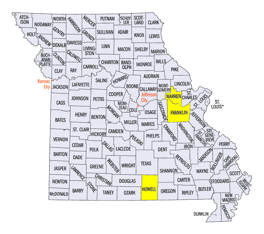
After spending most of March in a tornado drought, the first week of April brought multiple tornadoes to the region (Figure 8), with April 2-3 bringing multiple tornadoes to southwest Missouri. A stationary boundary through northern Missouri helped fuel storms late in the day on April 2. Five separate tornadoes touched down in Missouri. The strongest-rated tornado was located just north of Pomona, MO in Howell County. Manufactured homes and small farm buildings were completely destroyed by the EF-2 tornado as it tracked along State Route UU for over 5 miles. EF-1 tornadoes were also reported near Seligman and Vanzant, MO. Thankfully, no injuries or fatalities were reported.
More Northern Kentucky Flash Flooding and Severe Weather April 7
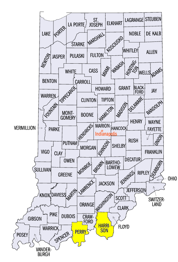
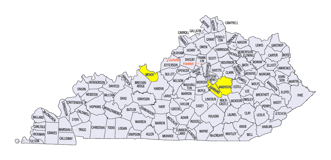
Yet another flash flooding event moved through southern Indiana and north-central Kentucky on April 7, adding even more insult to injury. This time, flooding was only part of the risk as severe thunderstorms also caused damage to trees and homes. Hail as large as 2.75 inches was reported with rainfall amounts of 2-5 inches seen in many areas. No tornadoes were reported, but National Weather Service surveys are being conducted to see if some damage was caused by a tornado in Perry & Harrison County, IN and Meade, Garrard & Madison County, KY. Hail was reported throughout central Illinois and in southeast Iowa. Two inch diameter hail was also seen in Warren & Franklin County, MO.
-BJP-
The National Weather Service-Louisville, KY also contributed to this report.
The National Weather Service-Springfield, MO also contributed to this report.