December 22-31, 2016
Midwest Weekly Highlights - December 22-31, 2016
Warm End to 2016
Warm weather was common across the Midwest as the entire region was more than 5°F above normal
during the last week of December (Figure 1). Most of Iowa, Missouri, Illinois, Indiana, Wisconsin and Minnesota were 8-10°F above normal. Maximum temperatures on Christmas Day (Figure 2) and December 26
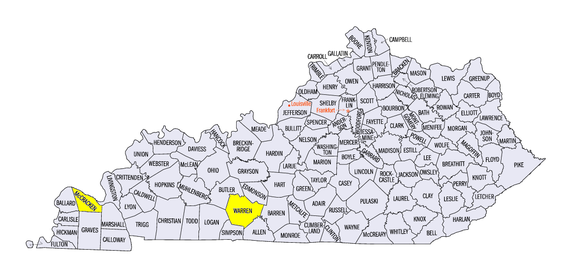
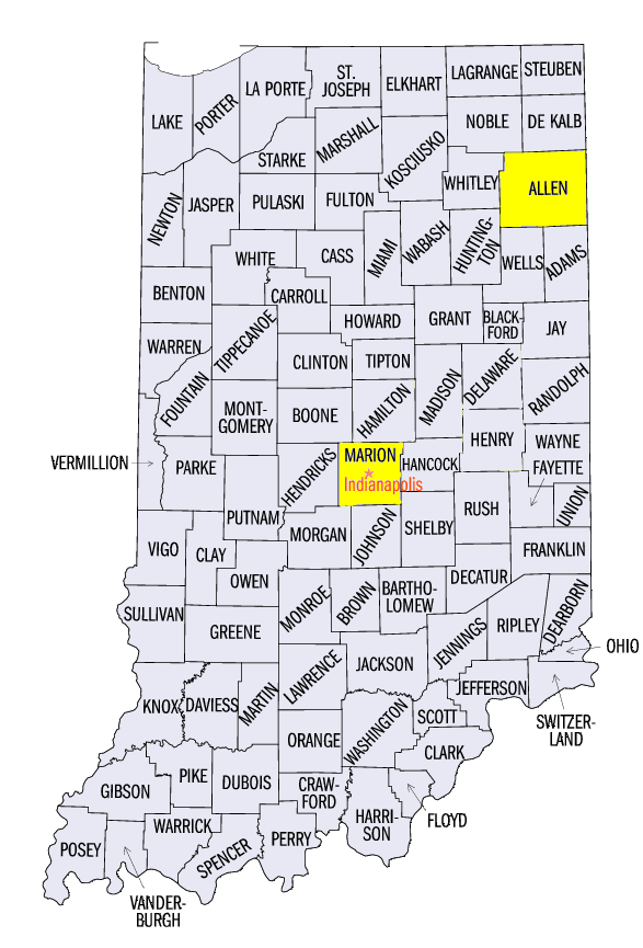
(Figure 3) broke nearly 200 daily records. Many of these records were in the southern half of the region, where temperatures reached the upper 50s and 60s, with lower 70s in Kentucky. Cities including Paducah, KY (McCracken County), Bowling Green, KY (Warren County), Fort Wayne, IN (Allen County), and Indianapolis, IN (Marion County) broke their December 26 record that was set just one year earlier in 2015.
Wet Weather for Many
Precipitation in the form of rainfall and mixed precipitation was common across the Midwest during the period (Figure 4). A storm on December 25-27 brought rain and freezing rain to Iowa, Wisconsin and Minnesota. Only parts of northern Minnesota received snowfall from the event, while areas of southern Minnesota, northern Iowa and western Wisconsin were under a freezing rain advisory on December 25 through the morning of December 26 as temperatures hovered near freezing. Over a
half-inch of precipitation fell across these areas (Figure 5). As the storm moved eastward, moderate rainfall fell across Kentucky, with most areas receiving more than a half-inch of rain (Figure 6). Precipitation from the storm was more than twice the normal amount in Iowa, Wisconsin and Minnesota and more than one-and-a-half times the normal amount in Kentucky
(Figure 7). Snowfall during the period was largely isolated to lake-effect storms in the U.P. of Michigan and northern Lower Michigan, where 7-10 inches fell (Figure 8). A storm on December 23 through the morning of December 24 also dropped 2-3 inches of snow across northern Iowa, Central Wisconsin and northern Lower Michigan.
Icy and Windy Christmas in Minnesota, Iowa, Wisconsin
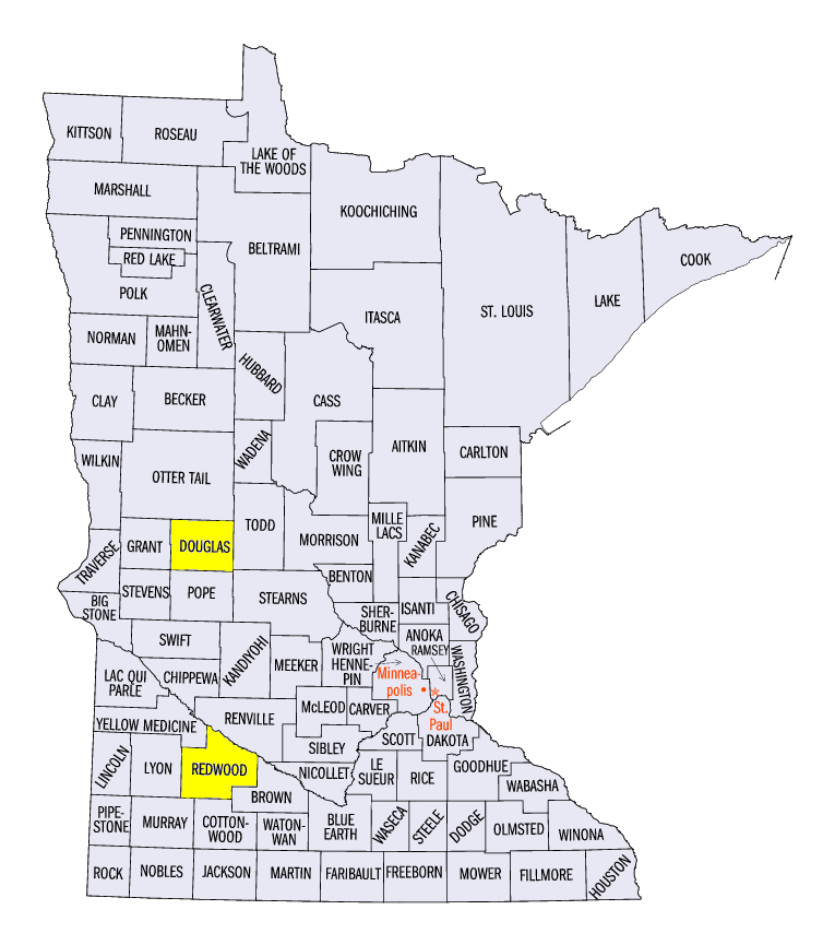
Temperatures near freezing on December 25 led to icy conditions across southern Minnesota, northern Iowa and western Wisconsin. Freezing rain accumulation of a tenth of an inch was common, with nearly seven-tenths of an inch in Alexandria, MN (Douglas County). Winds were also strong during the periods of freezing rain, with wind gusts of 40-60 mph. One of the strongest wind gusts was 66 mph near Redwood Falls, MN (Redwood County).
Drought Eliminated From Kentucky
Continued precipitation in Kentucky aided in the National Drought Mitigation Center eliminating drought from Kentucky in the December 27 U.S. Drought Monitor (Figure 9). Moderate drought covered over 60 percent of the state just one week prior. The onset of the drought had only begun in late October and rapidly advanced in November before quickly declining in December (Figure 10). However, over 70 percent of Kentucky remains abnormally dry. Nearly 90 percent of Missouri was also classified as abnormally dry, with two small pockets of moderate drought in southern Missouri.
-BJP-