October 25-31, 2016
Midwest Weekly Highlights - October 25-31, 2016
Warm for Many, Cold in Michigan
Above-normal temperatures were common across most of the Midwest with a few exceptions
(Figure 1). The warmest state was Missouri, where western parts of the state were 9-12°F above normal. Most of Iowa, Illinois, Kentucky, Indiana and Ohio were 4-8°F above normal. Maximum temperatures played a large role in the above-normal temperature pattern, as most of Missouri and Kentucky were more than 8°F above normal (Figure 2). Over 100 daily maximum temperature records were broken from October 28-31. Further north, average temperatures in Wisconsin were near to slightly above normal. Most of Michigan was 1-4°F below normal for the period.
Wet Upper Midwest
A system on October 25-27 brought moderate to heavy rain across Minnesota, northern Iowa, Wisconsin and Michigan
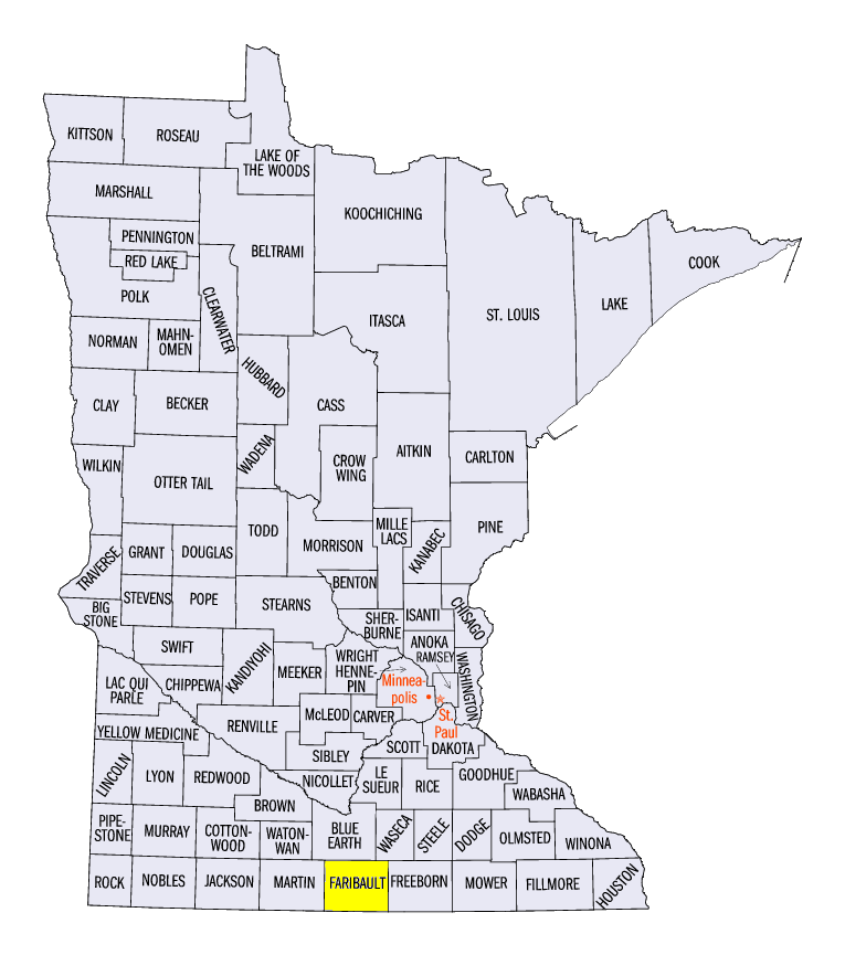
(Figure 3). The heaviest of this precipitation fell through the morning of October 26 in southwestern Minnesota, northeastern Iowa, and southern Wisconsin (Figure 4). Over two inches fell in most areas, with some areas in Minnesota receiving more. Wells, MN (Faribault County) received 4.43 inches while Winnebago, MN (Faribault County) recorded 4.00 inches. As the storm moved east, Lower Michigan had over an inch of precipitation through the morning of October 27
(Figure 5). The precipitation from this storm was the only major precipitation event of the period, as the remainder of the region was below normal (Figure 6). Most of the southern third of the region had less than half the normal amount
(Figure 7).
First Snowfall of the Season
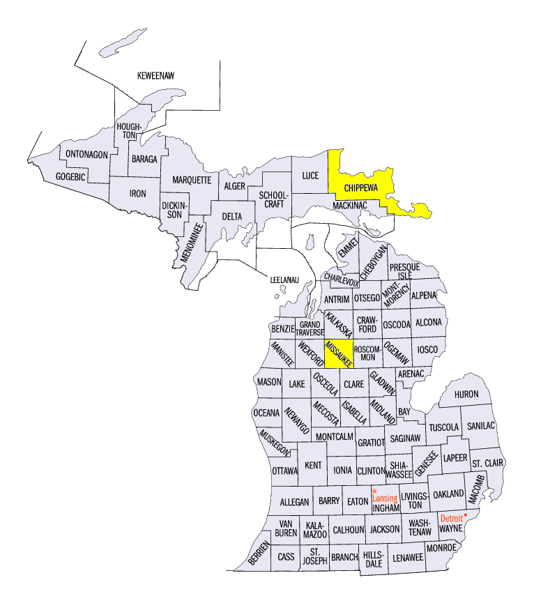
Temperatures near- to slightly below-freezing in Michigan brought the first snowfall of the 2016-17 winter season through the morning of October 27 (Figure 8). Amounts generally less than two inches fell across northern Lower Michigan and far eastern parts of the U.P. of Michigan. The highest reported snowfall total was 3.0 inches, occurring both near Houghton Lake (Missaukee County) and near Rudyard (Chippewa County).
Harvest Season Nearing End
While wet weather has limited farmers in some areas, the soybean harvest in northern states and corn harvest in southern states in the Midwest neared their end according to the October 30 NASS Crop Progress Report. The corn harvest in Missouri, Illinois and Kentucky was more than 90% completed, while Iowa, Minnesota and Indiana were more than 70% completed (Figure 9). The soybeans harvest was more than 80% completed in Iowa, Wisconsin, Illinois, Indiana and Ohio, while the soybeans harvest concluded in Minnesota (Figure 10). Only the soybeans harvest in Michigan was more than 5% behind the five-year average.
-BJP-