October 1-10, 2016
Midwest Weekly Highlights - October 1-10, 2016
Warm Temperatures
Temperatures were above normal across most of the Midwest this week
(Figure 1). Most of Michigan was 5-7°F above normal, while most of Wisconsin, Illinois, Indiana and northern Ohio was 3-6°F above normal. Only parts of northwestern Missouri, western Iowa and southwestern Minnesota were near normal.
Drier Weather
A large portion of the region had below-normal precipitation during the first week of October (Figure 2). Most of the Ohio River Valley, Wisconsin, and eastern Iowa received less than half the normal amount of precipitation in the period
(Figure 3). Some areas on the western edge of the region, northern Illinois, and Lower Michigan had above-normal precipitation. Parts of western Missouri, northwestern Iowa and southwestern Minnesota received over two inches (Figure 4).
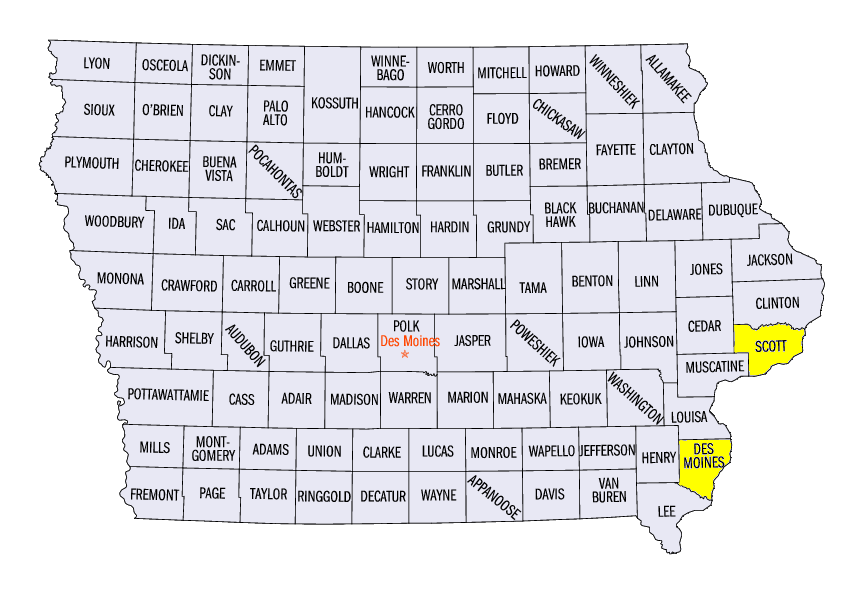
October 6 Severe Weather
A late-season storm near the Quad Cities, Iowa/Illinois area caused multiple tornadoes and wind damage
(Figure 5). Three tornadoes were reported, with one rated EF-0 and two rated EF-1. The most significant of these had a 20-mile track that went through downtown Davenport, IA (Scott County) after 10:30PM local time. Peak winds were estimated at 100 mph. Fortunately, no one was injured. Wind reports were also common in Scott County, IA and Rock Island County, IL from storms in the area. Further to the east, wind damage was also reported in Lake County, IL along Lake Michigan from another storm. Trees and power lines were downed due to the high winds.
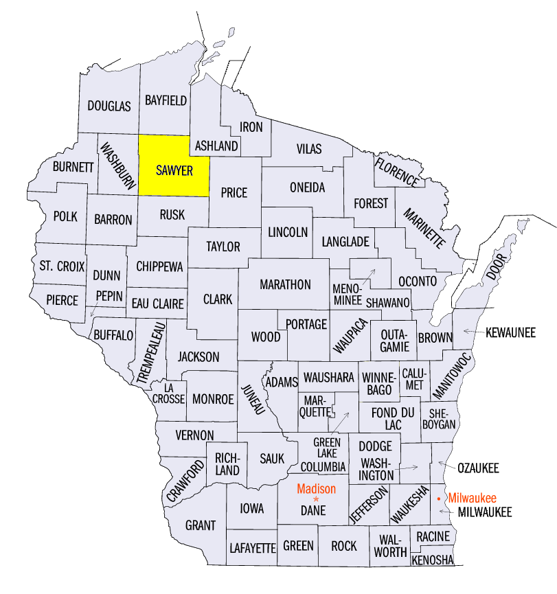
Upper Midwest Receives First Fall Freeze
Portions of Minnesota, Wisconsin and Michigan received their first fall freeze during the period, marking the end of the growing season (Figure 6). While some of these first freezes came on the mornings of October 7 and October 8 in northern Minnesota, many in Wisconsin and Minnesota came on the morning of October 9
(Figure 7). Minimum temperatures in the upper-20’s were common, with a minimum temperature of 21°F reported in Winter, WI (Sawyer County).
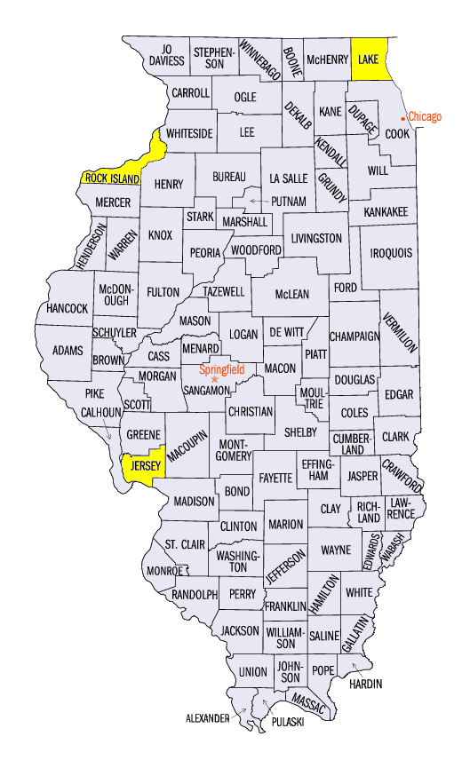
Flood Waters Receding
After moderate to major flooding occurred across Wisconsin and Iowa in late September, flood waters receded below flood stage at many gauges across the region (Figure 8). By October 10, only stream gauges on the Mississippi River were in minor flood stage, with many near or past their peak crest. Minor flooding was occurring on the river from Burlington, IA (Des Moines County) through Grafton, IL (Jersey County) and was forecast to subside in the coming week.
Fall Harvest Behind Schedule
While drier conditions in some areas allowed farmers to head out into their fields, corn and soybeans harvests remain behind schedule in parts of the Midwest. Corn harvests in Iowa and Minnesota were both more than 10 percent below the five-year average according to the National Agriculture Statistics Service report for the week ending October 9 (Figure 9). Only two states, Illinois and Kentucky, were ahead of schedule with the corn harvest. Nearly 20% of the total corn crop in Illinois was harvested during the week in part due to dry weather. Meanwhile, the soybeans harvest was below average in four Midwest states, with no Midwest state more than five percent above the five-year average (Figure 10). Iowa, Wisconsin and Michigan were all more than 10 percent below the five-year average.
-BJP-