September 15-21, 2016
Midwest Weekly Highlights - September 15-21, 2016
Hot Fall Temperatures
Well above-normal temperatures were common across the Midwest during the week
(Figure 1). Most of Missouri, Iowa, Illinois, Indiana, Kentucky, Ohio and western Lower Michigan were 5-9°F above normal. The relative cool spot was in northern Minnesota, where temperatures were only 1-4°F above normal. Maximum temperatures often reached the 80s across the southern half of the region, with a few lower 90s on September 20 (Figure 2). A few dozen high-maximum and high-minimum temperature records were broken on these days across the region.
Heavy Rain Continues
Heavy rain continued to be a story across the Midwest on multiple days during the period
(Figure 3). Two areas received two to three times normal rainfall: much of Iowa, southern Minnesota, and southern Wisconsin and southern Missouri, southern Illinois, and parts of Indiana (Figure 4). September 15 through the morning of September 16 was particularly wet across western Iowa, where 2-4 inches of precipitation fell
(Figure 5). Isolated areas in southern Missouri, Illinois and Indiana received upwards of two inches a day later through the morning of September 17 (Figure 6). The start of a very wet two-day period in Minnesota, Iowa and Wisconsin began on September 20 (Figure 7). Rainfall continued throughout the day on September 21 and through the morning of September 22 (Figure 8). More than 100 daily precipitation records were broken during the period, with over 50 in Iowa.
September 21 Flash Flooding
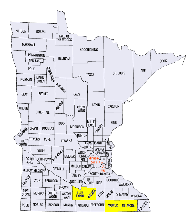
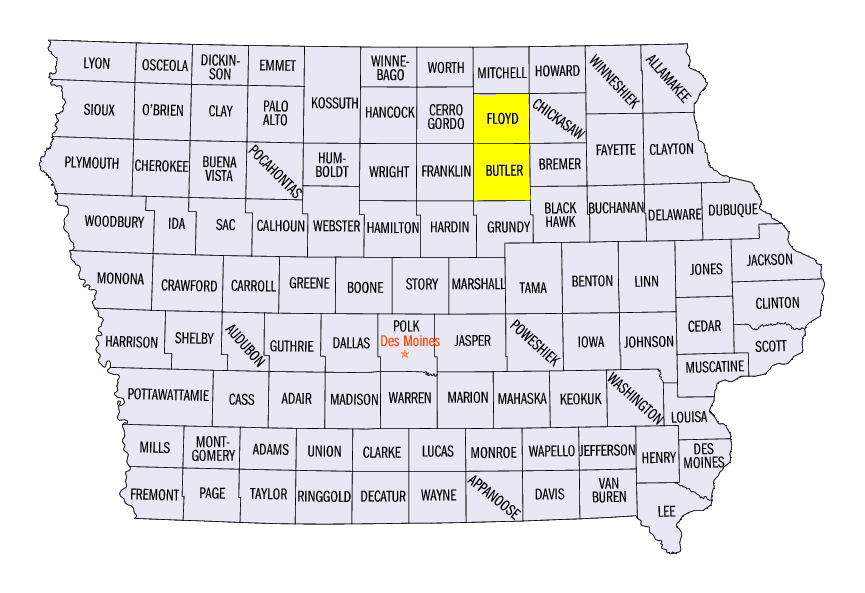
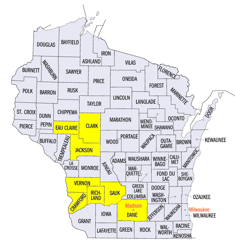
Slow-moving storms in eastern Iowa, southern Minnesota and southwest Wisconsin led to flash flooding on September 21 (NWS La Crosse Report) (NWS Quad Cities Report). Three to five inches of rain fell in these areas over a two-day period, with a majority of the rainfall coming during the evening of September 21. Flash flood or flood warnings were in effect at some point in over 50 counties on September 21 through the morning of September 22 (Figure 9). Rivers including the Black (Figure 10), Cedar (Figure 11), Kickapoo (Figure 12), Zumbro (Figure 13) and Upper Iowa (Figure 14) rivers all reached flood stage in a matter of hours. One of the heaviest reports of precipitation was near Waseca, MN (Waseca County), where 10.16 inches of rain fell in 48 hours. Other 48-hour precipitation reports included 6.69 inches near Mankato, MN (Blue Earth County), 6.47 inches near Lanesboro, MN (Fillmore County), 7.55 inches in Nashua, IA (Floyd County), 6.85 inches in Gays Mills, WI (Crawford County), 6.02 inches near Augusta, WI (Eau Claire County) and 6.81 inches in Readstown, WI (Vernon County).
Major impacts to transportation and property occurred due to the flooding. A state of emergency was declared in 13 Wisconsin counties as many roads were impacted by flooding. Mudslides were common along the Mississippi River bluffs, leading to the closure of Wisconsin Highway 35 in Crawford and Vernon counties. A man was killed when his home fell in a mudslide onto the highway. Interstate 90 was briefly closed near Austin, MN (Mower County) due to water on the road. Minnesota Highway 13 and 83 and U.S. Highway 14 were closed in southern Minnesota. Iowa Highway 188 and 14 and U.S. Highway 63 were also blocked in Iowa. The city of Greene, IA (Butler County) evacuated residents and closed schools due to flooding on the Shell Rock River. Impacts were expected to last into the following week as rivers continue to flow downstream. Flooding along the Cedar River at Cedar Rapids (Figure 15) and Waterloo
(Figure 16) were forecast to reach levels not seen since the historic flooding in June 2008.
September 19 Severe Weather
A line of strong thunderstorms caused hail across southern Wisconsin on September 19 (Figure 17). One particularly long-lived storm dropped hail along a path through Richland, Sauk and Dane counties. The largest hail was reported in the Madison area, where the largest hailstone was measured at 2.25 inches
-BJP-
The National Weather Service-La Crosse also contributed to this report.
The National Weather Service-Chanhassen also contributed to this report.