August 22-31, 2016
Midwest Weekly Highlights - August 22-31, 2016
Heavy Rain Common
Thunderstorms caused heavy rain across many different portions of the Midwest during the final week of August
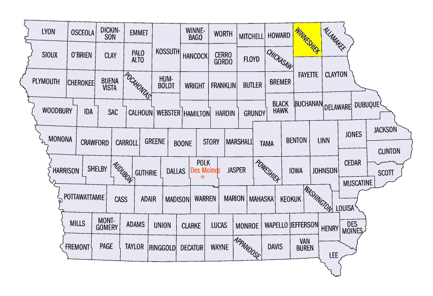
(Figure 1). Some of the heaviest rain occurred through the morning of August 24, where over six inches of rain fell in northeast Iowa (Figure 2). Decorah, IA (Winneshiek County) received 8.06 inches, shattering their all-time daily precipitation record of 6.60 inches on June 8, 2008. Portions of western Missouri, southeast Wisconsin and central Indiana received upwards of two inches of precipitation through the morning of August 25
(Figure 3). Pockets of heavy rain were seen once again in northwestern Missouri through the morning of August 27 (Figure 4). Northern Minnesota was quite wet through the mornings of August 28
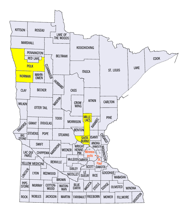
(Figure 5) and August 29 (Figure 6), where more than two inches fell. Ada, MN (Norman County) received 3.82 inches through the morning of August 28, which was more than an inch above the normal amount for the month of August. More heavy rain fell in Minnesota through the morning of August 30
(Figure 7). Milaca, MN (Mille Lacs County) received 5.06 inches, while the St. Cloud Airport (Sherburne County) received 4.08 inches. The heavy rain across parts of the region during the period was often more than twice the normal amount (Figure 8).
Hot End to Summer
Above-normal temperatures were common across the eastern half of Midwest to end the month of August
(Figure 9). Most of Illinois, eastern Wisconsin and the U.P. of Michigan were 1-3°F above normal. Lower Michigan, Indiana, Kentucky and Ohio were slightly hotter at 3-6°F above normal. Maximum temperatures reached the upper 80s to low 90s across the southern third of the region most of the week, with one of the warmest days on August 28 through the morning of August 29 (Figure 10). Minimum temperatures often remained in the 70s overnight, as airports in cities such as Louisville, KY, Detroit, MI, and Chicago, IL either tied or broke daily high-minimum temperature records during the period.
Flooding and Flash Flooding
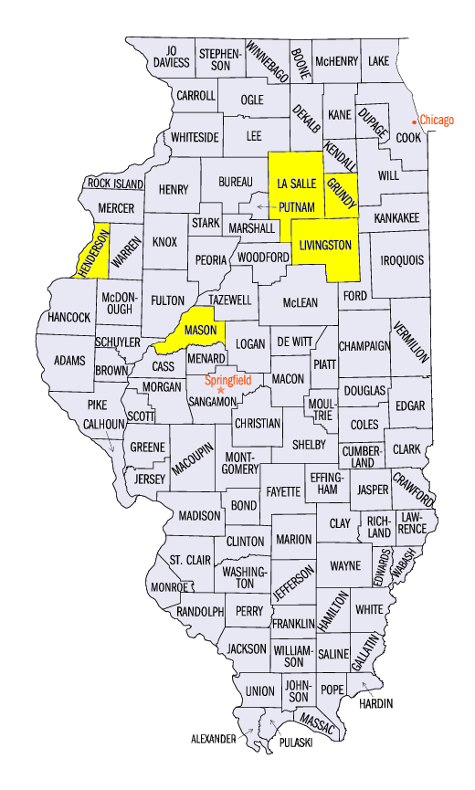
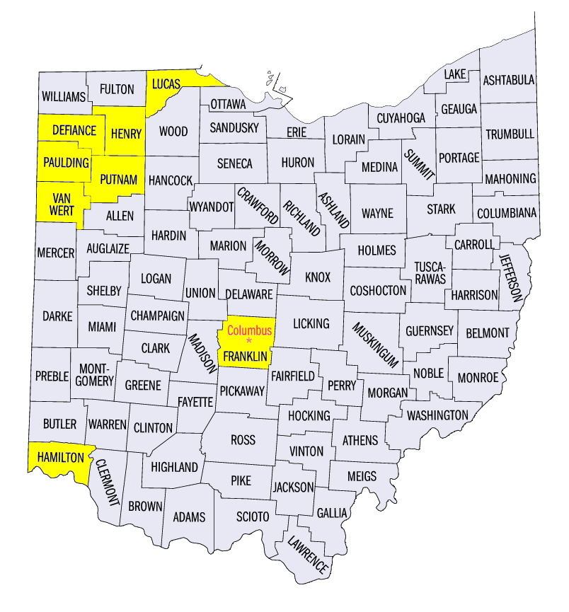
Heavy rain on multiple days led to flash flooding and flooding across portions of the Midwest. Heavy rain on August 23 through the morning of August 24 caused flooding on the Turkey River (Figure 11) and Upper Iowa River (Figure 12). Flash flooding was reported in northeastern Illinois and southwestern Ohio on August 28. Braceville, IL (Grundy County) and Odell, IL (Livingston County) had flooded streets from heavy rain. Cincinnati, OH (Hamilton County) and Columbus, OH (Franklin County) also had flooded basements and impassable roads due to flooding. Milwaukee, WI (Milwaukee County) also received up to three inches of rain on August 30, resulting in flash flooding and an overflow to the city’s sewer system.
River flooding was also common during the period on the Illinois and Mississippi Rivers. The Illinois River at La Salle (Figure 13, La Salle County) and Havana
(Figure 14, Mason County) reached minor flood stage during the period. The Mississippi River at Gladstone, IL (Figure 15, Henderson County) also reached minor flood stage.
Strong Tornadoes and Severe Weather
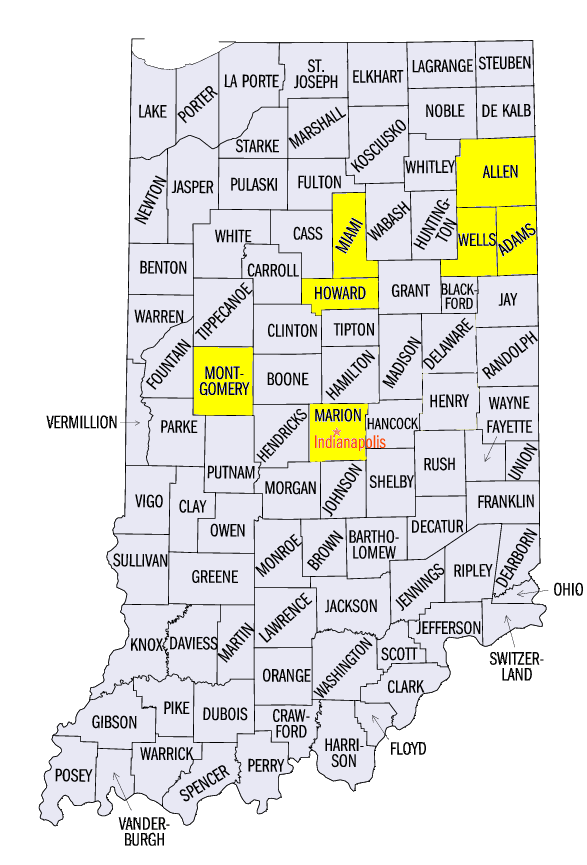
Multiple tornadoes were reported in Indiana on August 24, with some reaching EF-2 and EF-3 strength. Three of these tornadoes touched down near Kokomo (Howard County), with the strongest an EF-3 that hit southern portions of the city during the mid-afternoon. Winds were estimated at 152 mph and caused 20 injuries along a nearly nine-mile-long path. Several hours later, an EF-1 tornado passed to the north of the city, while an EF-0 tornado passed to the south during the evening hours. An EF-2 tornado was observed near Crawfordsville (Montgomery County). Other tornadoes in the state included an EF-1 tornado near Russiaville (Howard County) and in northeast Indianapolis (Marion County). In northern Indiana, an EF-3 tornado was observed near Woodburn, IN (Allen County) with winds estimated at 160 mph. An EF-1 tornado was also reported near Berne, IN (Adams County) and EF-0 tornadoes were observed in Wells and Miami counties. Tornadoes continued to be spotted as these storms moved into Ohio. Eleven confirmed tornadoes were reported in Ohio in Paulding, Defiance, Van Wert, Henry, Putnam and Lucas counties. The strongest of these was an EF-2 tornado near Antwerp (Paulding/Defiance counties) with winds of up to 130 mph. Only one injury was reported any of the confirmed tornadoes in Ohio.
An EF-2 tornado was also observed during the late evening hours of August 28 in northwestern Minnesota. The 10 mile long tornado had estimated winds of 115 mph, and resulted in the destruction of a barn near Gary, MN (Norman County). Earlier that evening, an EF-0 tornado was reported in Polk County, MN. No injuries were reported from either tornado.
Strong winds and hail were also reported during the period (Figure 16). Strong winds up to 60 mph were common during thunderstorms in Missouri on August 24 and August 25. Strong winds and damage were common across western Ohio on August 27, including a 62 mph wind gust at the Toledo Express Airport (Lucas County). One-inch hail and winds up to 60 mph were common across Indiana, Ohio and eastern Kentucky on August 28.
-BJP-