August 15-21, 2016
Midwest Weekly Highlights - August 15-21, 2016
Heavy Rain Continues
A slowly moving boundary that began in the previous week continued to meander to the east, bringing heavy rainfall to southeastern Missouri, eastern Illinois, Indiana and southern Lower Michigan (Figure 1). Over three inches of rain fell in these areas, with amounts over five inches in some areas. In most cases, this was two to five times the normal amount for the period (Figure 2). Most of this precipitation fell at the beginning of the period on August 15-16.
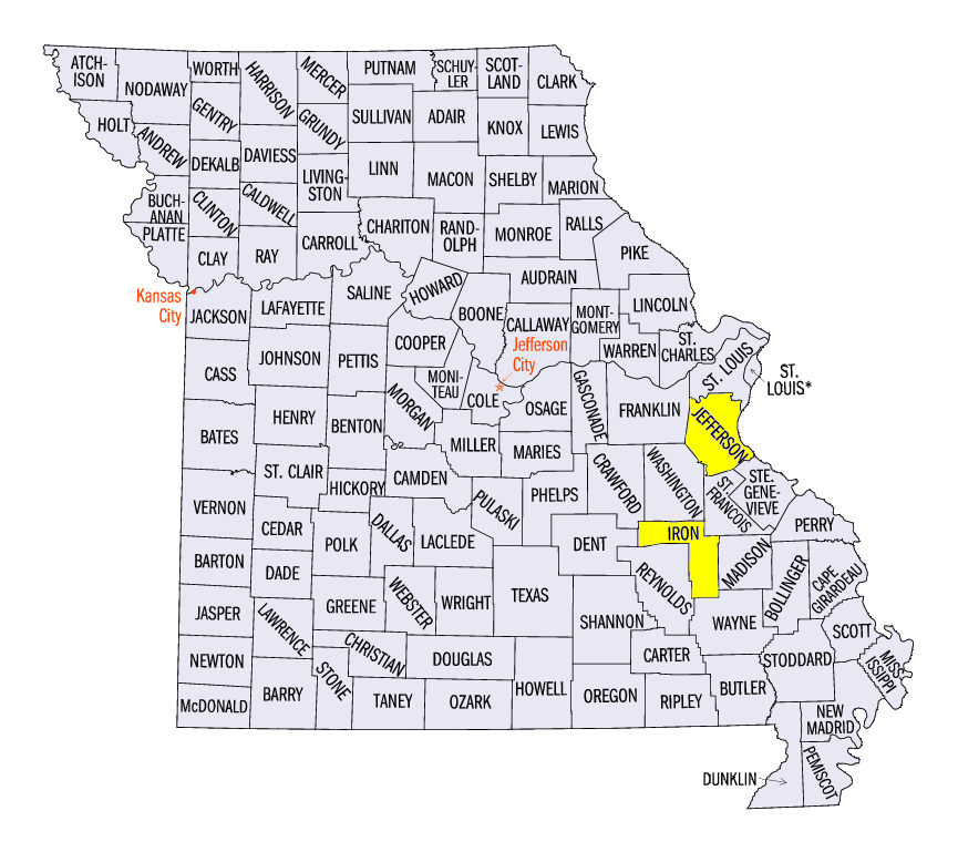
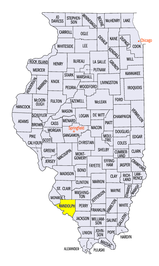
Through the morning of August 15, southeastern Missouri and southern Illinois received 2-4 inches of rain, with southern Indiana and Ohio having up to an inch (Figure 3). Some of the heavier totals included 6.00 inches near Belleview, MO (Iron County), 5.95 inches in Festus, MO (Jefferson County), and 4.37 inches near Red Bud, IL (Randolph County). Over fifty daily precipitation records were broken, with over 20 occurring in Illinois. An all-time daily precipitation record of 7.69 inches was also set on August 15 at the South Bend, IN Airport (Saint Joseph County).
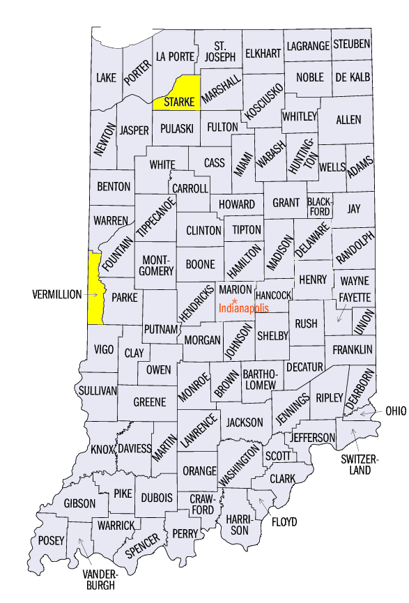
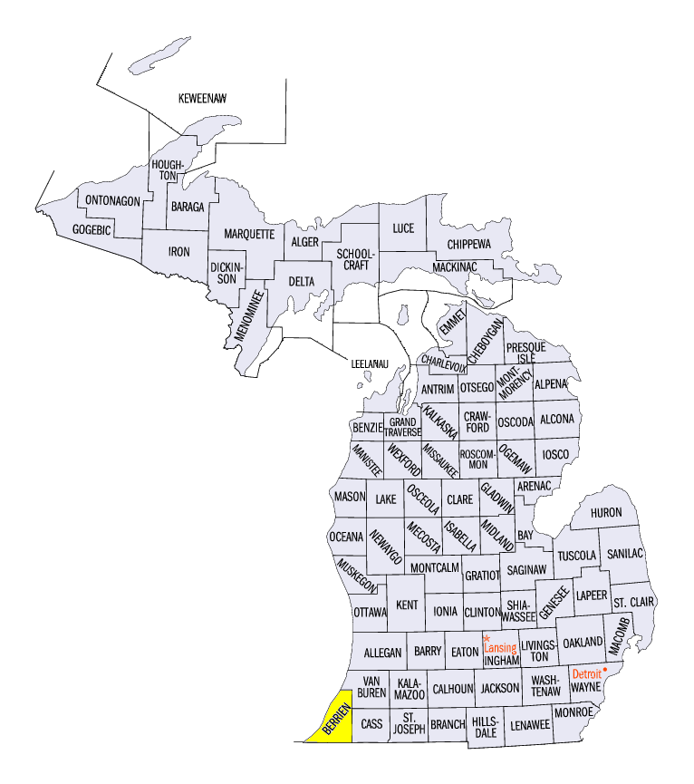
The heaviest rain moved northward during the day on August 15 through the morning of August 16, dumping upwards of three inches in parts of eastern Illinois, northwestern Indiana and southwestern Michigan (Figure 4). Over 60 daily precipitation records were broken. All-time daily precipitation records were set in Niles, MI (6.69 inches, Berrien County), and near Perrysville, IN (4.26 inches, Vermillion County). Knox, IN (Starke County) also received 8.23 inches while near North Judson, IN (Starke County), an incredible 10.24 inches of rain fell.
Moderate to heavy rain also fell in other areas of the region during the remainder of the period. Another 100 daily precipitation records were set from August 17-21. Over two inches of rain fell in parts of northern Illinois and southern Ohio through the morning of August 18
(Figure 5). Similar totals fell in western Wisconsin through the morning of August 19 (Figure 6) and in central Iowa through the morning of August 20
(Figure 7). Kentucky and the U.P. of Michigan also received over 1.5 inches through the morning of August 21 (Figure 8).
Hot to the East, Cool in Missouri
Temperatures were above normal across most of the eastern half of the Midwest
(Figure 9). Wisconsin, northern Illinois, Indiana and Kentucky were 1-3°F above normal for the period. Hotter temperatures were observed across Michigan and Ohio, which were 3-6°F above normal. Maximum temperatures in these areas were even warmer at 5-8°F above normal (Figure 10). Most of Iowa and Minnesota were near normal, while Missouri was 1-4°F below normal. Minimum temperatures were even cooler across Missouri through the Ohio Valley
(Figure 11).
Severe Weather and Tornadoes
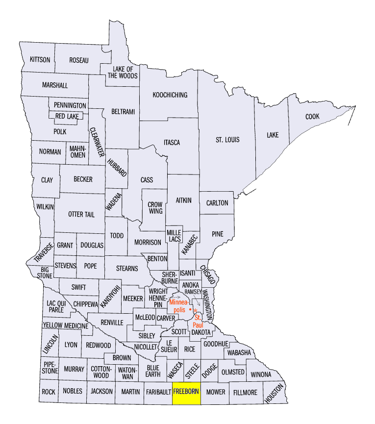
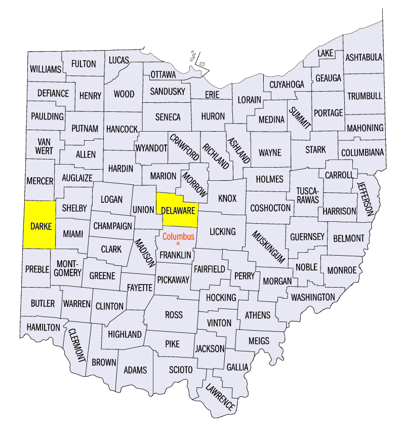
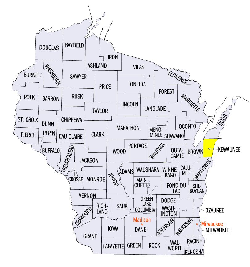
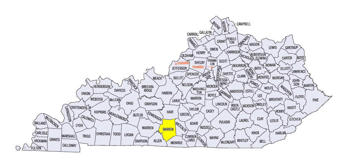
Heavy rain wasn’t the only hazard from storms during the week, as storm damage from wind gusts and tornadoes were also common (Figure 12). Tornadoes spawned across the western suburbs of Indianapolis on August 15. Eight tornadoes were reported: three EF-0 tornadoes, four EF-1 tornadoes and 1 EF-2 tornado. Storms on August 18 blew through southern Minnesota, causing wind damage. A tornado was also reported near Hollandale (Freeborn County). Tornadoes were common yet again on August 20 across central Ohio and southwestern Michigan. At least four tornadoes were confirmed across southwestern Michigan. Two of these tornadoes occurred near Grand Rapids, MI. Two more tornadoes were reported in Ohio near Gettysburg (Darke County) and Delaware (Delaware County). Brief tornadoes were also reported in Kewaunee County, WI and Barren County, KY.
Drought Improves in Ohio, Michigan
Heavy rain across Michigan and Ohio decreased areas of drought in the August 16 Drought Monitor (Figure 13). Severe drought that was introduced just a week earlier was eliminated in Ohio, while areas in drought were nearly halved in the state. Drought was nearly eliminated in Michigan, as less than one percent of the state was considered to be in moderate drought. Over 35 percent of the state remains abnormally dry.
-BJP-