August 8-14, 2016
Midwest Weekly Highlights - August 8-14, 2016
Widespread Heat
Above-normal temperatures were common across the Midwest
(Figure 1). The hottest areas were in the eastern part of the region, where Michigan, northern Indiana and eastern Kentucky were 4-6°F above normal. Ohio was also warm at 5-9°F above normal. Only a few areas were near normal along Lake Superior. Maximum temperatures reached the 90’s from August 9-12 as over 50 daily high maximum temperature records occurred in the region. Most of Lower Michigan had temperatures in the lower 90’s on August 10 through the morning of August 11 (Figure 2). Temperatures refused to cool off overnight as well. Over 300 daily high minimum temperature records were set in the region from August 10-14.
Heavy Rain and Flash Flooding
Wet weather was common in the Midwest during the period, with rainfall totals over two inches across portions of Minnesota, Iowa, southern Missouri and through the northern Ohio Valley (Figure 3). These areas received at least twice the normal amount of precipitation, with parts of southern Minnesota more than five times above normal (Figure 4 ). More than 200 daily precipitation records were broken during the period. The cause of this heavy rainfall was a slow moving frontal boundary that stalled multiple times during the week.
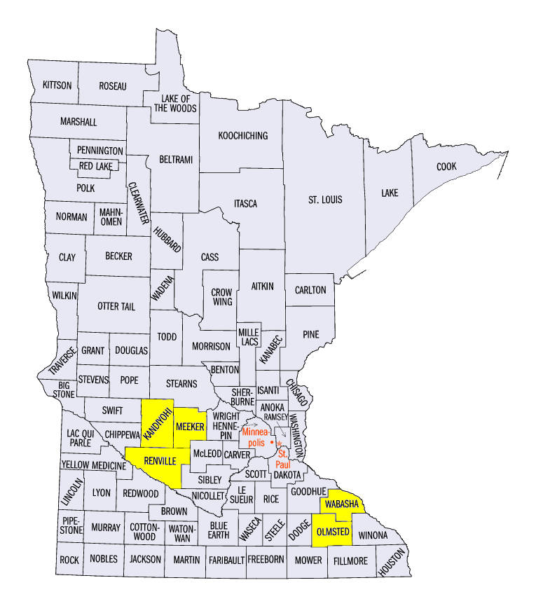
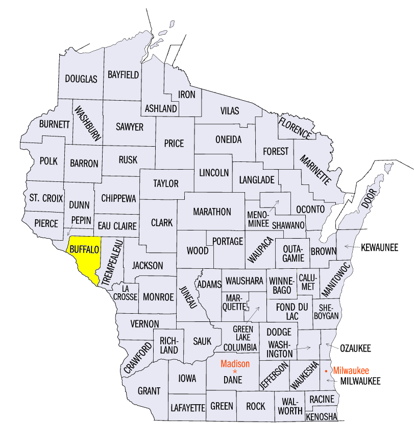
The heavy rain began on the afternoon of August 10 through the morning of August 11 in Minnesota and northern Wisconsin (Figure 5). Training bands of thunderstorms dumped up to eight inches of rain in western Minnesota. Near Wilmar (Kandiyohi County), 8.09 inches fell while multiple reports of 5-7 inches were recorded in Renville and Meeker counties. Further east, thunderstorms dropped 5-8 inches across Olmstead and Wabasha counties, MN and Buffalo County, WI. Roads were washed out from the flooding that occurred.
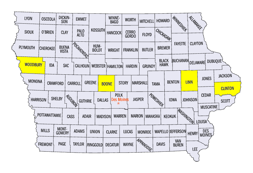
The system moved slightly farther south to Iowa on August 11 through the morning of August 12 (Figure 6). Flash flooding was common across central and western portions of the state as 2-4 inches of rain fell. Nearly 50 daily precipitation records were set across the state. The Cedar Rapids Municipal Airport (Linn County) received 4.91 inches while 4.40 inches fell near Ames (Boone County). The Wapsipinicon River near De Witt (Clinton County) reached moderate flood stage as 4.25 inches fell in the city. The Cedar and English rivers also reached minor flood stage.
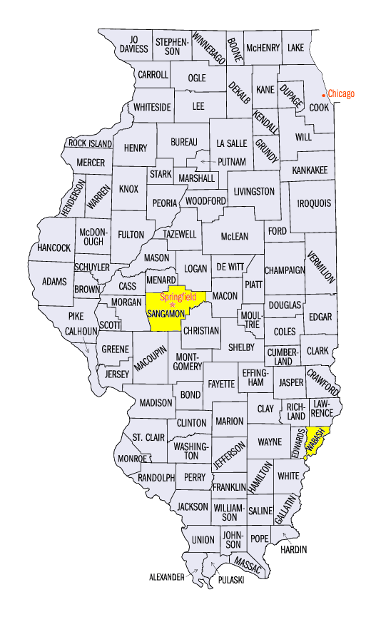
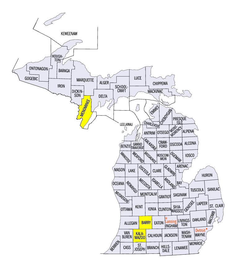
The frontal boundary moved slightly farther south on August 12 through the morning of August 13, bringing heavy rain to northern and central Illinois (Figure 7). Thunderstorms during the afternoon of August 12 dumped 5.59 inches of rain on Springfield, IL (Sangamon County). More than half of that total, 3.34 inches, fell between 6pm and 7pm local time, which was more than the normal monthly amount for August. The daily rainfall set an all-time daily precipitation record at the Springfield Capitol Airport. Flash flooding impacts were compounded due to the Illinois State Fair in the city. Trucks and trailers were flooded in low-lying parking lots from the quickly rising water. Heavy rain also was common in southwest Michigan, where 2-4 inches of rain was common. Hastings (Barry County) received 4.46 inches while 5.16 inches of rain fell near Fulton (Kalamazoo County).
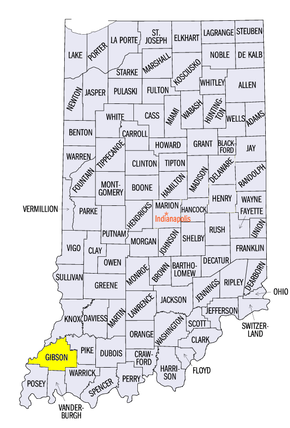
Heavy rain continued on August 13 through the morning of August 14 along the northern Ohio River Valley (Figure 8). Two to five inches of rain fell across southeastern Missouri, southern Illinois and southwestern Indiana. Hazelton, IN (Gibson County) received 5.20 inches, Mt. Carmel, IL (Wabash County) had 5.07 inches and Williamsville, MO (Wayne County) set an all-time daily precipitation record of 8.11 inches.
Severe Weather August 10-11
Storms in Minnesota and Iowa on August 10-11 caused wind and hail damage along with the flash flooding
(Figure 9). Trees were snapped due to winds up 60 mph on August 10. Two-inch hail was also reported in Kandiyohi County, MN. Most of the reports on August 11 were due to high wind in western Iowa. An 84 mph wind gust was reported in Woodbury County, IA during the evening hours. A weak tornado was also reported in the U.P. of Michigan in Menominee County during the afternoon hours.
Chicago Landspout Tornado
The first tornado to occur in the city limits of Chicago, IL since 2006 touched down on August 9 during partly cloudy skies. The tornado was specifically called a landspout since it was not caused by a rotating thunderstorm system. A lake breeze boundary off of Lake Michigan helped create the rotation that led to the landspout. The tornado was rated at EF-0 and no damage was reported.
Drought Intensifies in Ohio
Before rain began to fall from August 10-14, drought worsened in Ohio according to the August 9 Drought Monitor (Figure 10). Severe drought was introduced into portions of northwest Ohio, with isolated areas of severe drought added in southeastern Lower Michigan. Moderate drought was also introduced into northeast Indiana. Significant rainfall after August 9 likely alleviated some drought in these areas.
-BJP-