July 18-24, 2016
Midwest Weekly Highlights - July 18-24, 2016
Wet in the Upper Midwest
Multiple rounds of storms made for a very wet week across Minnesota, Iowa, Wisconsin, Illinois, Indiana and Michigan
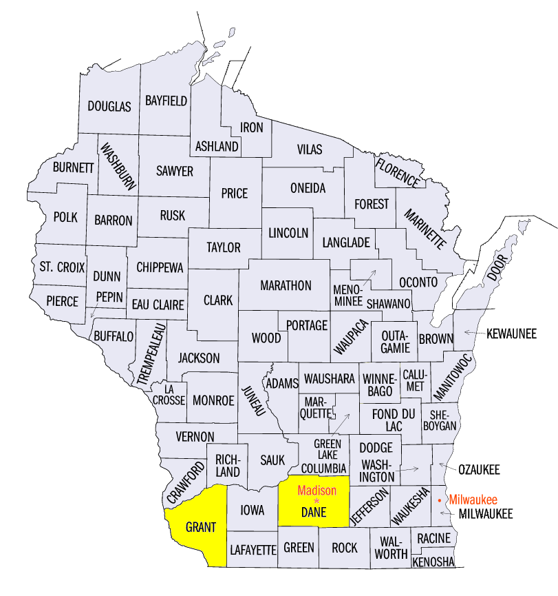
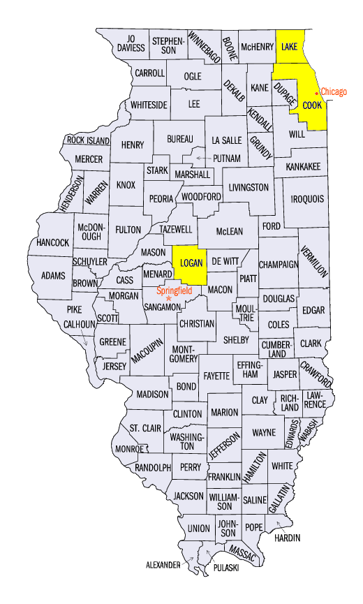
(Figure 1). More than an inch of precipitation fell across most of these states. Totals of over three inches were common across southern Wisconsin and northern Illinois. Most of these areas had at least twice the normal amount of precipitation for the period (Figure 2). Locally higher amounts included 6.41 inches near Lancaster, WI (Grant County), 7.11 inches near Madison, WI (Dane County) and 5.08 inches in Park Forest, IL (Cook County).
Hot Weather
Well above normal temperatures were common across the entire Midwest
(Figure 3). Missouri was one the hottest locations with temperatures 4-7°F above normal. Most of Wisconsin, Minnesota and northern Iowa were also 4-6°F above normal. Average temperatures across Illinois, Indiana, Ohio, Kentucky and Lower Michigan were 3-5°F above normal. Minimum temperatures were even more above normal across Iowa and Missouri at 5-8°F above normal (Figure 4). Maximum temperatures also routinely reached the upper 80's and 90's across most of the region
(Figure 5). One of the hottest days across the region was on July 21 through the morning of July 22, where temperatures were in the 90's across a large portion of the region (Figure 6).
July 21-24 Excessive Heat and Humdity
A dome of high pressure over the central U.S. brought excessive heat and humidity to the Midwest from July 21-24. Heat Index values above 100°F were common across most of Missouri, Iowa, Minnesota, Wisconsin and Illinois, where excessive heat warnings were in place
(Figure 7). Many locations had Heat Index values near or above 110°F, including St. Louis, MO, Des Moines, IA and Chicago, IL (Figure 8). One of the hottest areas was central Illinois on July 24, where the heat index was as high as 121°F in Lincoln, IL (Logan County). Minimum temperatures were quite warm as well, with over 140 daily high minimum temperature records broken in the region from July 21-24.
July 20-21 Severe Weather and Flash Flooding
A strong line of thunderstorms on the evening of July 20 through the morning of July 21 caused damage across Minnesota and Wisconsin
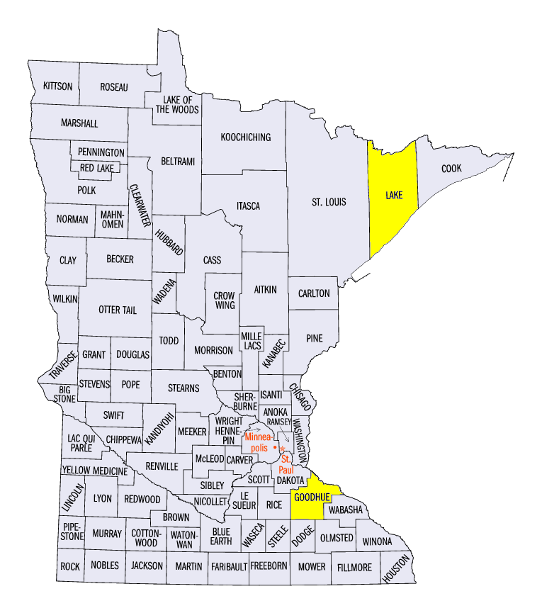
(Figure 9). On the evening of July 20, the line of thunderstorms caused two fatalities at a Boy Scout camp in Lake County, MN. The line then progressed through Duluth, MN and left more than 75,000 without power. The line of storms remained intact overnight and moved through eastern Wisconsin during the morning hours. More than 14,000 were without power in Milwaukee, WI due to the storm. A second line of storms formed during the early afternoon hours in central Wisconsin. This line of storms was very slow moving and caused flash flooding along with wind damage in southern Wisconsin through northern Illinois and eastern Iowa through the morning of July 22
(Figure 10).
July 23 Severe Weather and Flooding
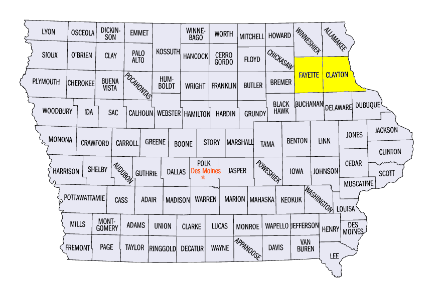
Heat and humidity on July 23 provided fuel for severe storms and heavy rain from Minnesota through Illinois (Figure 11). Multiple days of heavy rain across northeast Iowa and southwest Wisconsin led to flooding on tributaries leading into the Mississippi River. Rain through the mornings of July 21 and July 22 saturated the area before multiple rounds of rainfall on July 23 through the morning of July 24 dumped 2-4 inches of rain. The Turkey River reached minor flood stage at Eldorado, IA (Figure 12, Fayette County) and Elkader, IA (Figure 13, Clayton County). The Grant River at Burton, WI (Grant County) reached moderate flood stage on the morning of July 24 (Figure 14). Rainfall over these areas and further north led to high water on the Mississippi River. While no flooding was reported, many river gauges from Lake City, MN (Goodhue County) to Guttenberg, IA (Clayton County) were near or in the action stage.
Chicago, IL was also hit hard by storms late in the afternoon on July 23. Winds up to 60 mph were accompanied by heavy rain. Flash flooding was common across both Cook and Lake Counties from the 2-4 inches of rain that fell. A Cook County Precipitation Network gauge in the far northeast corner of Cook County recorded 4.97 inches from the combined morning and afternoon storms. Strong winds knocked over rapid transit platforms in the city and delayed trains while leaving more than 87,000 without power in northern Illinois.
More Drought Introduced in Ohio
Continued dry weather in Ohio led to the introduction of drought across more of northern Ohio in the July 19 Drought Monitor (Figure 15). Nearly 30% of the state was considered to be in moderate drought, which was more than double the amount reported on July 12. Most of Michigan also remained abnormally dry or in moderate drought. An estimated nine million people were in drought areas, including the cities of Detriot, MI, Toledo, OH and Cleveland, OH. Drought relief was found in Iowa, however. From July 17-24, more than twice the normal amount of rainfall fell across abnormally dry and drought areas in the state (Figure 16).
-BJP-