July 11-17, 2016
Midwest Weekly Highlights - July 11-17, 2016
Wet Weather in the West
Adequate precipitation fell across most of the western Midwest, as more than an inch of precipitation fell across most of Minnesota, Wisconsin, Iowa, Illinois, western Missouri and western Kentucky
(Figure 1). Some of the wettest weather was in Minnesota and northern Wisconsin, where more than three inches of precipitation fell. Isolated areas received more than six inches of precipitation. In many cases, this was 3-5 times the normal amount (Figure 2). Over 100 daily precipitation records were broken during the period in the region, with nearly 50 of them in Minnesota and Wisconsin. Drier conditions were found in the eastern half of the region. Most of Ohio, Michigan, Indiana, southern Wisconsin, southeast Missouri, southern Illinois and eastern Kentucky received less than an inch of precipitation.
Cool in Minnesota and Iowa, Warm in Ohio
Temperatures were within a few degrees of normal across most of the region, with a few exceptions in the eastern and western reaches of the region
(Figure 3). Portions of western Iowa and western Minnesota were 2-4°F below normal for the period as high temperatures only averaged in the 70’s (Figure 4). Most of Ohio, Michigan and Kentucky were a few degrees above normal, but only eastern Ohio was more than 3°F above normal.
Northern Wisconsin Flooding July 11-12
Record and near-record precipitation fell across northeastern Wisconsin on the night of July 11 through the morning of July 12
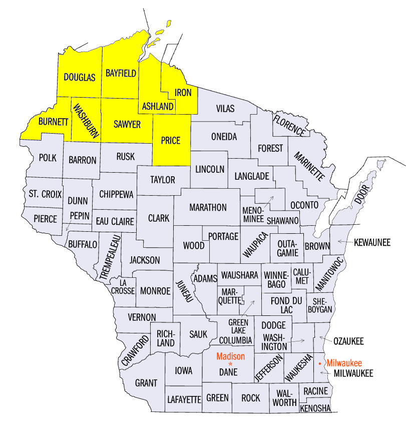
(Figure 5). The result was widespread flooding that continued through the weekend of July 16-17. Three Wisconsin stations, Danbury (7.27 inches, Burnett County), Gordon (7.87 inches, Douglas County) and Gurney (9.65 inches, Iron County) recorded their highest one-day precipitation total on record on the morning of July 12. The Wisconsin governor issued a state of emergency in response to the flooding for Ashland, Bayfield, Burnett, Douglas, Iron, Price, Sawyer and Washburn counties. Many state and U.S. highways were closed, including U.S. Highways 2 and 63, due to standing water and loss of pavement. Damage also occurred to many homes in the affected area and sunk boats in harbors along Lake Superior. Preliminary damage estimates across the eight counties was over $28 Million to public infrastructure and over $1.7 Million to homes and businesses as of July 17. Damage estimates to infrastructure in Iron County were well over $11 Million. At least three fatalities were confirmed to be attributed to the flooding. Additional information, including surveys and pictures of the flooding, is available from NWS Duluth, MN and Ready Wisconsin.
Abundant Severe Weather
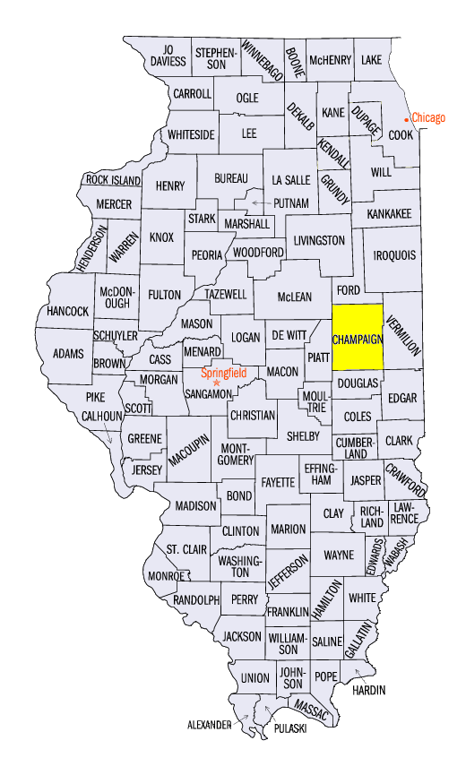
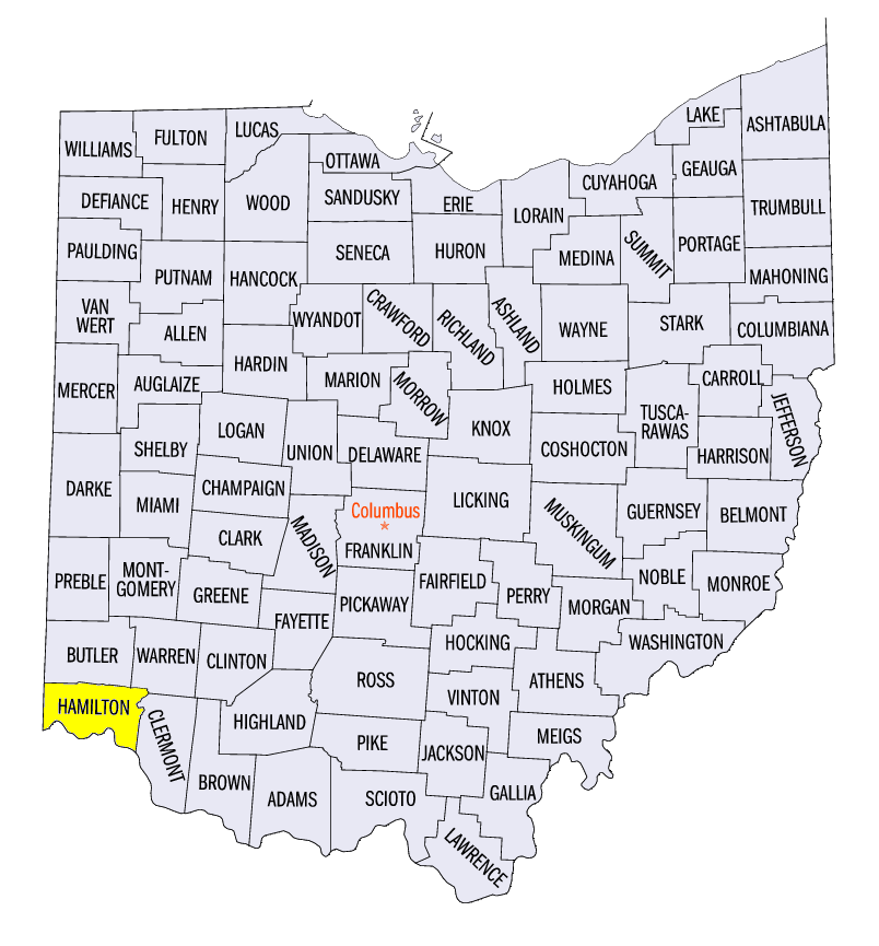
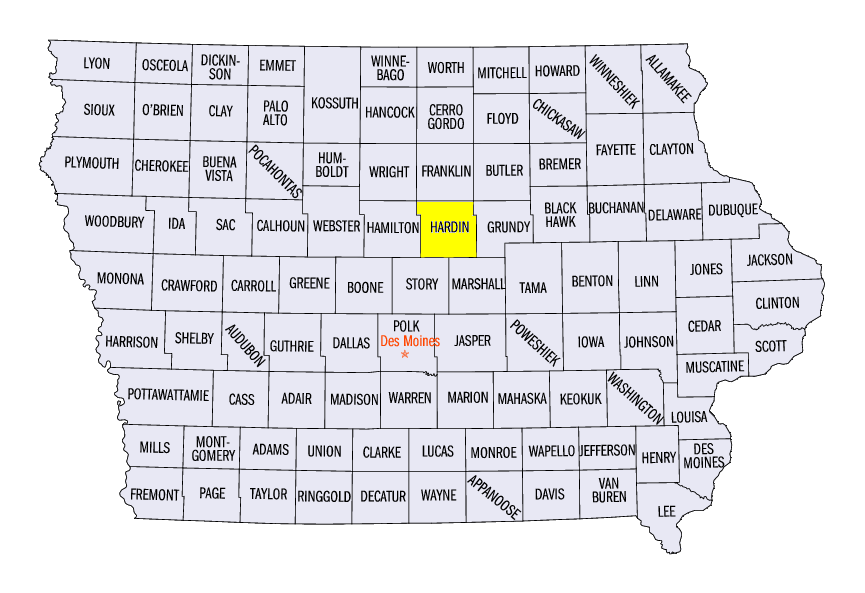
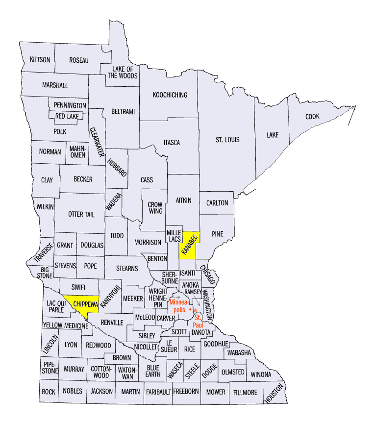
Wind and hail reports were common across the central and southern Midwest in another busy week of severe weather (Figure 6). A majority of these reports came from a strong line of storms during the afternoon and evening hours of July 13. Wind gusts of 60-70 mph were common across Missouri, Illinois, Indiana and Ohio, with a wind gust of 78 mph reported in Urbana, IL (Champaign County). An EF-0 tornado was also confirmed in Hamilton County, OH that evening. Scattered storm reports were found every other day in the week, including weak tornadoes in Minnesota and the U.P. of Michigan on July 11, eastern Iowa on July 16 and in northern Illinois and eastern Iowa on July 17. A wind gust of 88 mph was reported in Hardin County, IA and there was a two-inch hail report in Chippewa County, MN on July 16. A 2.5 inch hailstone was also reported in Kanabec County, MN on July 11.
Drought Improvement in Minnesota, Introduction in Ohio
Wet weather in Minnesota during the period led to improvement of abnormally dry and drought conditions across parts of Minnesota in the July 12 Drought Monitor (Figure 7). Severe drought was removed from the state, and only slightly more than one percent of the state remained in moderate drought. Only around nine percent of the state was considered abnormally dry or in drought compared to nearly 33 percent on July 5. Moderate drought was introduced to Ohio in the July 12 Drought Monitor as well, mostly in the northern third of the state. Nearly 14 percent of Ohio was considered to be in moderate drought, with over 60 percent of the state considered either abnormally dry or in drought. Nearly six million people were estimated to be in drought areas across the Midwest.
-BJP-