July 1-10, 2016
Midwest Weekly Highlights - July 1-10, 2016
Very Wet Week in the Southern Midwest
Heavy rain across Missouri, southern Illinois, southern Indiana and Kentucky occurred on multiple occasions and led to more than 3 inches of precipitation for the period
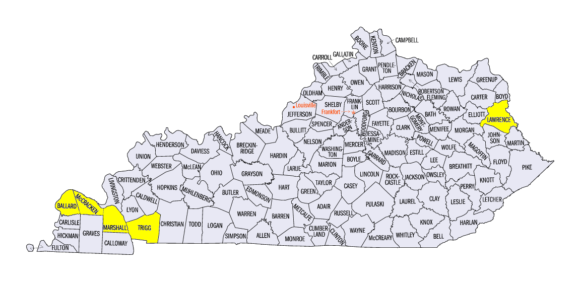
(Figure 1). Amounts exceeding 8 inches were common in western Kentucky, where 6-8 inches fell during the 24-hour period through the morning of July 7 alone (Figure 2). Total precipitation for the period in Cadiz, KY (Trigg County) was above 12 inches, and the Kenlake State Resort Park (Marshall County) recorded 15.47 inches. Nearly 200 daily precipitation records were recorded across the region, with a majority occurring in Missouri, Illinois and Kentucky. In the northern half of the region, drier conditions were found across northern Indiana, Ohio, Iowa and Wisconsin. Precipitation that fell in northern Indiana and northern Ohio was less than half the normal amount
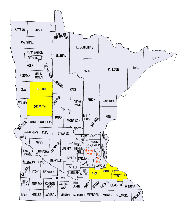
(Figure 3). More than two inches of precipitation fell across western and southern Minnesota, which was more than an inch above the normal amount (Figure 4). The above normal precipitation was welcomed in western Minnesota and Lower Michigan, as drought and abnormal dryness were common in these areas in the July 5 Drought Monitor
(Figure 5).
Cool in the Central Midwest
Cooler conditions were common to begin the month of July across the central Midwest (Figure 6). Most of Iowa, Illinois, Indiana and northern Missouri were 2-4°F below normal. These cooler conditions were largely due to record low maximum temperatures on July 2 through the morning of July 3
(Figure 7) and July 3 through the morning of July 4 (Figure 8). Nearly 200 daily record low maximum temperatures were recorded in that two-day period, with most occurring in Iowa, Illinois, Indiana and Missouri. Elsewhere, temperatures were near normal across northern Minnesota, Kentucky, eastern Ohio and Lower Michigan. A few areas in the southern fringes of Missouri and Kentucky and the eastern U.P. of Michigan were slightly above normal. Most of Wisconsin, southern Minnesota and western Ohio were slightly below normal.
Western Kentucky Flash Flooding
Heavy rain through the morning of July 7 led to major flash flooding in western Kentucky. Slow moving thunderstorms trained for multiple hours during the late night to early morning hours of July 6-7. Rainfall rates over an inch per hour were reported by a trained spotter near Cadiz (Trigg County) reporting 3.16 inches in one hour. Roads were closed and washed out due to the multiple feet of water on the road.
Busy July Start to Severe Weather
Multiple storm systems crossed the Midwest during the start of July, leading to hundreds of storm reports during the period (Figure 9). While the first three days of July were quiet, strong storms caused wind damage across eastern Kentucky on July 4. Two tornadoes were reported as well, including an EF-2 tornado that injured 5 people in Louisa, KY (Lawrence County).
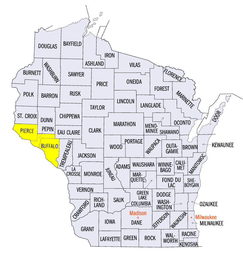
On July 5, a strong line of thunderstorms blew through the Twin Cities, MN area with wind gusts up to 80 mph. Trees and power lines were felled and over 100,000 people in the Twin Cities and surrounding areas were without power. As the line moved east, multiple EF-0 and EF-1 tornadoes were reported in Rice, Goodhue and Wabasha counties in Minnesota, and Pierce, Pepin and Buffalo counties in Wisconsin.
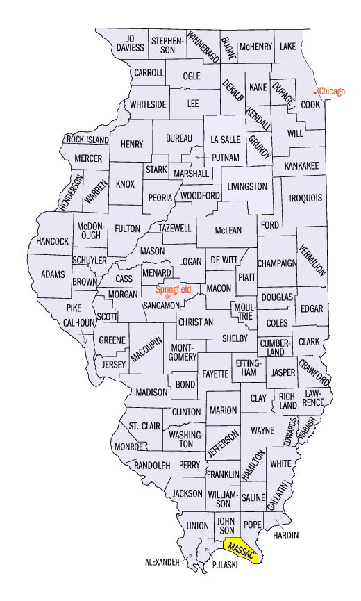
Wind reports were common across Iowa, Missouri and Kentucky on July 6. Two EF-1 tornadoes were reported along the Ohio River near Bandana, KY (Ballard/McCracken counties) and Metropolis, IL (Massac County). Two injuries were reported from the Metropolis, IL tornado.
Severe weather in western Kentucky resumed in the afternoon of July 7 after morning flash flooding. Wind gusts of 60-70 mph were reported through central Kentucky. Wind damage was also common in Missouri during the morning hours of July 7.
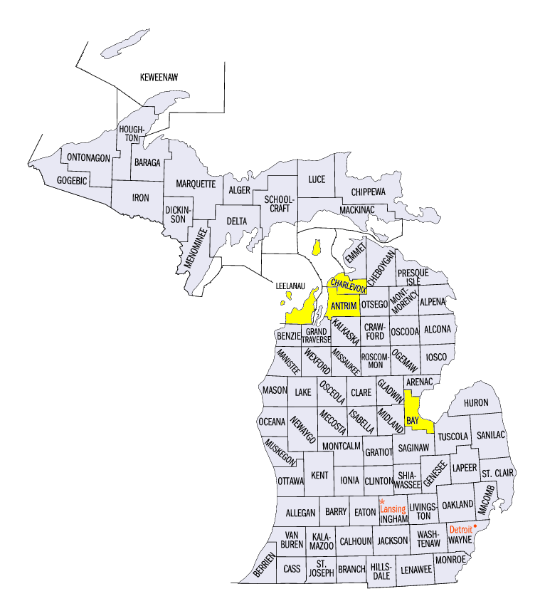
Wind damage continued to occur in Kentucky on July 8, with many of the reports happening along the Ohio River during the morning hours. Wind and hail damage was also common on July 8 in Lower Michigan. Reports of 3 inch diameter hail were found in Leelanau, Charlevoix and Antrim counties. An EF-0 tornado was also reported in Pinconning, MI (Bay County).
July 9-10 were much less eventful, except in northwest Minnesota. Wind and hail were common on July 9, where a wind gust of 70 mph was reported in Ottertail County, MN. A single storm in Becker County, MN led to an 82 mph wind gust during the overnight hours of July 10, ending an eventful severe weather period.
-BJP-