June 15-21, 2016
Midwest Weekly Highlights - June 15-21, 2016
Much Needed Precipitation
Parts of northern Missouri and Indiana received much needed precipitation during the period
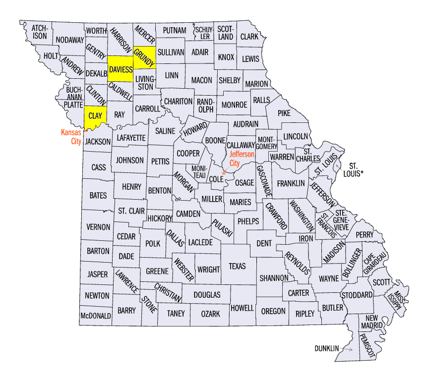
(Figure 1). Heavy rain fell on June 20 through the morning of June 21 across northern Missouri (Figure 2). Some of the wettest locations included 3.98 inches in Trenton (Grundy County), 4.15 inches in Kearney (Clay County) and 6.29 inches in Gallatin (Daviess County). More than an inch of rain also fell on Indiana through the mornings of June 15 and June 21, with some locations receiving up to four inches. Plentiful precipitation also fell in Minnesota, Wisconsin and northern Illinois, with some areas receiving more than twice the normal amount
(Figure 3). Dry conditions were common across Iowa, southern Missouri and western Illinois at more than a half an inch below normal (Figure 4). Eastern Kentucky and Ohio were also dry with less than half the normal amount of precipitation.
Feeling the Heat
Above-normal temperatures were common across the Midwest
(Figure 5). The majority of the region was 2-6°F above normal. Only a small area of eastern Kentucky was near normal. Missouri was the hottest spot in the region at 5-8°F above normal. Maximum temperatures averaged in the low 90’s across the state (Figure 6). Maximum temperatures in the 80’s to low 90’s were common across the rest of the Midwest. Two of the hottest days were during the 24-hour periods ending on June 16
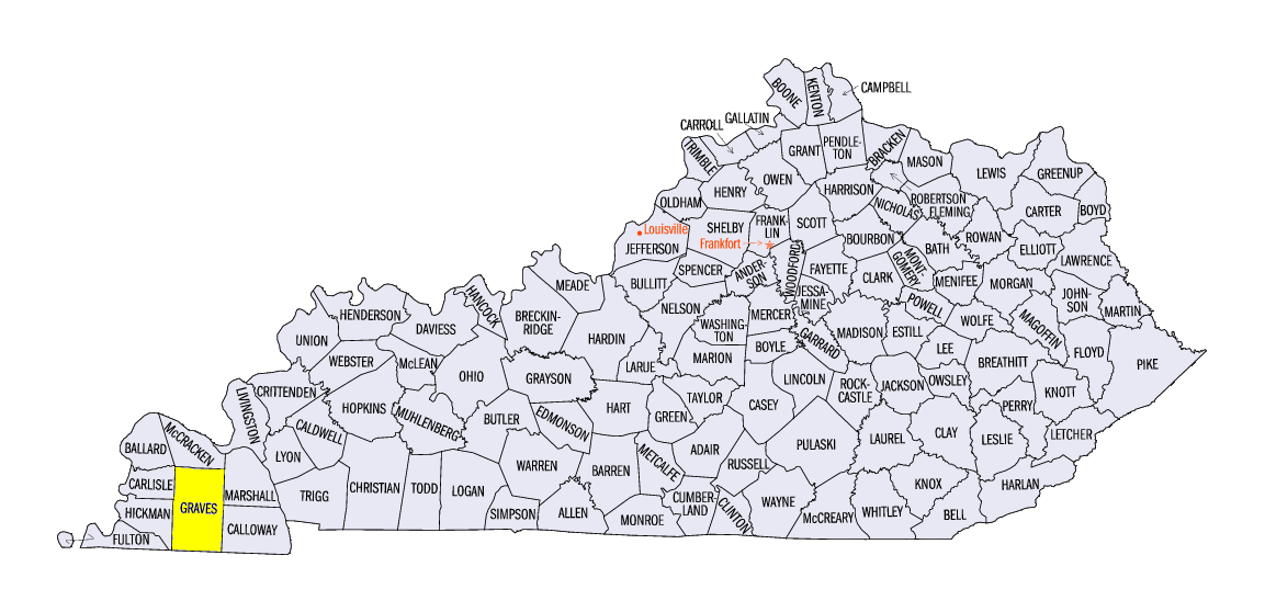
(Figure 7) and June 17 (Figure 8), where maximum temperatures neared 100°F. Multiple daily records were broken, including the record maximum temperature of 100°F at the Barkley Regional Airport in Paducah, KY. Heat advisories were common in Missouri and western Iowa due to heat index values over 105°F.
Drought Worries Increasing
A very dry June across portions of the Midwest has led to some concern for drought. Parts of Iowa and Missouri have received less than a quarter of the normal amount of precipitation during the month so far
(Figure 9). The latest Drought Monitor from the National Drought Mitigation Center for June 21 had nearly 30 percent of the Midwest classified as abnormally dry, with moderate drought in portions of southeast Iowa, northeast Missouri and west-central Illinois (Figure 10). Heat exacerbated evapotranspiration, causing soil moisture to decrease
(Figure 11). Adequate to surplus soil moisture has decreased by more than 10 percent in seven Midwest states from National Agricultural Statistics Service reports on June 5 and June 19, with Missouri, Iowa and Ohio dropping 20 or more percent.
Severe Weather Summary
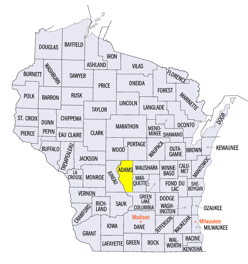
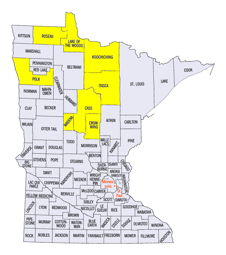
An active week of thunderstorms led to many wind and hail reports across the Midwest (Figure 12). All seven days in the period had at least one storm report. Wind reports were common in the Ohio Valley on June 15. A microburst with estimated peak wind gusts of 85 mph in Graves County, KY led to the death of a 56-year old man in his truck. Two-inch hail was also reported in Adams County, WI. Hail and strong winds were common across western Minnesota on June 17, with a report of 80 mph winds in Polk County, MN. The only tornadoes reported during the period occurred in Minnesota on June 19 in Wadena, Cass and Itasca counties. Strong storms in northern Minnesota also produced two-inch and larger hail in Lake of the Woods, Koochiching, Wadena, Cass, Roseau counties and a four-inch hailstone in Crow Wing County. One injury was also reported due to a tree trapping a family in their house. Wind reports were common on June 20 in northern Missouri through central Illinois and Indiana. Tree limbs were downed as wind gusts of up to 60 mph were reported.
-BJP-