April 22-30, 2016
Midwest Weekly Highlights - April 22-30, 2016
Wet Week for Many
April showers were common across a major portion of the region, with much of the region receiving one or more inches of precipitation
(Figure 1). Some of the wettest areas were across Minnesota, western Iowa, northwest Missouri, and the Ohio Valley. Up to four inches were recorded in western Iowa and northwest Missouri, more than two inches above the normal amount (Figure 2). A dry pocket was found across southern Wisconsin, however, as less than half the normal amount of precipitation fell during the period
(Figure 3).
Cold North, Warm South
A north-south divide in temperature departures was seen across the Midwest to end April (Figure 4). Below-normal temperatures were common across the northern half of the region, with Minnesota, Wisconsin and Michigan all 2-5°F below normal for the period. A few colder areas were found in the U.P. of Michigan where temperatures were up to 8°F below normal. Temperatures skewed above normal across the southern half of the region. Most of Missouri and the northern Ohio Valley were 2-5°F above normal. The warmest state was Kentucky at 4-7°F above normal. High temperatures across the state reached the low- to mid-80s on multiple occasions, including the days ending on the morning of April 21
(Figure 5) and April 27 (Figure 6).
Active Period of Severe Weather
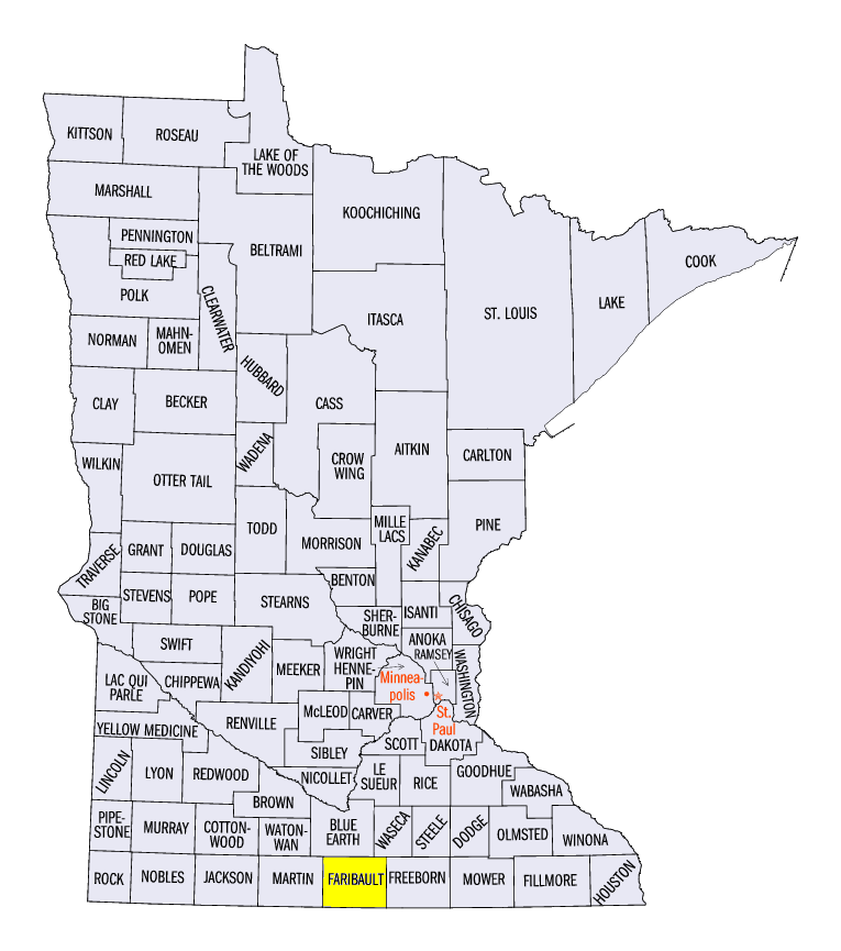
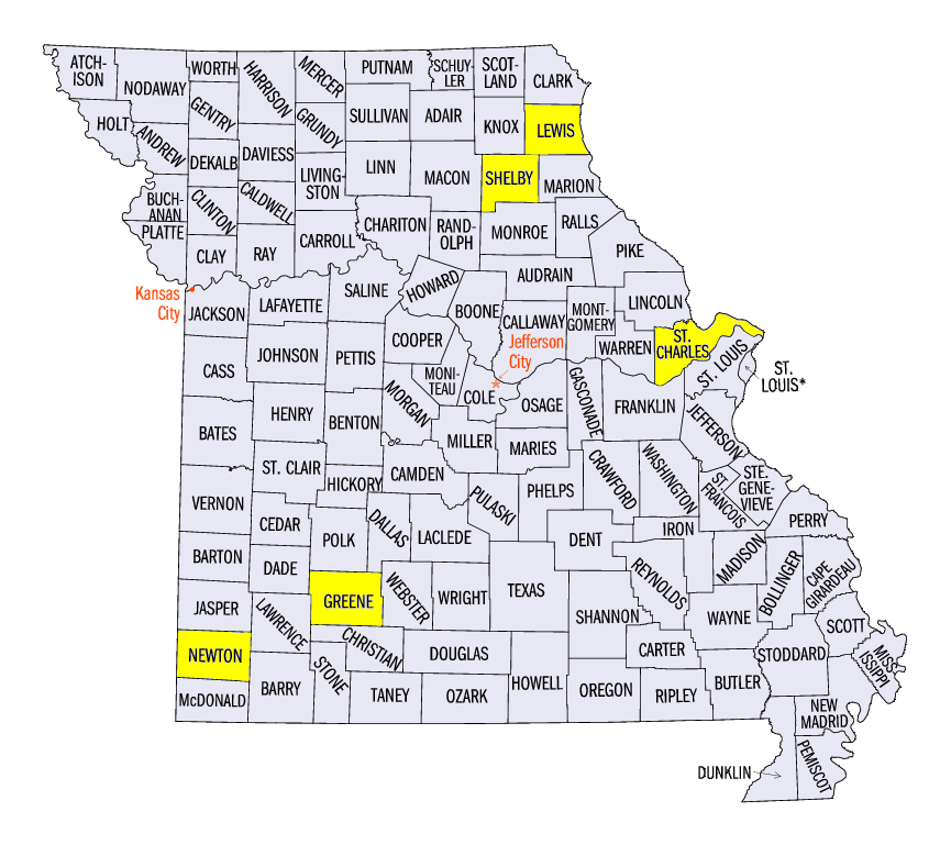
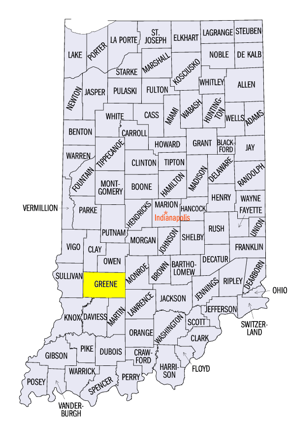
Severe weather reports peppered the region from storms that produced strong winds, large hail and tornadoes (Figure 7). A severe thunderstorm on April 24 tracked through northwest Iowa into south-central Minnesota, bringing high winds, hail and a brief tornado touchdown in Faribault County, MN. April 25 brought hail to the southern Lake Michigan shores, as reports came in from near Chicago and Milwaukee, as well as southwestern Michigan. A majority of the remaining storm reports came from the southern half of the region, as a strong system moved through the region on April 26-27. A bowing line of thunderstorms moved through central Missouri during the morning hours of April 26 and dropped 1- to 2-inch hail while also producing 60-70 mph winds. This line of thunderstorms continued into southern Illinois and along the Ohio River during the afternoon. Weak tornadoes were reported in St. Charles, Newton and Greene counties in Missouri and Greene County, IN. On April 27, two main lines of storms formed across western Iowa and in the Lower Ohio Valley. Nearly 20 weak tornadoes were reported in Iowa, Missouri, Illinois and Kentucky. Wind gusts knocked down trees and power lines across eastern Kentucky while two-inch diameter hail fell in Missouri.
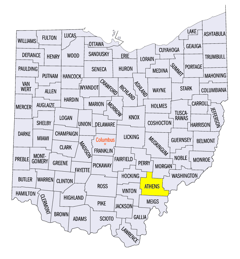
A few other notable severe weather events occurred before the end of the month. On April 28, tornadoes touched down in Shelby and Lewis counties in Missouri while 2.5 inch hail fell in Athens County, OH. April 30 also brought hail across the St. Louis area, with a two-inch hail report in St. Clair County, IL. In total, more than 250 storm reports were recorded across the region in this active final week of April.
-BJP-