March 22-31, 2016
Midwest Weekly Highlights - March 22-31, 2016
Another Wet Week in the Upper Midwest
Above-normal precipitation fell once again across the Upper Midwest to end the month of March
(Figure 1). Multiple storms crossed the region, bringing over an inch of precipitation to a majority of the region (Figure 2). Heavier amounts were found in eastern Lower Michigan where up to 3 inches of precipitation fell during the period, which was more than four times the normal amount
(Figure 3). A portion of this precipitation came as snowfall in the upper Midwest, as 5-10 inches fell during a storm on March 23-25 (Figure 4). Meanwhile, portions of Missouri, Kentucky and northern Minnesota were drier than normal for the period. Far eastern Kentucky and extreme northwest Minnesota received less than half the normal amount of precipitation.
Warmth Remains
Above-normal temperatures were common once again across most of the region (Figure 5). The greatest departures were found across northern Minnesota and Ohio, where temperatures were 4-8°F above normal. Southern Minnesota, northern Wisconsin, eastern Missouri, Illinois, Kentucky, Indiana and southern Lower Michigan were slightly less warm at 2-5°F above normal for the period. Most of Iowa, southern Wisconsin and the U.P. of Michigan were closer to normal. These areas of near normal temperatures were in line with the snow that had fallen between March 23-25.
March 23-25 Snowstorm
A strong system coupled with cold temperatures led to a heavy snow event across the Upper Midwest on March 23 through the morning of March 25. The storm began bringing snow to the Plains starting on March 22 through the morning of March 23 (Figure 6). However, the majority of the snow fell during the day of March 23, through the morning of March 24
(Figure 7). Snow amounts of 5-10 inches fell from northwest Iowa through northeast Wisconsin, while 2-5 inches fell across northern Lower Michigan. Sharp contrasts in snow accumulation were observed across the region. Northern portions of the Minneapolis/St. Paul metro area received little to no accumulation, while southern portions received up to 8 inches. Snowfall continued into the day of March 24 through the morning of March 25 in parts of Michigan and eastern Wisconsin (Figure 8). Up to 8 inches of snow fell across northern Lower Michigan and eastern parts of the U.P. of Michigan. By the end of the period, most of the snow that had fallen during this three day period had melted
(Figure 9).
Minor Spring Flooding on the Mississippi River
Melting snow and above-normal precipitation across the upper Midwest led to minor flooding downstream on Mississippi River during the period (Figure 10). Minor flooding earlier in the period occurred along the river from Fulton, IL in Whiteside County, through the Quad Cities. As of March 31, minor flooding was occurring from New Boston, IL in Mercer County through Grafton, IL in Jersey County. Minor flooding was also occurring on the Wabash River in Indiana. Upgrades to the moderate flooding category were not expected to occur on either of these rivers as they crest in the coming weeks.
Multiple Days of Severe Weather
Severe weather was common across the Midwest during the period as multiple events caused high winds, large hail and multiple tornadoes
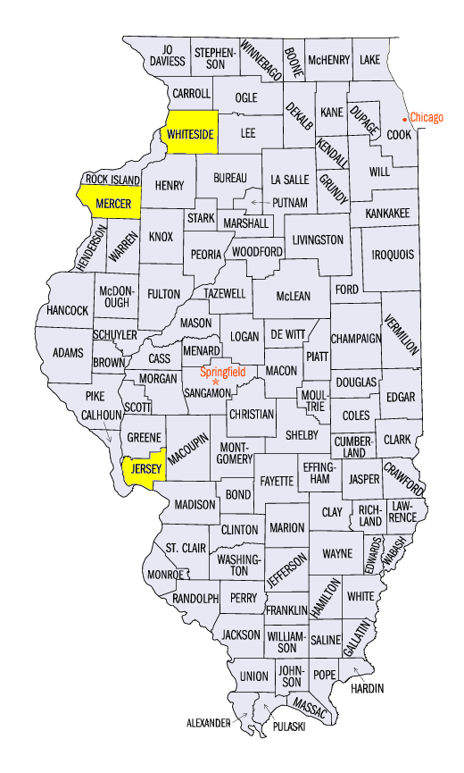
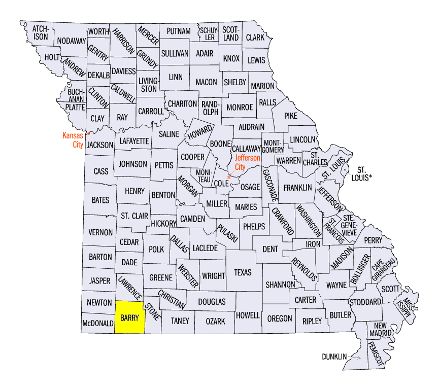
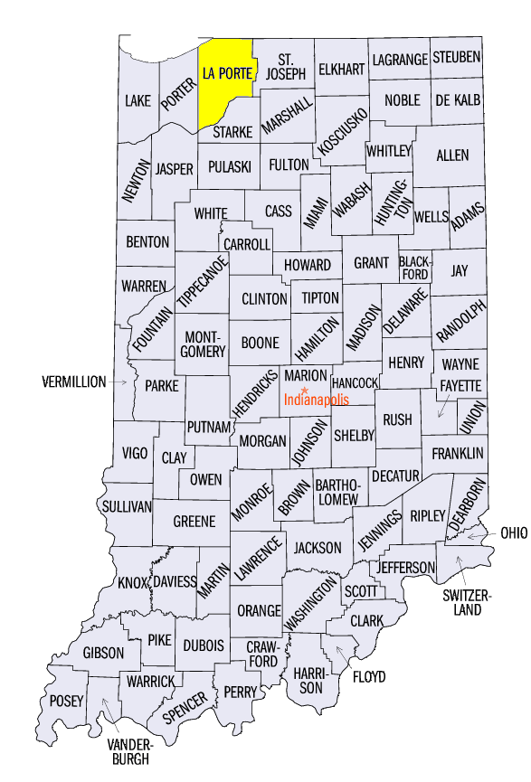
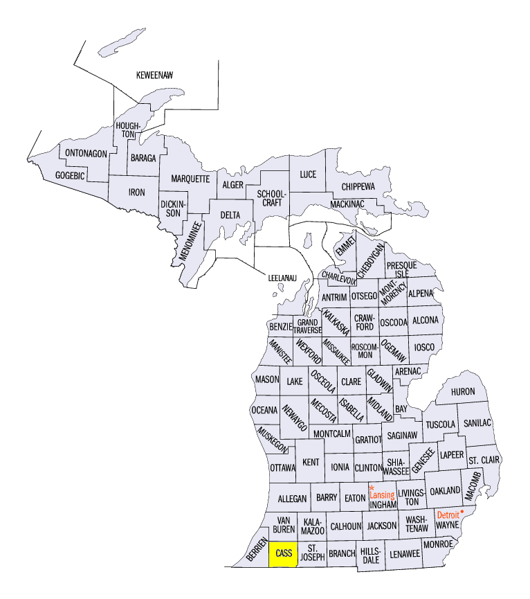
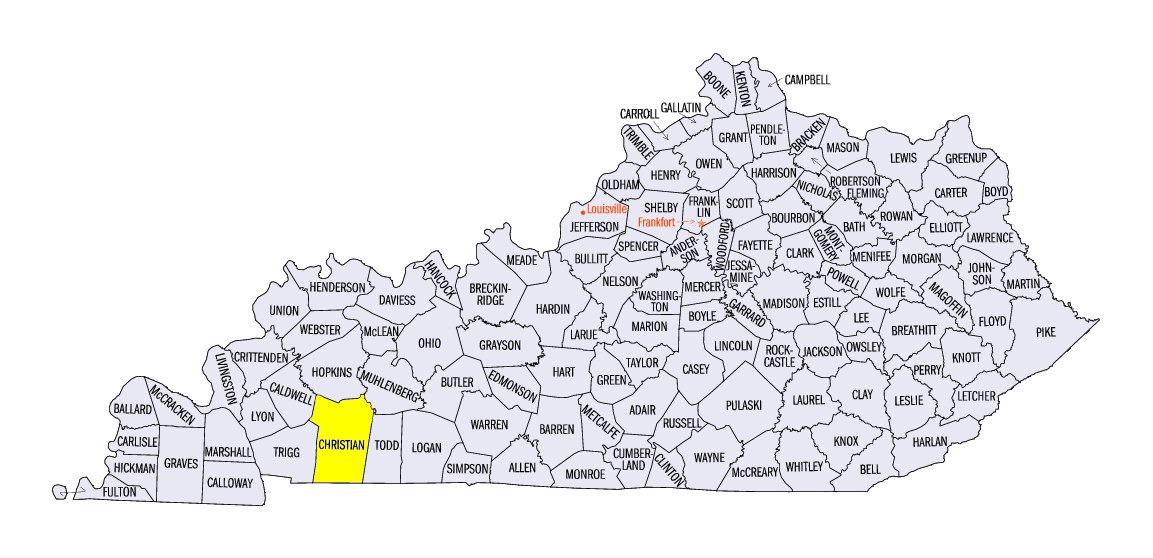
(Figure 11). The snowstorm on March 23 in the Upper Midwest also caused a few strong storms that produced wind and hail damage in western Missouri and extreme southwest Iowa. An EF-1 tornado was also surveyed in Barry County, MO. Multiple reports of tornadoes were found in La Porte County, IN and Cass County, MI the next day as the main system moved east. On March 27, a system led to over 70 storm reports in the region across Indiana, Ohio and western Kentucky. Many of these reports were for 1 inch hail across Indiana. Multiple tornadoes were reported in Christian County, KY, with the strongest rated as an EF-2. Yet another storm system crossed the region on March 30-31, bringing storm reports to every Midwest state except Minnesota. Scattered storm reports were found in Missouri and Iowa on March 30, while wind damage reports were concentrated in central Kentucky on March 31. No tornadoes were reported on either of these two days.
Abnormally Dry Conditions Spread Across Missouri
Continued dry conditions in Missouri since the start of 2016 has led to the addition of abnormally dry conditions across most of the state in the latest Drought Monitor from the National Drought Mitigation Center for March 29 (Figure 12). After near-record precipitation and flooding in the state in December 2015, most of Missouri has experienced departures of 2-5 inches below normal since January 1 (Figure 13). Abnormally dry conditions have also persisted in northwest Minnesota. Despite the increase of abnormal dryness in the region, the Midwest remained drought-free for the third consecutive month.
-BJP-