January 1-7, 2016
Midwest Weekly Highlights - January 1-7, 2016
Above-Normal Temperatures Continue
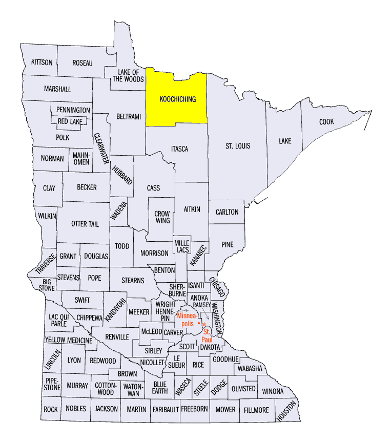
After the Midwest experienced its warmest December on record, a majority of the region continued to see above-normal temperatures into the New Year (Figure 1). Temperatures were 1-3°F above normal across most of Missouri, Illinois and Iowa, as well as parts of Indiana and Lower Michigan. Southern Minnesota, Wisconsin and the U.P. of Michigan were slightly warmer at 2-6°F above normal. Very warm conditions were common across northern Minnesota and extreme northwest Wisconsin, where temperatures were 10-18°F above normal. The International Falls Airport in Koochiching County, MN was 18.4°F above normal for the period.
Meanwhile, below normal temperatures were found across Kentucky and Ohio. Temperatures were mainly 1-3°F below normal in these areas. This was the largest expanse of below-normal weekly temperatures since the start of meteorological winter on December 1.
Drier Start to the New Year
After torrential rain caused major flooding in Illinois and Missouri, drier conditions took over across the Midwest to start 2016 (Figure 2). Little to no precipitation fell across Kentucky, Ohio, Indiana, and Illinois, while most of Minnesota, Iowa, Wisconsin and Lower Michigan had less than a tenth of an inch. Parts of the U.P. of Michigan, where lake-effect snow fell
(Figure 3), and western Missouri, had up to a half-inch of precipitation for the period, but all areas in the region had less than an inch of precipitation. This caused a majority of the region to be two-tenths of an inch or more below normal, with parts of Kentucky nearly an inch below normal (Figure 4). Only a few areas in northwestern Minnesota and western Missouri had near-normal precipitation
(Figure 5).
Flood Waters Starting to Recede Thanks to Drier Conditions
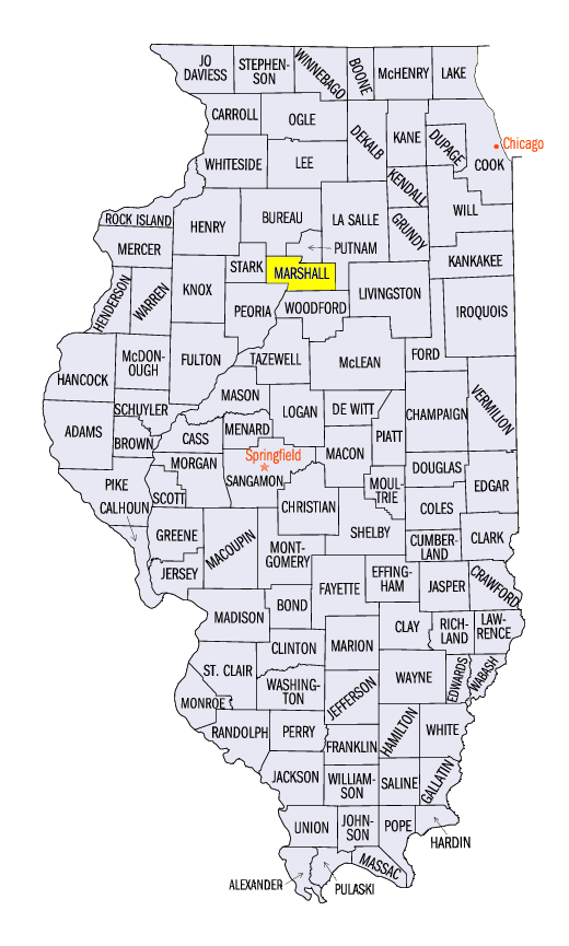
After historic floods occurred along the Illinois and Mississippi rivers to end 2015, river levels receded under drier conditions. However, many rivers dealt with major to moderate flooding during the week (Figure 6). As of January 7, major flooding continued along portions of the Illinois River, with Havana, Meredosia, Valley City and Hardin, IL all above major flood stage. Moderate flooding along the river reached as far upstream as Henry, IL in Marshall County. Major flooding continued to occur near the mouth of the Ohio River near Cairo, IL (Figure 7). Moderate flooding also continued along the southern half of the Wabash River. Flooding was forecast to continue on many of these rivers in the coming weeks as waters begin to slowly recede.
Flooding quickly receded along the Mississippi River, where as of January 7, only areas from Cape Girardeau, MO and south had moderate flooding. The river at St. Louis quickly receded from major flooding to below flood stage during the period (Figure 8). Flooding also quickly receded on the Meramec River in Missouri, with all gauges along the river no longer in flood stage (Figure 9).
Midwest Becomes Drought Free
Remaining drought in parts of Michigan and Indiana were eliminated in the January 5 Drought Monitor from the National Drought Mitigation Center (Figure 10). The entire Midwest region was free of drought in the update. Only slightly more than five percent of the region was rated abnormally dry. Record warmth and precipitation aided in recharging soil moisture and reservoirs during December, which has helped eliminate drought and dryness in the region.
-BJP-