December 11-17, 2017
Midwest Weekly Highlights - December 11-17, 2017
Wet and Snowy Great Lakes
A system that moved through the Upper Midwest and favorable conditions for lake-effect snow led to more than half an inch of precipitation across much of Michigan and northern Wisconsin (Figure 1). Areas in northern Minnesota also received more than a quarter-inch. These values were above normal for this time of year (Figure 2). Meanwhile, the southern half of the region received less than half the normal amount (Figure 3).
Snowfall was the main contributor to precipitation in the Upper Midwest, with more than 10 inches across portions of Michigan (Figure 4). Most of this snowfall occurred due to a system that moved through northern Minnesota into the northern Great Lakes on December 12-14. Some of the heaviest snowfall occurred through the morning of December 14, where 4-8 inches fell from northern Wisconsin through southeastern Lower Michigan
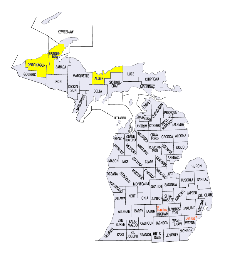
(Figure 5). Lake-effect snowfall continued to fall behind the system through December 17. Some of the heaviest snowfall totals for the period included 23.5 inches in Dollar Bay, MI (Houghton County), 21.5 inches in Munising, MI (Alger County) and 21.3 inches near Greenland, MI (Ontonagon County). Several dozen more stations in Michigan reported more than a foot of snow as well. Several dozen daily snowfall records were, mainly in Michigan and Wisconsin (Figure 6).
Contrasting Temperatures
A divide from very warm to the west, to very cold in the eastern Great Lakes was observed during the week
(Figure 7). Temperatures in southwestern Minnesota and western Iowa were 8-10°F above normal, with Missouri and most of Illinois 2-6°F above normal. Meanwhile, temperatures in parts of Michigan were 7-10°F below normal. Ohio, Kentucky and northeastern Wisconsin were also 2-5°F below normal.
Extreme Drought Added to Southern Missouri
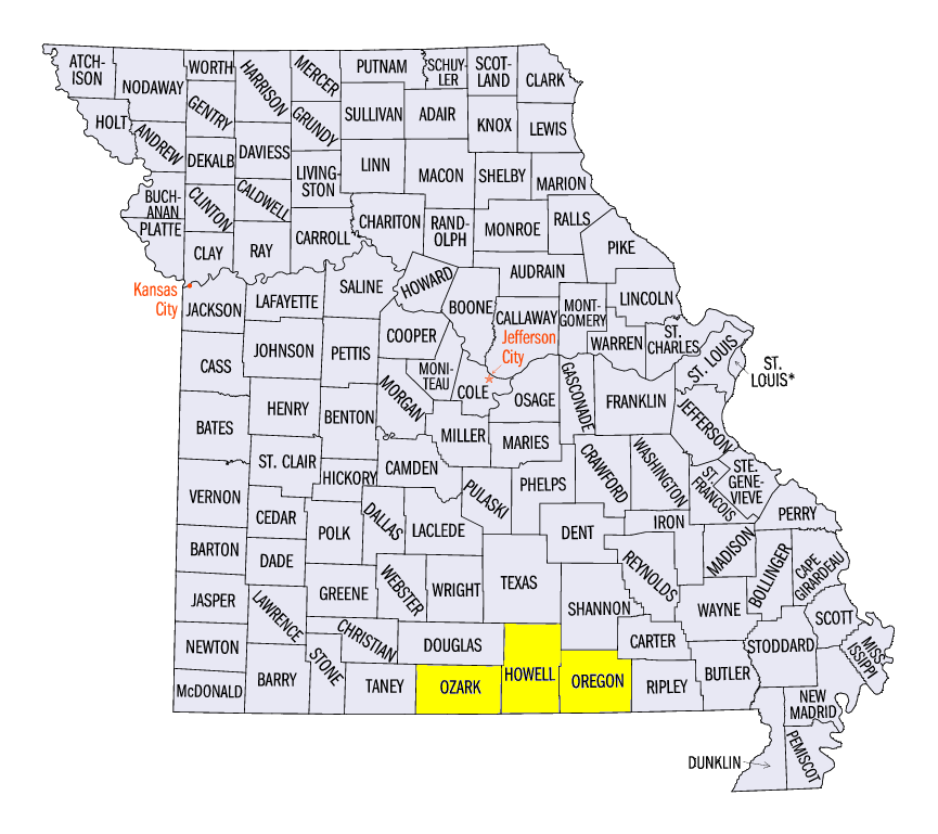
Extreme drought was added in parts of Ozark, Howell and Oregon counties, MO in the December 12 U.S. Drought Monitor as impacts to agriculture worsened (Figure 8). According to the impact summary, many ponds were empty while creeks and springs had little to no flow. Over-wintering crops were also being impacted due to lack of rainfall. Since October 1, most of southern Missouri has received less than half the normal amount of precipitation
(Figure 9).
-BJP-