December 1-10, 2017
Midwest Weekly Highlights - December 1-10, 2017
Relatively Dry, Except Near the Great Lakes
Most of the Midwest was dry during the first ten days of December
(Figure 1). Most of Iowa, Missouri, Minnesota, southern Wisconsin, Illinois, Indiana, northern Ohio and southern Lower Michigan received less than half an inch of precipitation. In many cases, this was less than half the normal amount (Figure 2). Wetter conditions were found around the Great Lakes, however. More than an inch of precipitation fell in the U.P. of Michigan and northwestern Lower Michigan. Northwestern Minnesota also had more than twice the normal amount.
Lake-Effect Snowfall
From December 4 through the morning of December 10, favorable conditions for lake-effect snowfall on Lake Superior and northern Lake Michigan led to 6-12 inches of snowfall across the U.P. of Michigan and northern Lower Michigan
(Figure 3). A storm system on December 4 through the morning of December 5 brought several inches of snow to Minnesota and northern Wisconsin (Figure 4). A cold air mass behind the storm filled in and brought northwesterly winds, which continued for several days. Some of the heaviest amounts occurred on December 6 through the morning of December 7, where 6-8 inches fell in the eastern U.P. of Michigan
(Figure 5). A quick-hitting system on December 9 also led to lake-effect snowfall in northern Indiana and southwestern Lower Michigan through the morning of December 10 (Figure 6).
Warm for the West
The western half of the Midwest recorded above-normal temperatures for the first ten days of December
(Figure 7). Most of Missouri, Iowa, Wisconsin, Minnesota and northern Illinois were all 1-5°F above normal. Most of Michigan was also 1-3°F above normal. The warmest areas were in northwestern Minnesota and north-central Iowa, where temperatures were 4-6°F above normal. Much of the warmth occurred during the first five days of the period. More than 150 daily high temperature records were broken during the warm stretch (Figure 8). Most of these occurred on December 4 through the morning of December 5, where maximum temperatures reached the 50s and 60s in many areas
(Figure 9). Meanwhile, Indiana, Ohio and Kentucky were all within 2°F of normal for the period. Some areas of north-central Kentucky were slightly cooler than normal.
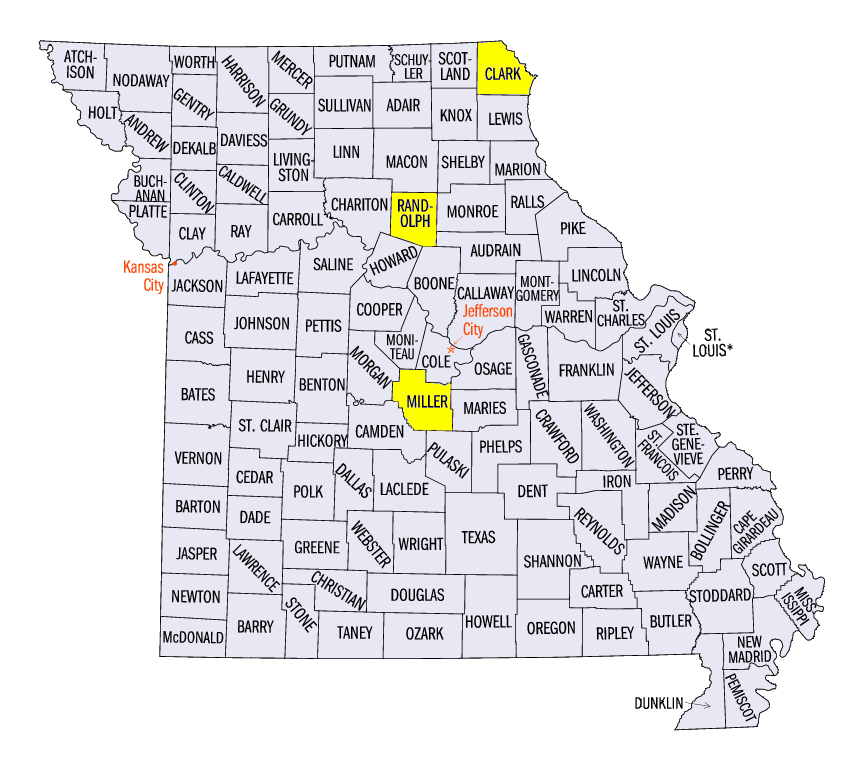
December 4 Severe Weather in Missouri
More than two dozen wind, hail and tornado reports were reported in Missouri on December 4 from strong thunderstorms in the afternoon and evening hours (Figure 10). Many of these reports were for strong thunderstorm winds up to 60 mph. An injury from strong winds was reported near Renick, MO (Randolph County). An EF-1 tornado was surveyed near Brumley, MO (Miller County) while an EF-2 tornado touched down in an open field near Wayland, MO (Clark County). No injuries were reported from either tornado.
-BJP-