November 1-7, 2017
Midwest Weekly Highlights - November 1-7, 2017
Wet for the Ohio River Valley
Wet weather was common across the Ohio River Valley during the first week of November (Figure 1). Amounts of 1-3 inches fell in southern Illinois, Kentucky, Indiana, Ohio and southern Lower Michigan. Isolated amounts of 3-5 inches also fell in Indiana and Ohio. In many cases, this was three to five times the normal amount (Figure 2). Some of the wettest locations included 5.82 inches at the Northern Indiana National Weather Service Office (Kosciusko County), 5.40 inches near Vernon, IN (Jennings County) and 5.17 inches in New Carlisle, OH (Clark County). Most of this rainfall occurred on November 5 through the morning of November 6 (Figure 3). More than 100 daily precipitation records were broken during the period (Figure 4), with many occurring through the morning of November 6.
Meanwhile, areas in the western half of the region were much drier. Most of Iowa and northern Missouri received less than a tenth of an inch of precipitation during the period. Most of Wisconsin, southern Minnesota, northern Lower Michigan, and the U.P. of Michigan were also drier than normal
(Figure 5). Precipitation in northern Minnesota and the U.P. of Michigan was mostly in the form of snowfall, as 5-10 inches fell in some areas of northern Minnesota (Figure 6).
Northwest to Southeast Temperature Divide
A very sharp contrast in temperatures was observed during the first week of November in the Midwest
(Figure 7). A dividing line from southwestern Missouri through southern Lower Michigan was observed, with areas to the north of the line colder than normal, and areas to the south warmer than normal. Minnesota was the furthest below normal. Most of the state was 7-10°F below normal with the northwestern corner 10-12°F below normal. Iowa, Wisconsin, northern Missouri and the U.P. of Michigan were 4-8°F below normal. Kentucky, by contrast, was the warmest state with temperatures 4-7°F above normal. Southeastern areas of the state were 7-10°F above normal. Southern Missouri, southern Illinois, Ohio and most of Indiana were 2-4°F above normal. Daily temperature records were broken for both high (Figure 8) and low values
(Figure 9).
November 5 Severe Weather and Tornadoes
A significant fall severe weather event swept from the St. Louis, MO area through northwestern Ohio on November 5 (Figure 10). More than 100 storm reports were reported in the Midwest, with 21 confirmed tornadoes in Midwest states (Figure 11) (Figure 12). Five of these tornadoes were rated EF-2. The most significant of these tornaodes tracked for 39 miles through Delaware, Blackford and Jay counties, IN and Mercer County, OH. The EF-2 tornado had estimated peak winds of 134 mph. Eight injuries were reported in total across the two states.
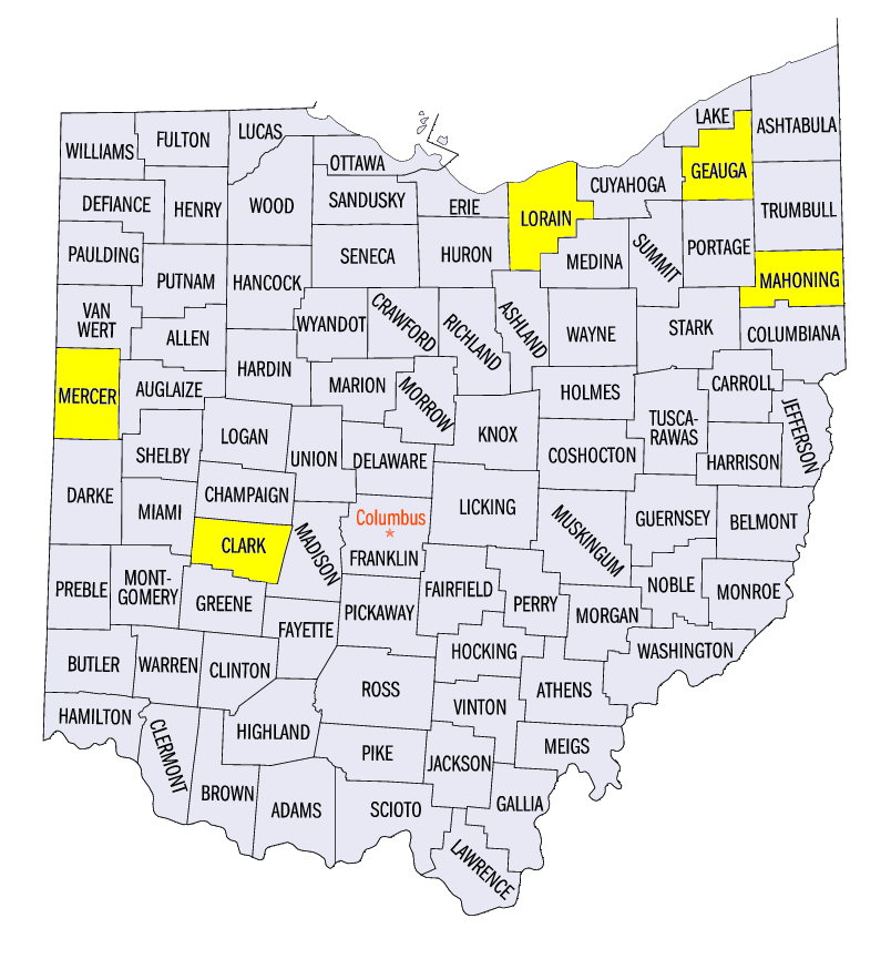
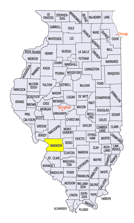
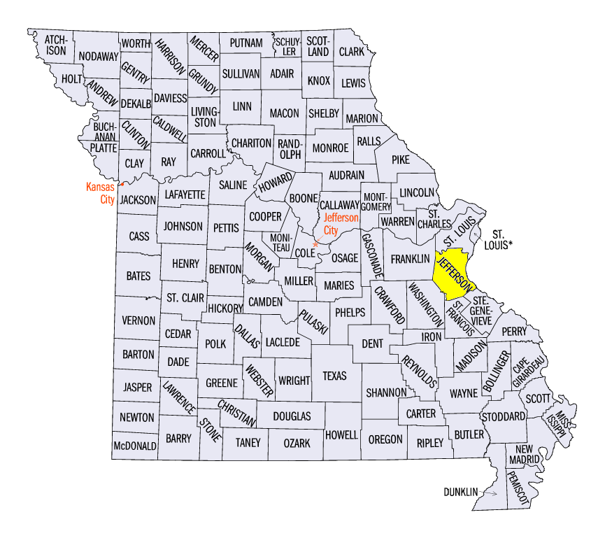
Hail and thunderstorm winds also caused damage. Roofs were blown off of outbuildings while electrical poles and trees were snapped in Missouri, Illinois, Indiana and Ohio. Several areas surveyed by the National Weather Service confirmed straight-line wind damage from 70-90 mph winds. Damage from 105 mph winds were confirmed in Lorain and Geauga counties, OH, as well as 100 mph wind damage from a microburst in Mahoning County, OH. Hail reports of 2-3 inches were also reported near the St. Louis, MO area. Three-inch hail was reported in Collinsville, IL (Madison County) and near Festus, MO (Jefferson County).
Severe Drought Introduced in Southern Missouri
Dry weather over the past two to three months in southern Missouri led to the introduction of severe drought in the November 7 U.S. Drought Monitor (Figure 13). Since August 1, southern and eastern portions of Missouri have received 2-6 inches less than normal, with isolated areas in southern Missouri having departures of 6-8 inches below normal (Figure 14). Meanwhile, drought was removed from areas in northeastern Ohio, as heavy rain fell during the first week of November. Overall, only seven percent of the Midwest was considered to be in drought. An estimated 5.5 million people were living in drought affected areas, with most of this population in St. Louis, MO.
-BJP-