July 18-24, 2017
Midwest Weekly Highlights - July 18-24, 2017
Hot for Many
Temperatures were above normal for a majority of the Midwest
(Figure 1). Southern Iowa, Missouri and southwestern Illinois were 4-7°F above normal, while most of Indiana, Kentucky, Illinois, Ohio and Lower Michigan were 1-4°F above normal. More than 75 daily high minimum temperature records were broken, along with a few daily high maximum temperatures from July 20-23 (Figure 2). A few areas around Lake Superior and in central Minnesota were slightly below normal for the period. A handful of daily low minimum and low maximum temperatures were broken in these areas
(Figure 3).
Heavy Rain in the Central Midwest
Strong thunderstorms on multiple days across portions of Minnesota, Wisconsin, eastern Iowa, Indiana and Ohio dumped multiple inches of rain in a very wet week (Figure 4). Many of these areas had more than double the normal amount of precipitation, with areas in northern Illinois and southwestern Wisconsin having more than five times normal
(Figure 5). More than 100 daily precipitation records were broken during the week (Figure 6). Meanwhile, very dry conditions continued across Iowa, Missouri and Kentucky. Most of Lower Michigan also had less than half the normal amount of precipitation.
Iowa, Illinois and Wisconsin Flooding and Flash Flooding
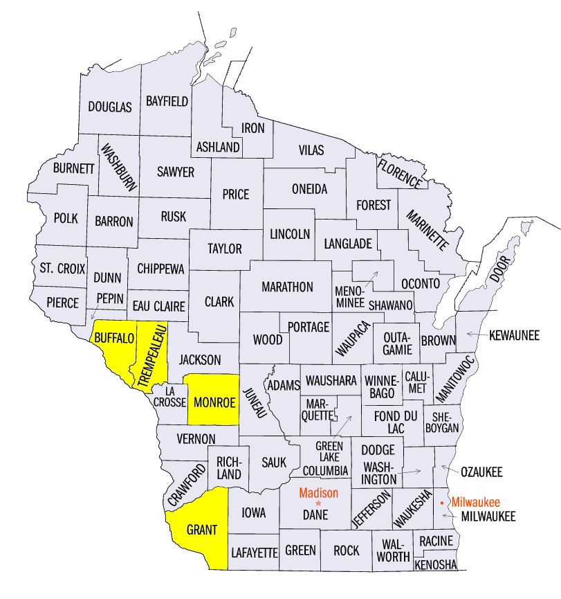
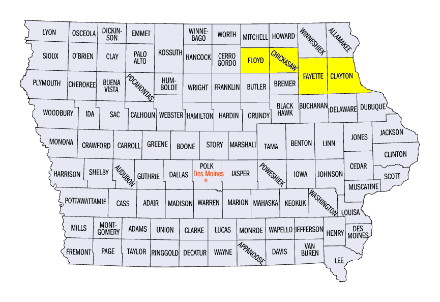
Heavy rainfall in eastern Iowa, western Wisconsin and northern Illinois from July 19-22 led to flooding and flash flooding. More than three inches of rain fell across a large area, with some areas receiving more than six inches through the morning of July 20 (Figure 7). Several of these high values included 6.37 inches near Alma, WI (Buffalo County), 6.15 inches near Cashton, WI (Monroe County) and 6.00 inches near Trempealeau, WI (Trempealeau County). More rain fell in northern Illinois during the day on July 20 (Figure 8), before the next round of precipitation began during the evening of July 21 through the morning of July 22 (Figure 9). Three to six inches of rain fell in northeastern Iowa, southwestern Wisconsin and northwestern Illinois. Some of the highest one-day totals included 9.30 inches near Ionia, IA (Chickasaw County), 7.34 inches in Fayette, IA (Fayette County) and 6.63 inches at Charles City, IA (Floyd County).
Many rivers and streams reached moderate to major flood stage from the precipitation (Figure 10). Major flood stage occurred along the Volga River near Littleport, IA (Figure 11, Clayton County). Evacuations were ordered in Volga, IA (Clayton County) in the low-lying areas of the town. The Grant River at Burton, WI (Grant County) had a record crest on July 22 (Figure 12). Several swift water evacuations were reported in Cassville and Potosi, WI (Grant County), two small towns near the Mississippi River. Major flooding also occurred on the Wapsipinicon River in eastern Iowa
(Figure 13), the Kickapoo River in southwestern Wisconsin (Figure 14) and on the Rock River in northwestern Illinois
(Figure 15). Seventeen Wisconsin counties were declared in a state of emergency from the flooding during the week (Figure 16), while seven Illinois counties were named in a disaster proclamation
(Figure 17).
Abundant Severe Storms
Over 400 storm reports of strong thunderstorm winds, large hail and tornadoes were reported in the Midwest in a stormy week (Figure 18). Most of these reports occurred on July 19-23.
July 19
A line of severe thunderstorms formed in southern Minnesota and northern Iowa on July 19 and traveled over 300 miles into southern Wisconsin and northern Illinois (Figure 19). This long-lived line carried winds of 60-70 along most of its path. Over 100 reports of wind damage were reported. Two tornadoes were reported in Iowa. The tornado in McGregor, IA (Clayton County) was rated as an EF-1 tornado and leveled several historic buildings in the downtown area (Figure 20). Two minor injuries were reported.
July 21
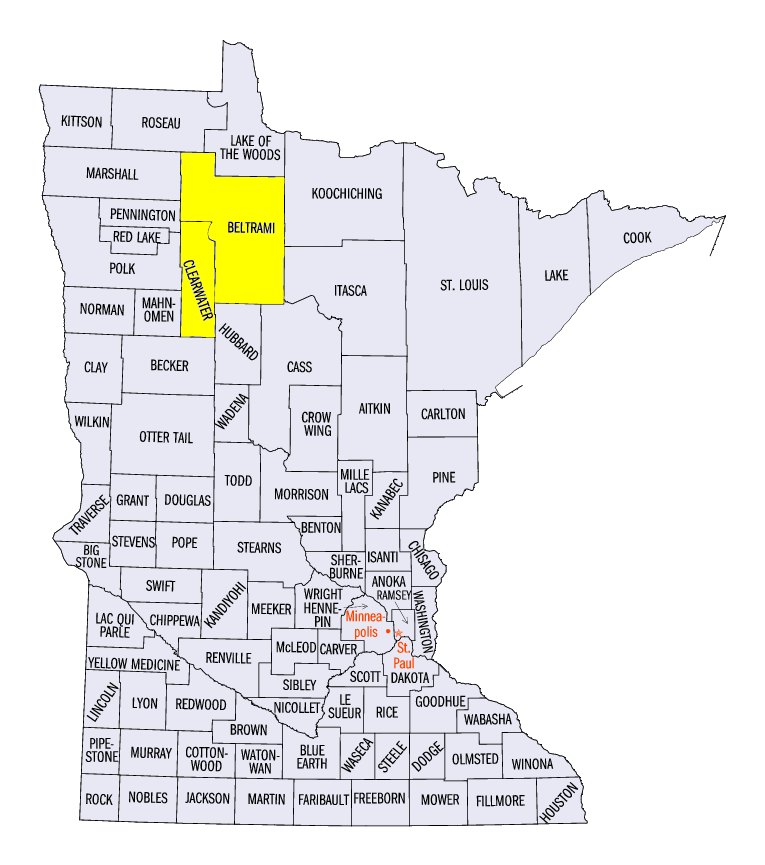
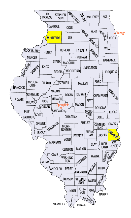
Severe thunderstorms erupted in northern Minnesota on July 21. Strong winds and large hail were common from these storms, including reports near Bagley, MN (Clearwater County) of two-inch hail and 90 mph winds. Brief tornado touchdowns were reported near Kelliher, MN (Beltrami County). Severe thunderstorms also formed in eastern Iowa, Illinois, Indiana and Ohio during the evening. Several tornadoes were reported, including an EF-1 tornado near Fulton, IL (Whiteside County).
July 22-23
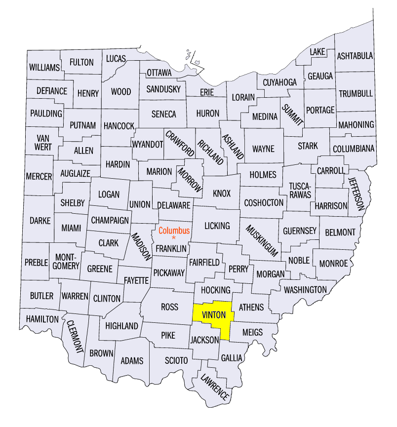
During in the afternoon on July 22, a set of thunderstorms formed in eastern Ohio. Wind damage was reported from many of these storms. An EF-1 tornado was also surveyed near McArthur, OH (Vinton County).
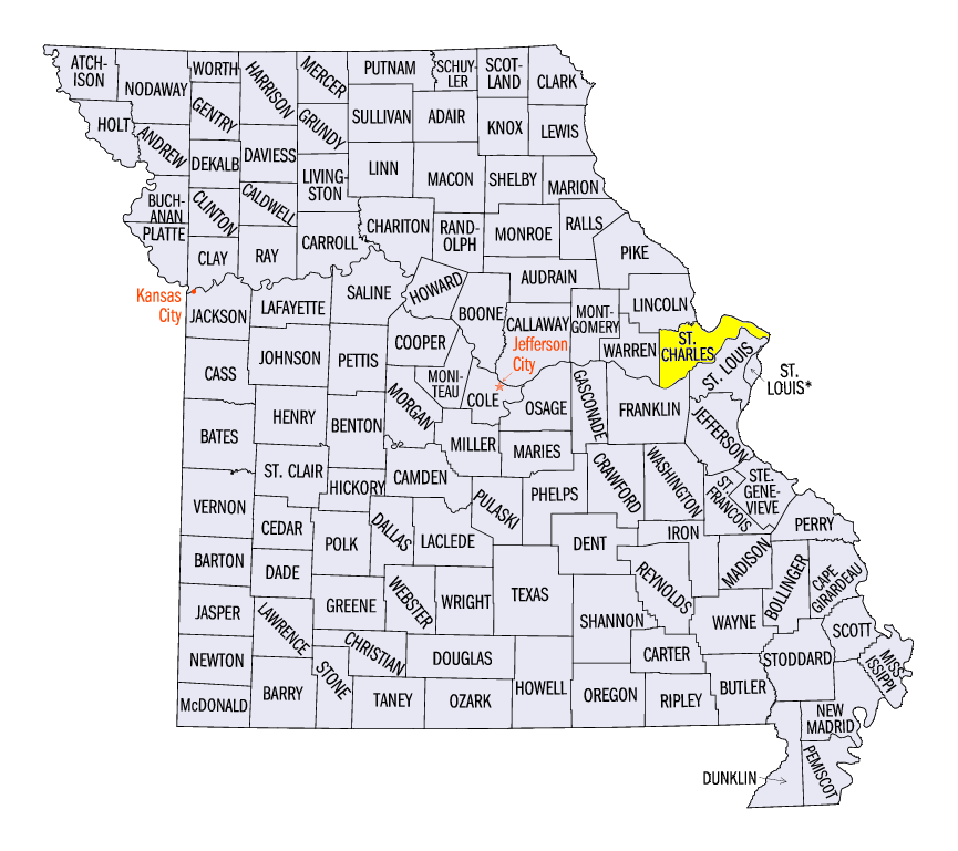
Strong thunderstorms that formed in Kansas tracked through Missouri, southern Illinois and southwestern Indiana during the overnight hours of July 22 through the morning of July 23. Several wind gusts of 80-85 mph were observed near the Missouri, Kansas border during the overnight hours. Three people were injured in the early morning hours of July 23 near Kampville, MO (St. Charles County) when their camper rolled over and were trapped inside. Trees were also downed in St. Louis. In Illinois, a 79 mph wind gust was reported at Oblong, IL (Crawford County).
Storms formed across southeastern Wisconsin and northeastern Illinois during the afternoon of July 23. Large hail was reported along with strong winds that toppled tree limbs. Several separate storms also formed across northern Indiana, western Ohio and eastern Lower Michigan.
Drought Expands in Western Iowa
While areas in eastern Iowa have been wet, drier weather continued across western and southern Iowa. Moderate drought expanded to over one-fifth of the state in the July 18 U.S. Drought Monitor (Figure 21). More than half of the state was considered to be abnormally dry. Moderate drought also slightly expanded in northern Minnesota, where eight percent was considered to be in moderate drought and over 35 percent of the state was considered abnormally dry. The drought in these states were the far eastern portion of a much larger and more severe drought across the Great Plains (Figure 22).
-BJP-