July 1-10, 2017
Midwest Weekly Highlights - July 1-10, 2017
Near-Normal Temperatures
Temperatures were seasonal across the Midwest during the first 10 days of July
(Figure 1). Most of Kentucky, Missouri, Indiana, Ohio, Michigan and Wisconsin were within a degree of normal. Northern Illinois, Iowa and western Minnesota were very slightly above normal, with small areas of southern Missouri and northwestern Ohio slightly below normal.
Dry to the West, Wet to the East
Precipitation was largely divided from west to east across the Midwest (Figure 2). Most of Minnesota, Iowa and northern Missouri had less than half the normal amount for the period, while most of Illinois had less than 75 percent
(Figure 3). Meanwhile, most of Kentucky, eastern Indiana, and Ohio had more than one-and-a-half times the normal amount. Over 100 daily precipitation records were broken during the period, with most occurring on July 7, July 8 and July 10 (Figure 4).
Widespread Severe Weather
Strong summertime thunderstorms were widespread across the Midwest throughout the period (Figure 5). Over 550 reports of tornadoes, high wind and large hail were reported, and July 8 was the only day during the period when no severe weather reports occurred.
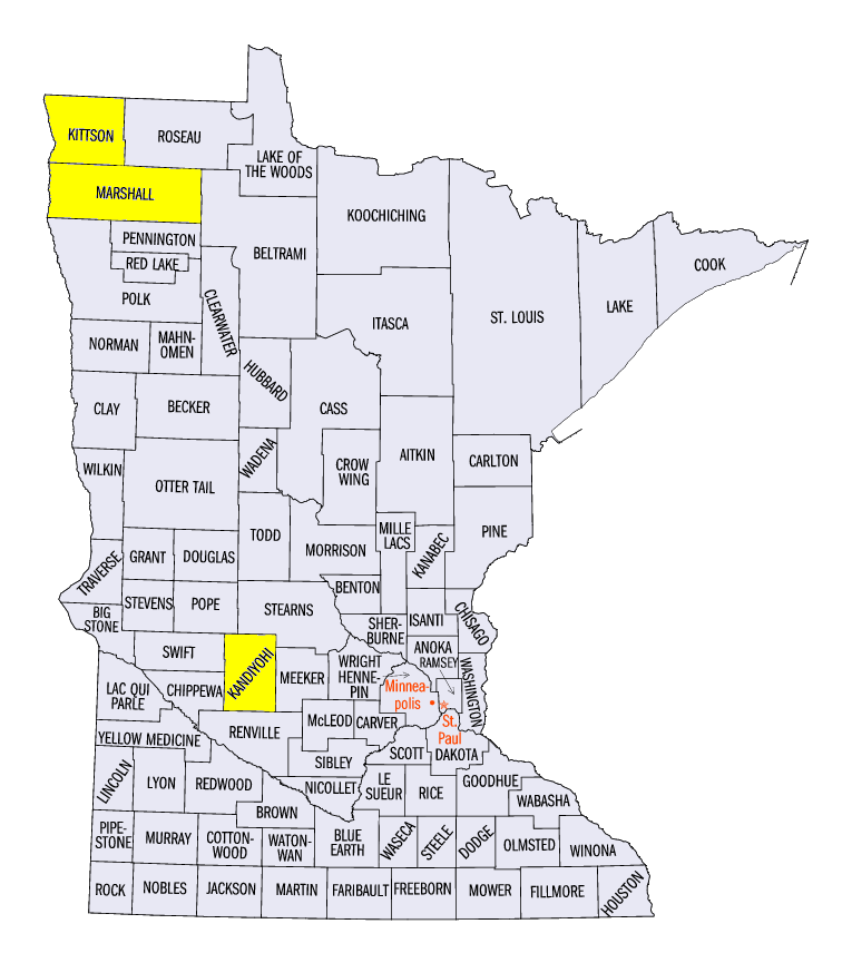
Hail was common across western Minnesota on July 4 (Figure 6). Several of these reports included two-inch hail near Sunburg, MN (Kaniyohi County) and 2.5-inch hail near Stephen, MN (Marshall/Kittson counties). Strong winds and hail were observed once again on July 5 in northern Minnesota (Figure 7).
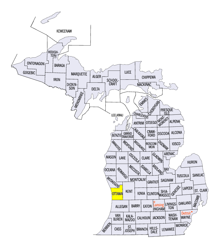
Strong thunderstorms moved into Wisconsin and Michigan on July 6 (Figure 8). These thunderstorms formed across Wisconsin during the evening hours and included two-inch hail near Hayward, WI (Sawyer County) and three-inch hail near Trempealeau, WI (Trempealeau County). Many of these storms moved across Lake Michigan and strong winds blew up to 90 mph during the overnight hours. A mesonet site near Grand Haven, MI (Ottawa County) recorded a 91 mph wind gust, where a man was killed when a large tree fell on his home. Wind damage was also observed in southeastern Kentucky from a separate area of thunderstorms during the evening hours.
Indiana and Ohio were next to receive severe weather on July 7 (Figure 9). Over 130 storm reports were observed in the two states combined, with most of the damage occurring in the morning and afternoon. Many trees and power lines were down across both states.
July 9 brought a new system of storms into the Midwest (Figure 10). Two EF-0 tornadoes were surveyed in southern Minnesota while another tornado briefly touched down in west-central Illinois. Storms continued to fire from Illinois through Ohio on July 10 as the system matured
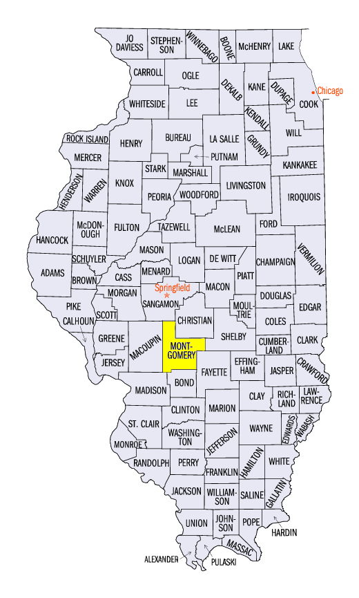
(Figure 11). Strong winds knocked over power poles in Illinois and an EF-0 tornado was surveyed as well. An injury was reported in Nokomis, IL (Montgomery County) from a severely damaged trailer. Several EF-1 tornadoes were also observed in northern Indiana. Wind damage was reported earlier in the day across central and southern Ohio, including many trees down.
Drought Expands in Iowa
Moderate drought expanded across portions of western and southeastern Iowa according to the July 4 U.S. Drought Monitor (Figure 12). Almost nine percent of the state was considered in moderate drought, while half of the state was considered abnormally dry. Meanwhile, drought persisted in northwestern Minnesota, while abnormally dry conditions remained in Illinois and southeastern Michigan.
-BJP-