June 22-30, 2017
Midwest Weekly Highlights - June 22-30, 2017
Cool and Pleasant
Temperatures were cool across the Midwest during the last week of June, as the entire region was below normal
(Figure 1). Most of Minnesota, Iowa and Wisconsin were 5-7°F below normal, while Illinois, Indiana, Kentucky and most of Missouri were 3-5°F below normal. Maximum temperatures were a major contributor, as the northern half of the region averaged high temperatures in the 70s, with only low 80s across southern parts (Figure 2). Areas in northern Wisconsin and the western U.P. of Michigan had maximum temperatures more than 10°F below normal
(Figure 3). These cooler temperatures resulted in over 300 combined low-minimum and low-maximum temperature records in the Midwest (Figure 4).
Wet for Many
Plentiful rainfall was observed across the Midwest in the period
(Figure 5). Areas in northern Missouri, northeastern Iowa and southern Wisconsin received in excess of three inches of rain, while most of Michigan, Indiana, Ohio and Kentucky had more than one inch. In many cases, this was more than twice the normal amount (Figure 6). The only dry areas during the period were in Minnesota and southern Illinois. Excess rainfall fell during a severe weather event on June 28 through the morning of June 29 in northeastern Iowa and southern Wisconsin
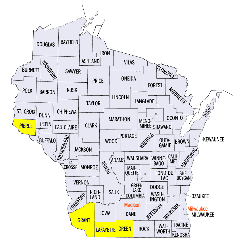
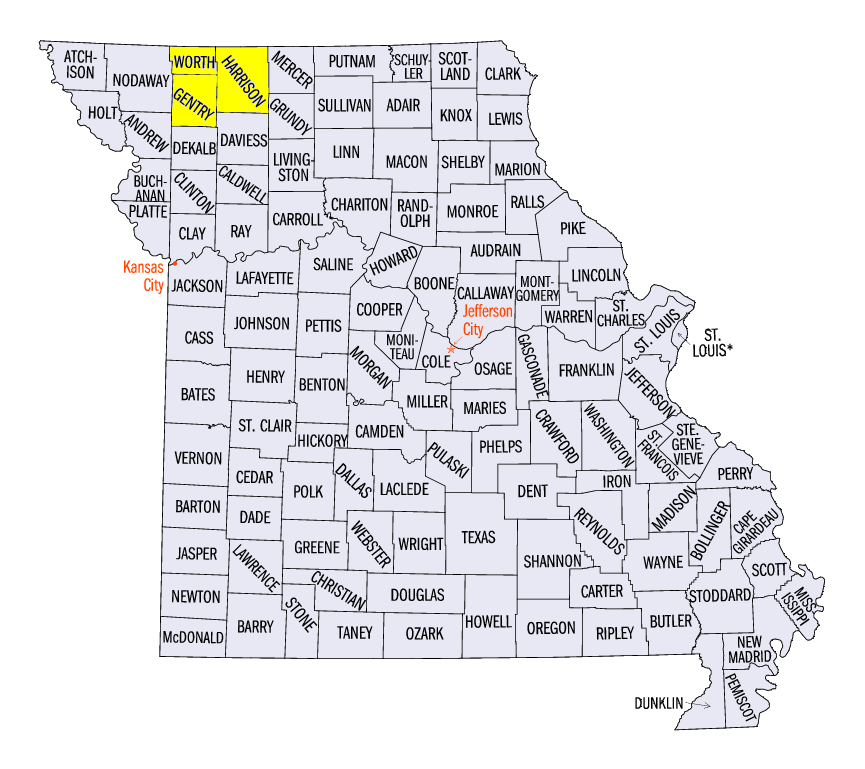
(Figure 7). Totals from this event included 4.20 inches in Darlington, WI (Lafayette County), 4.11 inches near Monroe, WI (Green County) and 3.70 inches in Argyle, WI (Lafayette County). Heavy rain hit northern Missouri through the morning of June 30, with several reports of precipitation over eight inches (Figure 8). These included 8.91 inches in Albany, MO (Gentry County), 8.89 inches near Grant City, MO (Worth County) and 8.20 inches in Bethany, MO (Harrison County). This heavy rainfall caused minor to moderate flooding on several rivers
(Figure 9) (Figure 10). More than 200 daily precipitation records were recorded during the period
(Figure 11).
June 28-29 Severe Weather
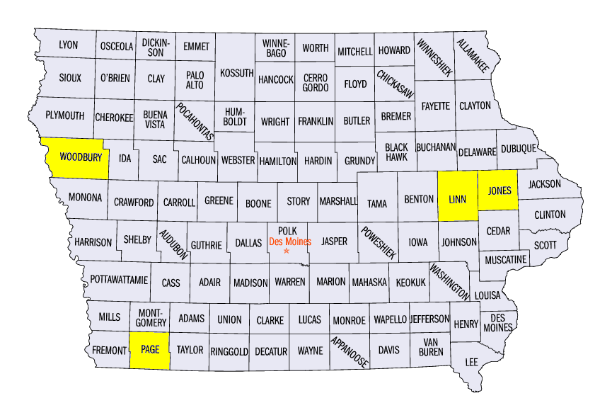
More than 300 severe weather reports were observed across the Midwest during the period, with over 200 of them occurring on June 28-29 (Figure 12). Strong thunderstorms developed in central Iowa during the afternoon on June 28 and dropped several EF-0 and EF-1 tornadoes (Figure 13). More tornadoes were reported as the system moved into eastern Iowa, including an EF-2 tornado through Central City, IA and Prairieburg, IA (Linn and Jones counties). One injury was reported when a garage collapsed on a woman. Livestock was also killed from the tornado. Tennis ball to baseball sized hail was also reported Several more tornadoes and funnel clouds were observed in southeastern Minnesota and western Wisconsin. An injury was reported near Ellsworth, WI (Pierce County) from a tornado, while straight-line winds up to 80 mph were observed in Grant County, WI. In central Wisconsin, two more EF-1 tornadoes were observed in Green County. Meanwhile in western Iowa and northwestern Missouri, strong thunderstorms dropped tennis ball- to baseball-sized hail along with strong winds. An EF-1 tornado was observed near Shenandoah, IA (Page County) with an EF-2 tornado near Farragut, IA (Fremont County).
Severe weather developed again on June 29 in Nebraska and Kansas before moving into Iowa and Missouri (Figure 14). Large hail was observed along the eastern border of Iowa, including a 4.25 inch diameter hail stone near Sergeant Bluff, IA (Woodbury County). Wind and hail reports were also common across Missouri and Iowa during the evening hours.
-BJP-