May 22-31, 2017
Midwest Weekly Highlights - May 22-31, 2017
Cooler to the West
Temperatures were cool across the western half of the Midwest during the last ten days of May
(Figure 1). Most of Iowa and Minnesota were 2-4°F below normal, with Missouri, western Illinois and Wisconsin 1-3°F below normal. Near-normal temperatures were widespread across Indiana and Kentucky. A few warmer than normal areas occurred in Lower Michigan and Ohio, where temperatures were 1-3°F above normal.
Dry for Most
Drier weather was common across most of the Midwest for the period (Figure 2). Most of Minnesota, Iowa, Missouri, Illinois, Lower Michigan and western Indiana had below-normal precipitation for the period
(Figure 3). Minnesota, Iowa and southern Illinois had less than half the normal amount (Figure 4). A few wetter areas were found in southern Missouri, Kentucky, Ohio and eastern Indiana. Most of this rainfall fell through the mornings of May 25
(Figure 5) and May 28 (Figure 6) during strong thunderstorms.
May 24 Western Ohio Tornadoes
Strong thunderstorms across eastern Indiana and western Ohio caused six confirmed tornadoes in western Ohio
(Figure 7). Two of these tornadoes were rated EF-1 while the remaining four were rated EF-0. Fortunately, no injuries were reported.
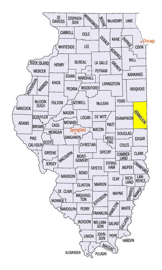
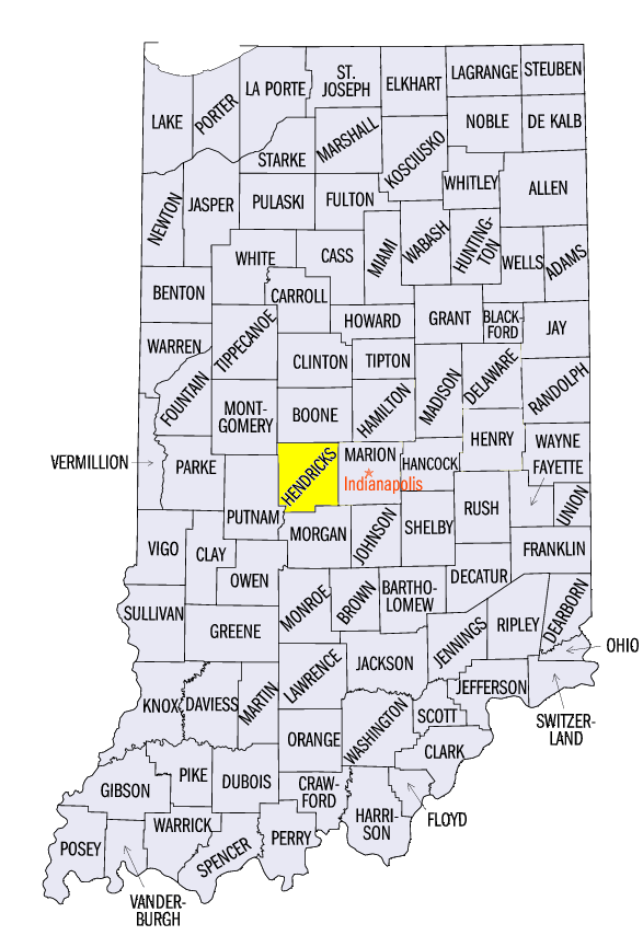
May 26 Illinois/Indiana Severe Thunderstorm
A strong thunderstorm in eastern Illinois through central Indiana caused damage from wind and hail on May 26 (Figure 8). Most of the significant reports occurred in Vermilion County, IL. Two-inch hail was reported across the northern half of the county, with the largest report of 2.5 inches near Rankin, IL. Wind gusts over 70 mph were reported, including an 80 mph wind gust in Rossville, IL. A 75 mph wind gust was also reported as the storm moved east near Pittsboro, IN (Hendricks County).
May 27 Southern Midwest Severe Weather
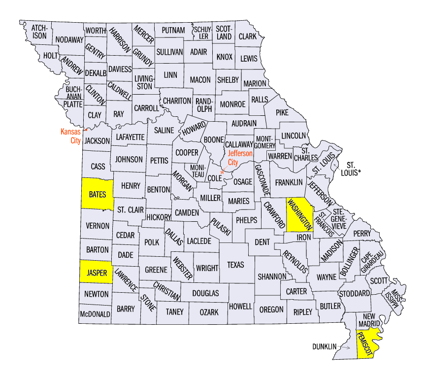
Memorial Day weekend began with widespread severe weather in Missouri and Kentucky during the afternoon and evening of May 27 (Figure 9). Tennis- to baseball-sized hail was reported, including a softball-sized hailstone near Ballard, MO (Bates County). An injury was reported near Carthage, MO (Jasper County) due to 2.5-inch hail breaking glass from windows. Strong winds of 60-80 mph were also reported. A 76 mph gust was reported near Potosi, MO (Washington County) and near Cooter, MO (Pemiscot County). High winds and large hail continued into Kentucky during the evening hours. In total, over 300 storm reports of wind, and hail occurred across the southern Midwest, with over 200 of them in Missouri. National Weather Service summaries of these storms are available here:
| NWS St. Louis, MO | NWS Springfield, MO |
| NWS Paducah, KY | NWS Jackson, KY |
Abnormally Dry in Northern Minnesota
After an unusually low amount of abnormally dry conditions and drought in the Midwest, most of northwestern Minnesota was classified as abnormally dry according to the May 30 U.S. Drought Monitor (Figure 10). Dry weather in May could have been one of the factors, as these areas received less than half the normal amount of precipitation during the month (Figure 11).
-BJP-