May 15-21, 2017
Midwest Weekly Highlights - May 15-21, 2017
Warm, Except in the Upper Midwest
Temperatures were above normal across southern and eastern portions of the Midwest during the week
(Figure 1). Most of the Ohio River Valley was 6-9°F above normal, while Missouri, northern Illinois and Lower Michigan were 2-5°F above normal. Warm temperatures on several days broke dozens of daily high maximum and over 200 daily high minimum temperature records across the region (Figure 2). Cooler conditions were common across the Upper Midwest, where Minnesota and the U.P. of Michigan were 2-5°F below normal. Northern Wisconsin and northwestern Iowa were also 1-3°F below normal. Maximum temperatures through the mornings of May 20
(Figure 3) and May 21 (Figure 4) were unseasonably cool across the Upper Midwest and led to over 100 daily low maximum temperature records
(Figure 5).
Wet in the Upper Midwest
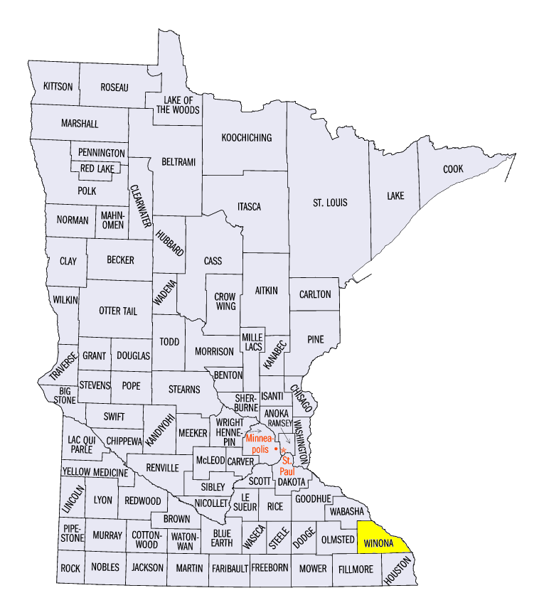
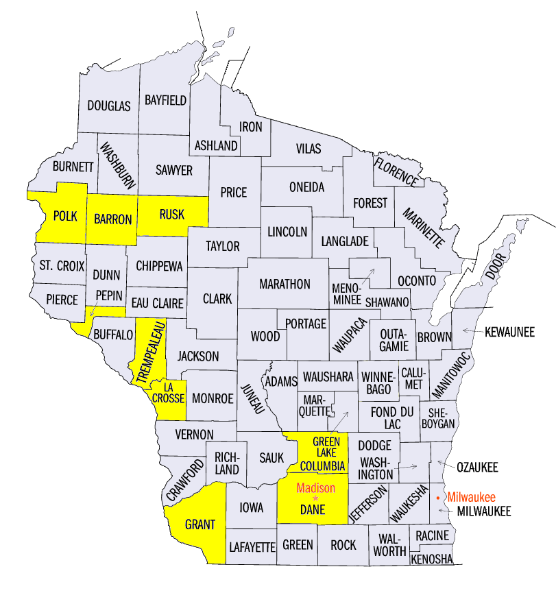
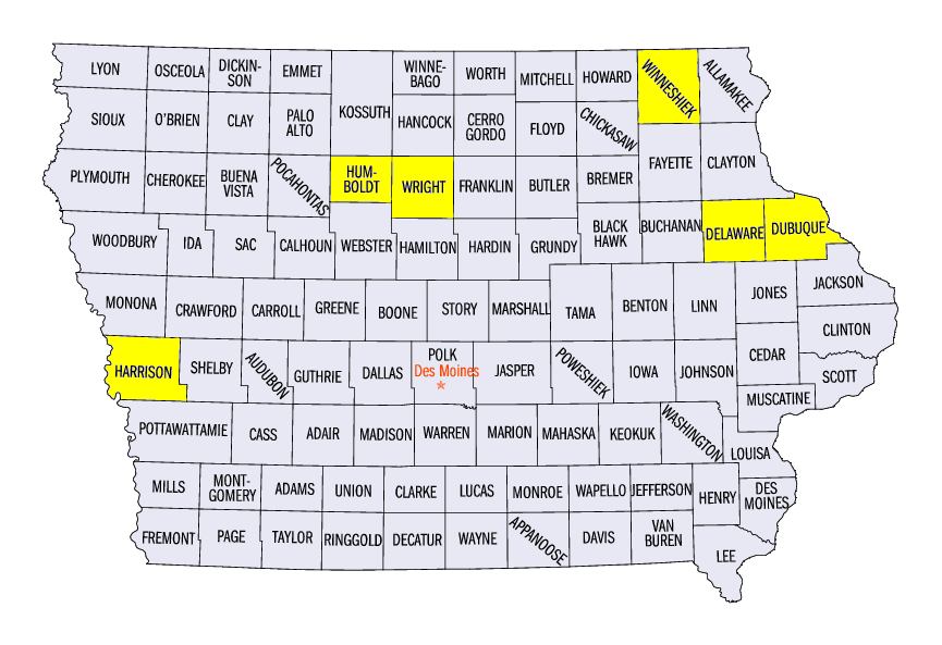
Rainy weather across the Upper Midwest was a common occurrence during the week (Figure 6). More than two inches of rain fell across western Iowa, southern Minnesota and northern Wisconsin. Some areas had more than four inches. Some locally higher amounts included 7.54 inches near Altura, MN (Winona County), 6.08 inches near La Crosse, WI (La Crosse County) and 5.41 inches in Pisgah, IA (Harrison County). This rainfall was three to five times the normal amount, with areas in northern Wisconsin and east-central Minnesota receiving more than five times the normal amount
(Figure 7). Elsewhere, parts of Missouri, Illinois and northern Indiana had more than one-and-a-half times the normal amount for the week. More than 200 daily precipitation records were broken throughout the week (Figure 8).
Widespread Severe Weather and Tornadoes
A very active weather pattern across the Midwest led to widespread severe weather and over 850 storm reports (Figure 9). Nearly 300 came from Iowa with over 100 reports each from Missouri and Wisconsin. Strong winds and large hail was common across northern Iowa, southern Minnesota and southern Wisconsin on May 15 (Figure 10). Hail of two inches in diameter or larger was reported more than half a dozen times, including 2.5 inch hail in Windsor, WI (Dane County), Thor, IA (Humboldt County) and Goldfield, IA (Wright County). An EF-0 tornado was also reported near Calmar, IA (Winneshiek County).
On May 16, severe thunderstorms fired again across the Upper Midwest (Figure 11). Strong winds were common across western Iowa, while hail and tornadoes were reported in southwestern Minnesota and northern Wisconsin. An EF-2 tornado killed one and injured 25 as it tracked through Polk, Barron and Rusk counties, WI. The Upper Midwest was hammered once again on May 17, with more than 350 storm reports in Iowa, Minnesota, Wisconsin and Illinois (Figure 12). Strong straight-line winds of 60-75 mph caused widespread damage. Some of the strongest gusts included 78 mph in Holy Cross, IA (Dubuque County), 80 mph in Patch Grove, WI (Grant County), and 89 mph near Ryan, IA (Delaware County). More than a dozen tornadoes were reported.
| NWS La Crosse (May 15) | NWS Twin Cities (May 16) | NWS La Crosse (May 17) |
| NWS St. Louis (May 19) | NWS Quad Cities (May 17) | NWS Chicago (May 17) |
| NWS Springfield, MO (May 19-20) | ||
High Winds and Illinois Dust Storm
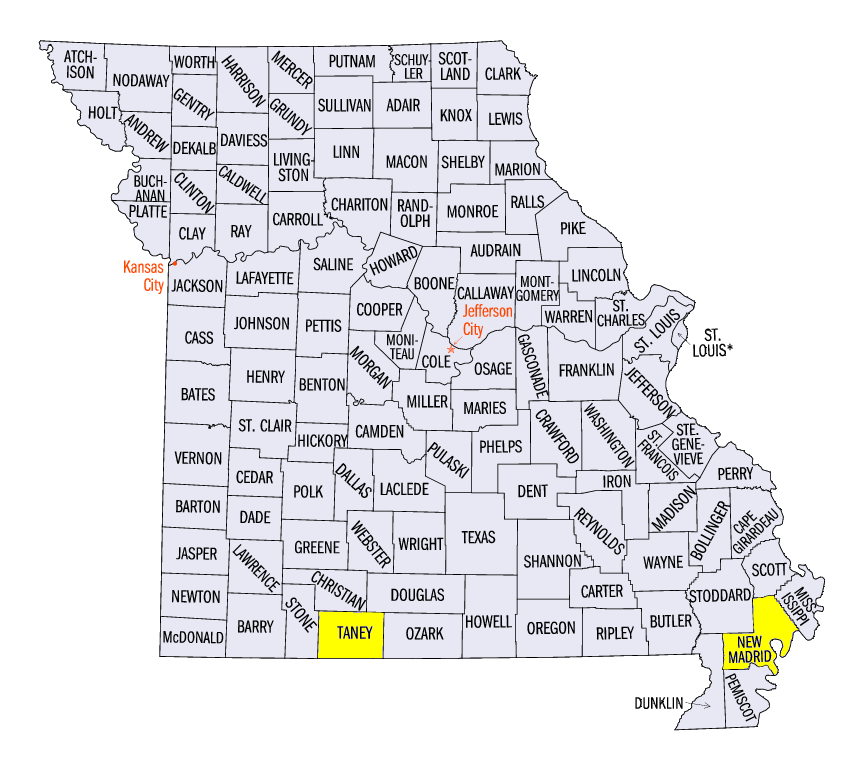
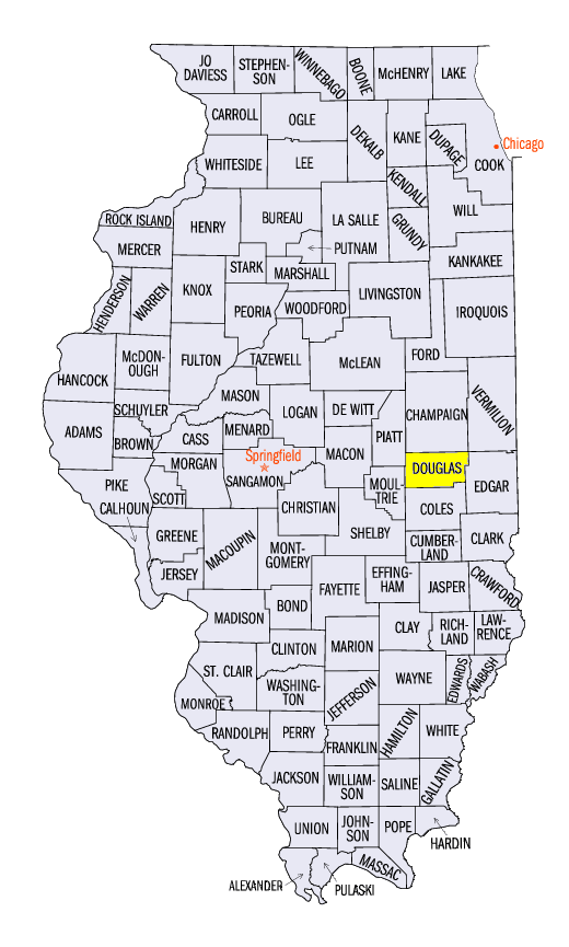
High non-thunderstorm winds on May 17 coupled with dry soils led to a dust storm that lowered visibility across central Illinois. Most of Illinois enjoyed a slight reprieve from wet conditions May 12 through the morning of May 17. While this allowed many farmers to till and plant fields, it also caused dry, loose soil to be picked up by 40-50 mph winds on May 17. Low visibility of a quarter-mile or less along the I-72 corridor in central Illinois caused several accidents, including a fatality in Douglas County, IL. High winds were also common in Missouri on May 17. One fatality was reported in Sikeston, MO (New Madrid County) from a rotten tree falling down.
Flooding Remains
While rivers in Missouri, Illinois and Indiana continued to slowly recede from flood stage, heavy rain in the Upper Midwest caused flooding across southern Minnesota and western Wisconsin (Figure 13). Gauges that reached moderate flood stage included the Chippewa River at Durand, WI (Figure 14 Pepin County), The Trempealeau River at Dodge, WI (Figure 15,Trempealeau County) and the Wisconsin River at Portage, WI (Figure 16, Columbia County). Minor flooding also occurred along the Mississippi River between St. Paul, MN and La Crosse, WI.
Further south, rainfall through the mornings of May 20-21 caused flood gauges to rise or remain steady across southern Illinois, Missouri and western Indiana. Heavy rainfall in Missouri caused most gauges along the Missouri River to reach minor flood stage, while several gauges along the Illinois River moved back into moderate flood stage.
Wet Soils and Flooded Fields
Rainfall since late April has complicated planting season for many farmers across the Midwest (Figure 17). More than twice the normal amount of rainfall has fallen in the 30-day period ending on May 21 across more than half of Missouri and nearly half of Illinois (Figure 18). According to the USDA NASS Crop Weather Report for the week ending on May 21, all nine Midwest states reported that more than 95 percent of topsoil and subsoil had either adequate or surplus moisture. The May 16 U.S. Drought Monitor also showed that less than one tenth of one percent of the Midwest was considered abnormally dry (Figure 19). The fifteen plus inches of rainfall in southern parts of Illinois and Missouri caused issues due to ponding of water in fields. Replanting of corn has begun for some in southern Illinois, while others are evaluating the profitability of replanting.
-BJP-