April 1-9, 2017
Midwest Weekly Highlights - April 1-9, 2017
Continued Warm Weather
Above-normal temperatures remained common across the Midwest during the first week of April
(Figure 1). Only a few areas in southwestern Michigan and northern Indiana were near-normal. The most above-normal areas were in Minnesota, northern Wisconsin and the U.P. of Michigan. Parts of northern Minnesota were 8-11°F above normal. The southern half of the region was closer to normal at 1-3°F above normal. Maximum temperatures were a major culprit for the well above-normal conditions in the northern parts of the region, as most of Minnesota and northern Wisconsin were 9-14°F above normal (Figure 2). One of these warm days was April 8, where temperatures in the upper 60s and 70s were widespread across the northern half of the region (Figure 3). Dozens of daily high maximum and minimum temperatures were broken due to the warm weather that day (Figure 4).
Wet Across the Central Midwest
Several days of wet weather occurred across the Central Midwest and Michigan during the period (Figure 5). Parts of northern Missouri, southern Iowa, Illinois, northern Indiana, eastern Ohio and Michigan had one-and-a-half times to two times the normal amount for the week (Figure 6). Portions of east-central Michigan and northwestern Missouri had more than three times the normal amount. Most of this precipitation fell during a three day period. More than an inch fell in northern Michigan through the morning of April 4, with amounts over a half-inch in Wisconsin and Iowa (Figure 7). Another system moved into Missouri and Illinois through the morning of April 5 (Figure 8). The system then moved east into eastern Illinois, Indiana and Michigan through the morning of April 6 (Figure 9). Nearly 100 daily precipitation records occurred during this three-day period (Figure 10). Snowfall was limited in the region to an inch or less across Michigan, with some areas up to three inches in northeastern Ohio (Figure 11).
Severe Weather and Tornadoes
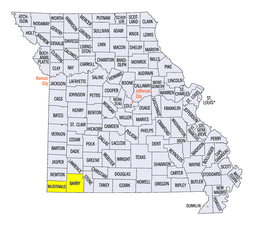
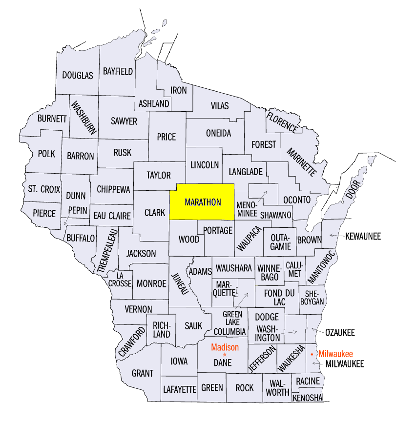
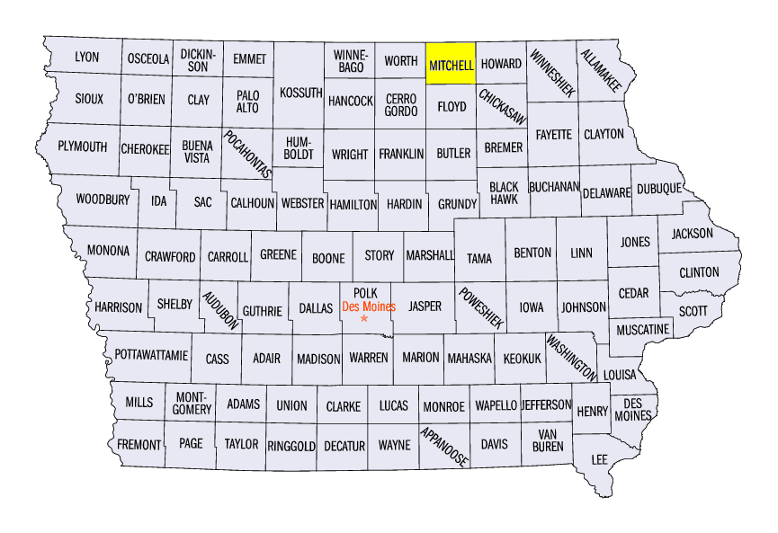
Severe weather and tornadoes were prevalent across the Midwest during the week (Figure 12). Strong storms first entered the region on April 4 in southern Missouri. Strong winds and hail occurred, as well as two confirmed tornadoes. An EF-2 tornado was surveyed near Goodman, MO (McDonald County) and an EF-1 tornado occurred near Seligman, MO (Barry County). As the system moved east, hail, wind and tornado damage occurred along the Ohio River Valley. Several confirmed tornadoes occurred in southern Illinois, southern Indiana, central Kentucky and southeastern Ohio. An 80 mph wind gust was also reported near Redhouse, KY (Madison County). Severe storms impacted Iowa, southeastern Minnesota, Wisconsin and northern Illinois on April 9. An EF-1 tornado touched down near Wausau, WI (Marathon County). Hail reports were common as well. A 2.5 inch hailstone was reported near Stacyville, IA (Mitchell County). Several wind gusts of up to 70 mph also occurred in the U.P. of Michigan.
Drought Coverage Decreases
Continued wet weather contributed to a decrease in drought coverage in Missouri, southern Iowa and southeastern Illinois in the April 4 U.S. Drought Monitor (Figure 13). Drought coverage decreased from 60 percent to 13 percent, including improvements in the St. Louis area. Coverage in Illinois went from 17 percent to six percent, while all drought was eliminated from Iowa. Abnormal dryness also decreased to 18.5 percent of the region, a change of 3 percent. An estimated one million people were still in drought-affected areas.
-BJP-