March 22-31, 2017
Midwest Weekly Highlights - March 22-31, 2017
Wet Weather Abounds
Widespread wet weather was common across Iowa, Missouri, northern Illinois, Wisconsin and Michigan during the period
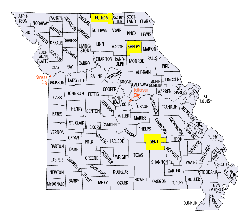
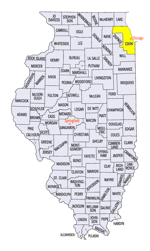
(Figure 1). Amounts of over an inch were common across most of these areas, with most of Missouri, northern Illinois and southern Lower Michigan receiving over two inches. In many cases, this was more than twice the normal amount (Figure 2). Some of the heaviest totals included 4.24 inches in Shelbina, MO (Shelby County), 4.19 inches in Unionville, MO (Putnam County) and 3.69 inches in Park Forest, IL (Cook County). Nearly 200 daily precipitation records were also broken during the week
(Figure 3). More than half of the records were broken through the mornings of March 30 (Figure 4) and March 31
(Figure 5). Minnesota and northern Wisconsin were the only major areas of dry conditions during the week. Less than half the normal precipitation fell during the period.
Warm Temperatures for Many
Above-normal temperatures were common across most of the region (Figure 6). Southern Missouri, Kentucky, southern Indiana and Ohio were 5-8°F above normal. Most of Minnesota and Illinois were also 2-6°F above normal. Temperatures were near normal across Iowa, Wisconsin, and most of Michigan. Several days during the period had maximum temperatures in the 70s across the southern parts of the region including widespread warmth on March 24
(Figure 7). However, it was minimum temperatures that were more above normal during the period (Figure 8). Dozens of high maximum and high minimum daily temperature records were broken across the region from the warm conditions during the week
(Figure 9).
Active Week of Severe Weather
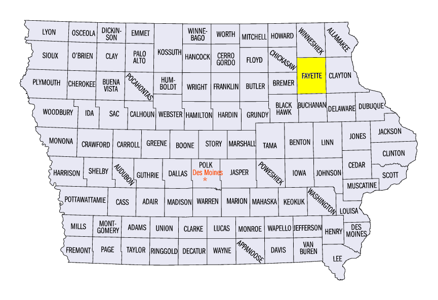
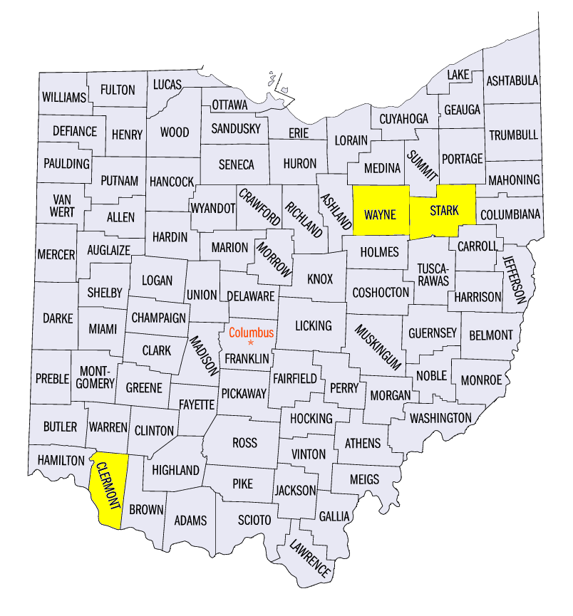
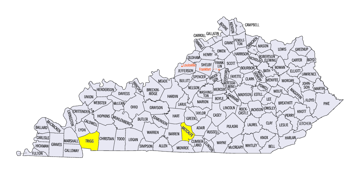
Severe weather was common across the Midwest as multiple rounds of storms crossed the region during the week (Figure 10). Hail was common across northern Iowa and southern Wisconsin on March 23, which included a two-inch hail report near Westgate, IA (Fayette County). A tornado was confirmed on March 26 near Williamsburg, OH (Clermont County) that was rated EF-1 and toppled a few structures. No injuries were reported. Hail and strong thunderstorm winds were common across Kentucky on March 27. Two tornadoes touched down in the state near Cerulean (Trigg County) and near Center (Metcalfe County). The next round of severe weather began on March 29 in Missouri, where hail reports were common, and an EF-1 tornado was confirmed near Sligo, MO (Dent County). Wind and hail reports from the storm system continued on March 30 across central Illinois, Indiana and eastern Ohio. Two-inch hail was reported in Dalton, OH (Wayne County) and near Canal Fulton, OH (Stark County).
Drought Decreases in Missouri
The above-normal rainfall in Missouri played a role in the reduction of drought coverage in the state in the latest U.S. Drought Monitor (Figure 11). Drought coverage dropped nearly 20 percent from close to 80 percent to 60 percent. Severe drought in the state also decreased, although no changes to drought coverage occurred in southern Iowa and southwestern Illinois.
-BJP-