March 8-14, 2017
Midwest Weekly Highlights - March 8-14, 2017
Winter Temperatures Return
Temperatures were colder than normal across the Midwest, ending a long stretch of above-normal temperatures in the region
(Figure 1). Most of Minnesota, northern Wisconsin and the U.P. of Michigan were 8-14°F below normal, with the rest of the Upper Midwest 4-7°F below normal. The southern half of the region was 2-5°F below normal. Maximum temperatures were a strong contributor, with most of the region 5°F or more below normal (Figure 2). Several dozen daily low maximum temperatures were broken in the region
(Figure 3). More than a dozen low maximum records were set in Minnesota, where maximum temperatures in the teens and single digits were common on March 10 (Figure 4).
Mainly Dry, But Snowy
Drier conditions were common across the Midwest during the week
(Figure 5). Only a few areas received near-normal precipitation (Figure 6). Most of northern Minnesota, Wisconsin southern Iowa, northern Missouri, Illinois, Indiana and Lower Michigan had less than half the normal amount. Only parts of eastern Ohio, southern Minnesota, northern Iowa, and the southern fringes of Missouri and Kentucky had more than the normal amount. Snowfall was more common with colder temperatures in the region, however
(Figure 7). More than 100 daily snowfall records were broken in the region, mostly through the mornings of March 13-14 (Figure 8).
March 12-13 Winter Storm
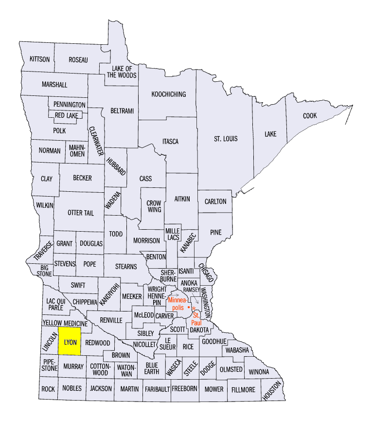
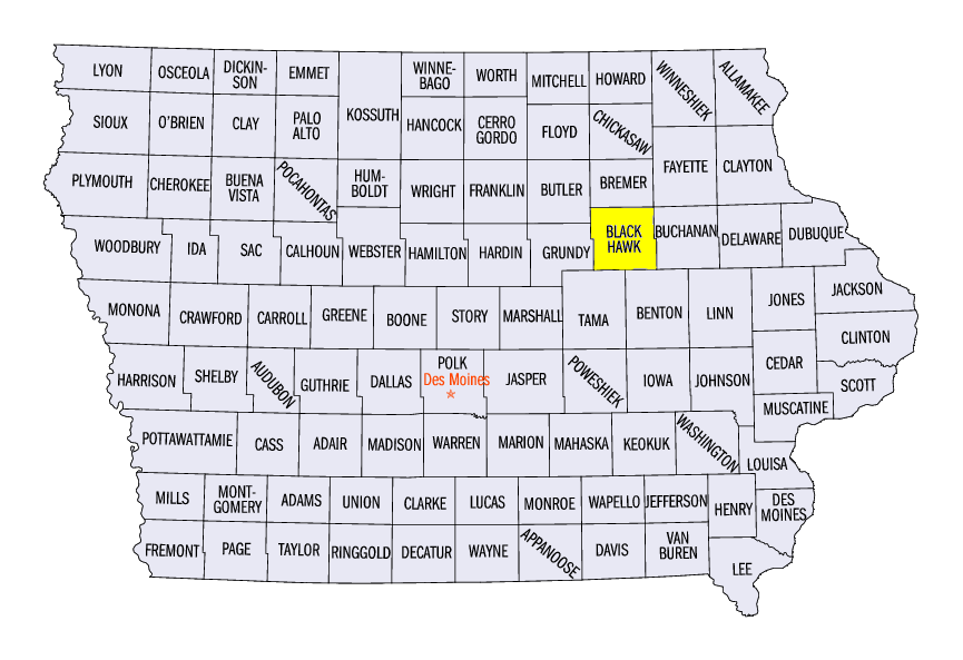
A potent winter storm dropped 4-8 inches of snow across an area from eastern South Dakota, southern Minnesota and northern Iowa on March 12-13
(Figure 9). Locally heavier amounts up to 12 inches were also recorded. Some of the heaviest totals included 12.0 inches in Tracy, MN (Lyon County) and 10.4 inches in Waterloo, IA (Black Hawk County). Snowfall amounts of 2-5 inches were also common across northern Illinois and southern Wisconsin during the overnight hours.
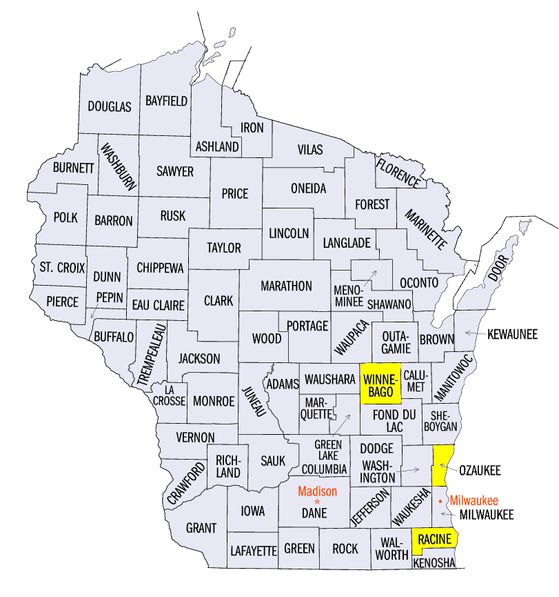
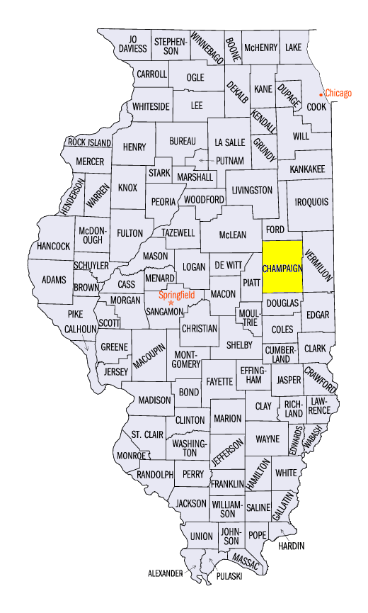
Chicago/Milwaukee Lake-Effect Snowfall March 13-14
An uncommon lake-effect snowfall event occurred in eastern Wisconsin and northern Illinois on March 13-14. Strong high pressure filled in behind a developing nor’easter along the east coast, which led to winds from the north-northeast across Lake Michigan (Figure 10). With most of Lake Michigan also free of ice cover
(Figure 11), lake-effect snow was common along the eastern shores of Wisconsin and northern Illinois. Some of the heaviest totals occurred in eastern Wisconsin through the morning of March 14 (Figure 12). Ten or more inches were common from Fredonia, WI (Ozaukee County) through Racine, WI (Racine County). Snowfall continued during the day on March 14
(Figure 13). Totals in the Chicago and northwestern Indiana area were generally 5-8 inches. Bands of snow went as far south as Champaign, IL (Champaign County).
March 8 Strong Winds
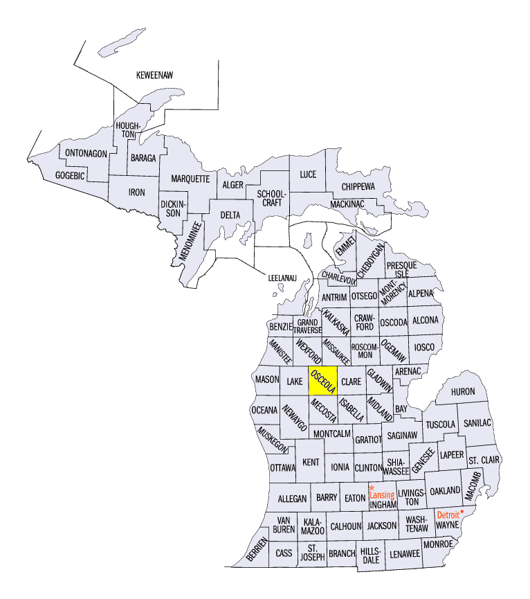
Wind gusts of 50-60 mph were common across eastern Wisconsin, northern Illinois and Lower Michigan on March 8. Wind gusts of 62 mph were recorded in the Chicago area, while a gust of 68 mph was reported southwest of Detroit. High winds caused a plane taking the University of Michigan basketball team to the Big Ten Tournament to abort a takeoff attempt and crash after running out of runway. Several semi-trucks were overturned on interstates in Wisconsin and Michigan. Power lines fell and trees came down on cars and homes as well. Two fatalities were reported near Temple, MI (Osceola County) when a tree fell on a car. An injury was also reported in Oshkosh, WI (Winnebago County), where a man tried to close the door of his semi and was thrown out by the strong winds.
March 9 Severe Weather
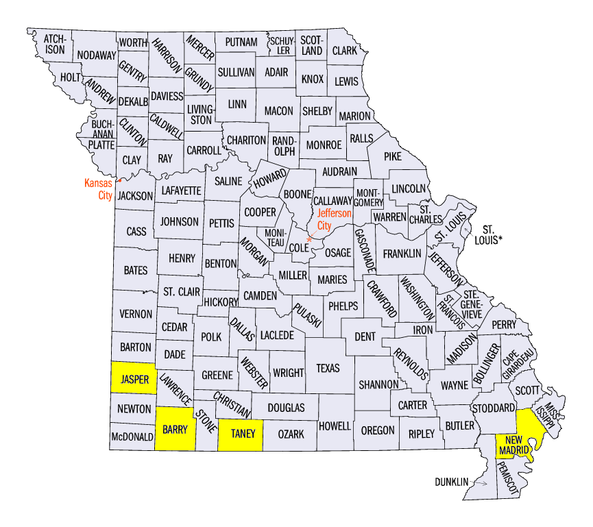
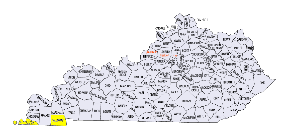
Hail damage was common across Missouri and southern Kentucky on March 9 (Figure 14). Thunderstorms during the afternoon through the evening hours produced widespread hail in southern Missouri up to baseball size. The largest hail report was 3.0 inches in Oronogo, MO (Jasper County). Several small tornadoes were also reported in Taney and Barry counties in Missouri and Fulton and Calloway counties in Kentucky. Two EF-2 tornadoes were surveyed in near Hickman, KY (Fulton County) and along the Mississippi River in New Madrid County, MO. Several other EF-1 tornadoes were also surveyed.
Drought and Fire Risk
Drought conditions remained similar to the previous week across the Midwest according to the March 14 U.S. Drought Monitor (Figure 15). However, drier weather has increased fire risk along the western fringes of the region. Several small fires were observed in western Missouri during the period.
-BJP-