March 1-7, 2017
Midwest Weekly Highlights - March 1-7, 2017
Warm Weather Continues
Above-normal temperatures remained common across the Midwest this week
(Figure 1). Most of southern Minnesota, Iowa and northern Missouri were 7-10°F above normal, while most of Illinois and Indiana were 6-8°F above normal. Dozens of daily maximum and high minimum temperature records fell during the week (Figure 2). Temperatures reached the mid- to upper-70s across western Iowa and Missouri on March 6
(Figure 3), which broke more than two dozen records in Iowa.
Wet Weather Region-Wide
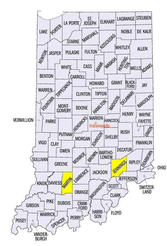
Multiple rounds of thunderstorms led to heavy rain across most of the Midwest in a very wet week for the region (Figure 4). Most of the region had above-normal precipitation, with many areas receiving more than twice the normal amount (Figure 5). Only a few areas along the western border of the region had less than normal preciptiation. Dozens of daily records were broken (Figure 6). Some of the heaviest precipitation fell across the Ohio River Valley. Amounts of 2-3 inches for the week were common. Some of the locally higher weekly amounts included 4.86 inches near Vernon, IN (Jennings County), 4.66 inches in Cheviot, OH (Hamilton County) and 3.78 inches near Shoals, IN (Martin County). Most of this rainfall occurred through the morning of March 1 (Figure 7). The accompanying severe weather that occurred during the early morning hours of March 1 can be read about in the previous week’s Midwest Climate Watch (Figure 8).
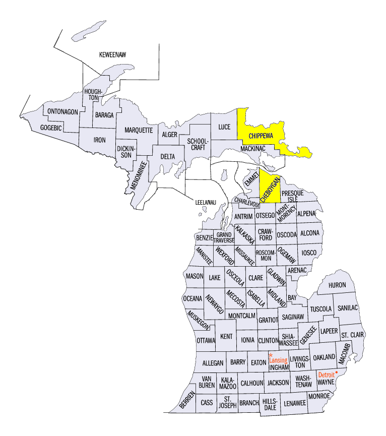
Snowfall was limited across most of the region
(Figure 9). However, heavy snowfall occurred in the Upper Midwest early in the week. Several inches of snow fell in Minnesota and northern Wisconsin through the morning of March 1 (Figure 10) and 4-8 inches of snow fell across northeastern Wisconsin and northern Michigan through the morning of March 2
(Figure 11). Some locally heavier amounts occurred through the morning of March 2 in Michigan, where Detour Village, MI (Chippewa County) received 16.0 inches and 14.0 inches fell in Cheboygan (Cheboygan County).
March 6 Severe Weather and Tornadoes
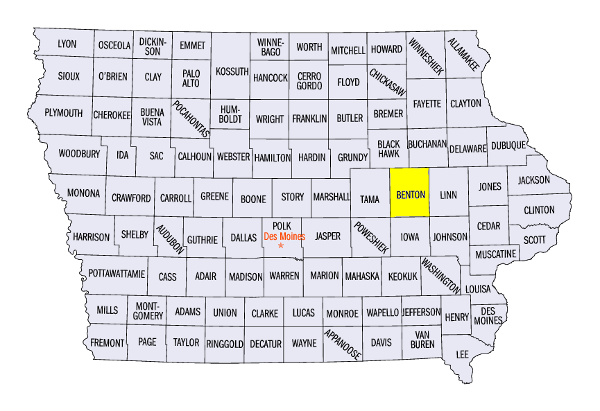
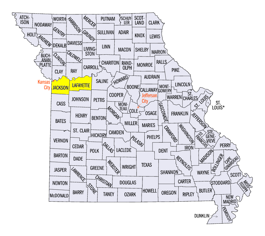
A potent line of thunderstorms stretched over 700 miles from Minnesota to Oklahoma on the evening of March 6 (Figure 12). Wind and hail damage as well as more than a dozen tornadoes were reported across the western half of the Midwest through the overnight hours along the line (Figure 13). Very strong winds of 60-70 mph were common along the line in Iowa. The strongest wind gust not associated with a tornado was 90 mph in Belle Plaine, IA (Benton County). More than a dozen tornadoes spun up along the line in Iowa, Missouri and Illinois. One of the strongest tornadoes was an EF-3 near Oak Grove, MO (Jackson and Lafayette Counties). Twelve injuries were reported. Around half a dozen EF-2 tornadoes were also surveyed in Missouri, Iowa and Illinois. Several more EF-1 and EF-0 tornadoes were also reported. Summaries and reports from National Weather Service offices are available below.
| NWS Quad Cities | NWS Des Moines |
| NWS Chicago | NWS Milwaukee |
| NWS Lincoln, IL | NWS St. Louis |
| NWS Kansas City | |
Drought Expands
Drought continued to expand across Missouri and southwestern parts of the region according to the March 7 U.S. Drought Monitor (Figure 14). More than three-fourths of Missouri was considered in drought. Severe drought was also introduced in central Missouri. Overall, 13 percent of the Midwest was considered in drought.
-BJP-