February 22-28, 2017
Midwest Weekly Highlights - February 22-28, 2017
Unusual Warmth Continues
Temperatures more than 10°F above normal remained common in parts of the Midwest this week (Figure 1). Most of Illinois, Indiana, Ohio and southern Lower Michigan were 12-17°F above normal. The warm weather continued a record-breaking stretch that started the week prior. Over a thousand daily maximum and minimum temperature records combined fell from February 22-25 (Figure 2). Maximum temperatures reached the 60s and 70s across a majority of the region on February 22 (Figure 3) and February 23 (Figure 4). Highs in the 80s were even reported in southwestern Missouri on February 24 (Figure 5).
Highest one-day temperature records for the month of February were also broken in the region, sometimes on multiple occasions. Cities that had stations break their record highest February temperature included Traverse City, MI, Sault Ste Marie, MI, Madison, WI, Milwaukee, WI, Green Bay, WI, Minneapolis/St. Paul, MN, Moline, IL, Louisville, KY, Covington/Cincinnati, KY/OH, Cleveland, OH, Youngstown, OH and Akron, OH.
As colder air moved into the region late in the week, maximum temperatures dropped 20-30°F in many areas. Parts of western Iowa had a drop of more than 30°F from February 23 to February 24 (Figure 6), while parts of eastern Indiana dropped more than 40°F from February 25 to February 26
(Figure 7). Maximum temperatures were around freezing in Indiana through the morning of February 26 (Figure 8), just one day after maximum temperatures were in the 70s
(Figure 9).
Wet and Snowy in the Upper Midwest
Well above-normal precipitation fell across most of the Upper Midwest this week (Figure 10). Most of Iowa, Wisconsin and Michigan had more than a half-inch of precipitation for the week, with parts of Michigan receiving more than an inch (Figure 11). In most cases, this was more than twice the normal amount
(Figure 12). Drier conditions were common in Missouri, Illinois and Kentucky, where less than half the normal amount fell. Near-normal precipitation fell in Ohio and eastern Kentucky. Snowfall was also common in the Upper Midwest
(Figure 13). Most of this snow fell during a snowstorm on February 23-25.
February 23-25 Snowstorm and Severe Weather
The first and only major snowstorm to impact the Midwest in February brought 4-8 inches of snow to northwestern Iowa, southern Minnesota and northern Wisconsin through the mornings of February 24 (Figure 14) and February 25
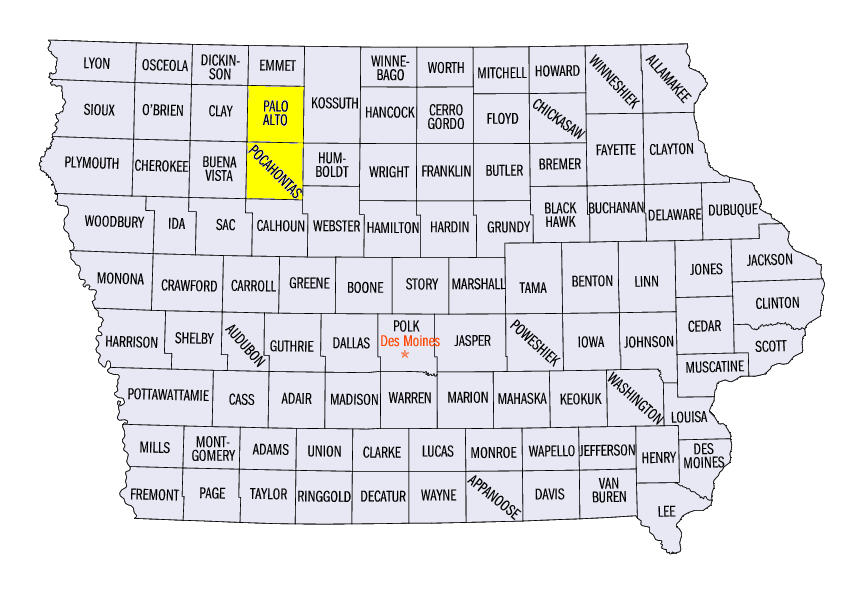
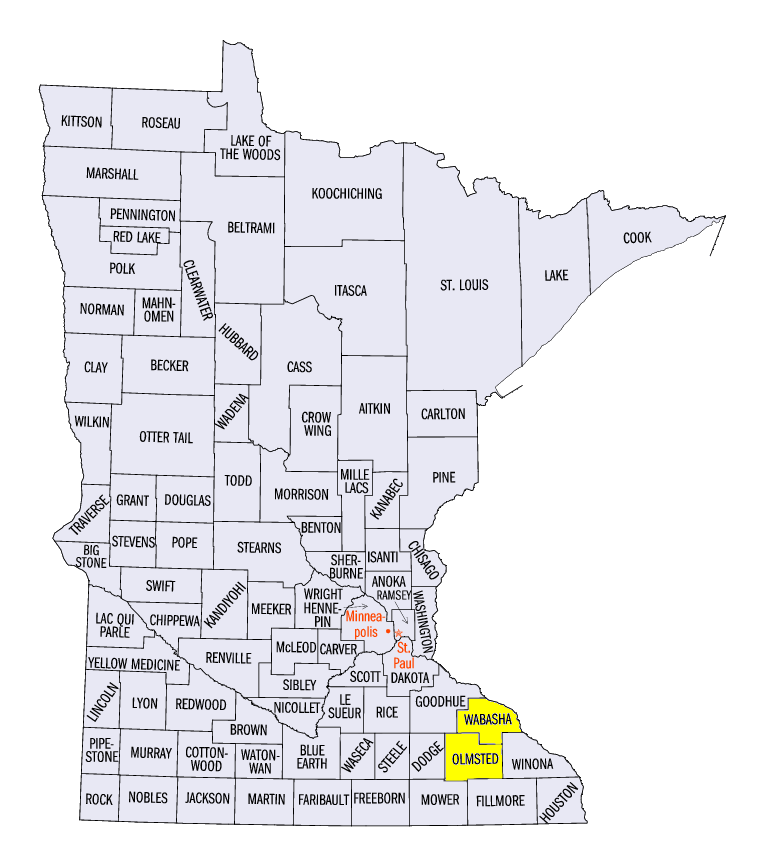
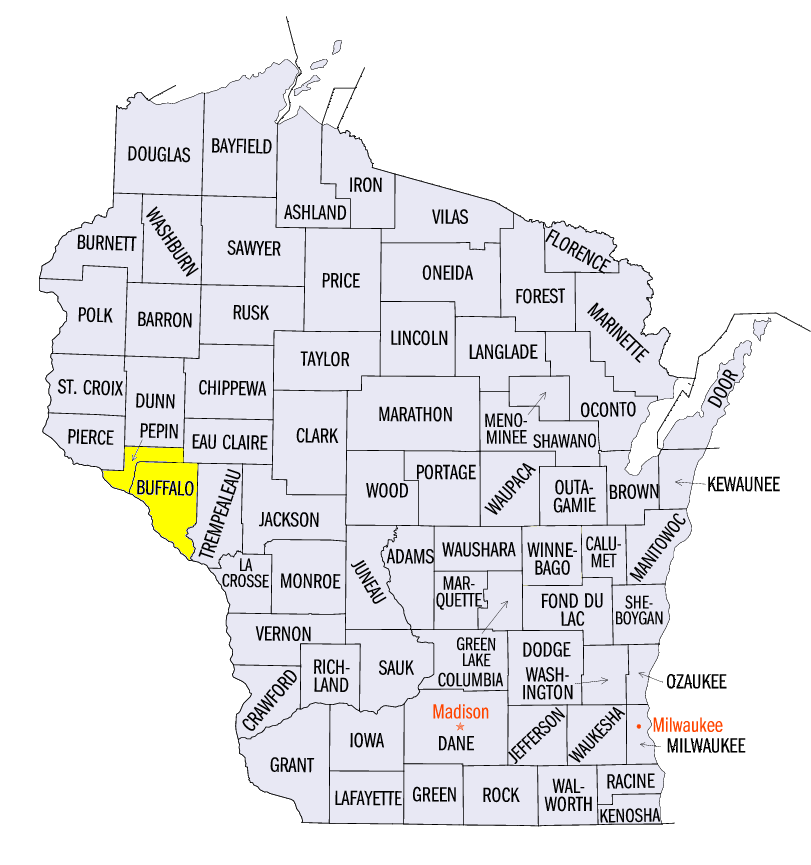
(Figure 15). Several stations received ten or more inches of snow, including Emmetsburg, IA (10.0 inches, Palo Alto County), Pocahontas, IA (10.0 inches, Pocahontas County), Theilman, MN (11.4 inches, Wabasha County), Byron, MN (10.6 inches, Olmstead County), Mondovi, WI (11.7 inches, Buffalo County), and Durand, WI (11.5 inches, Pepin County). Further east, wind and hail damage was common across parts of Indiana, Ohio, Michigan and Missouri (Figure 16). Winds up to 60 mph were observed while hail up to 1.5 inches was reported.
Severe Weather February 28-March 1
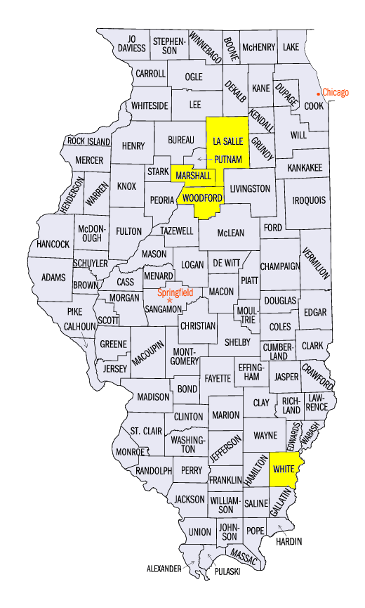
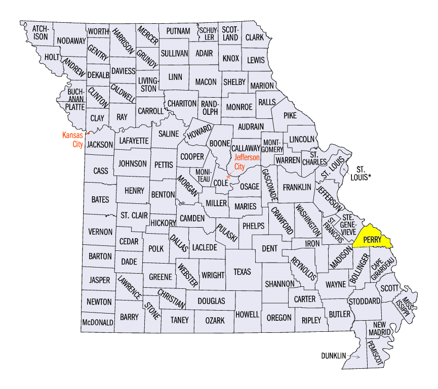
A potent storm system on February 28 brought strong winds, hail and deadly tornadoes the Midwest (Figure 17). Hundreds of reports were scattered across Missouri, Illinois, Indiana and Ohio on February 28, with many more in Kentucky on the morning of March 1. Four fatalities were associated with tornadoes in the region, the first fatalities in the Midwest since April 2015. At least two tornadoes were rated at EF-3. The Naplate/Ottawa, IL (LaSalle County) killed two people and injured 14, while the Washburn through Rutland, IL (Woodford, Marshall and La Salle Counties) fortunately caused no injuries or fatalities. Two other tornadoes were preliminarily expected to be rated at EF-3 or higher at Crossville, IL (White County) and Perryville, MO (Perry County). These tornadoes each killed one person.
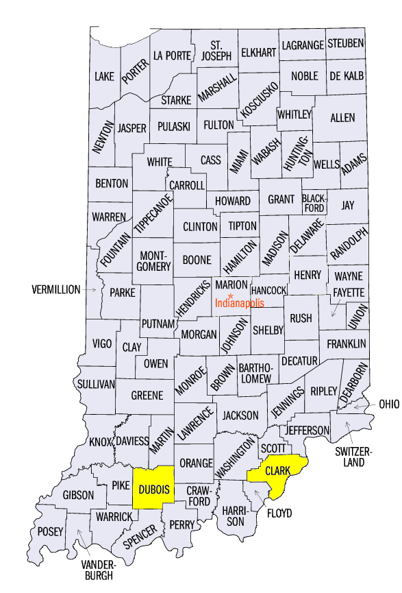
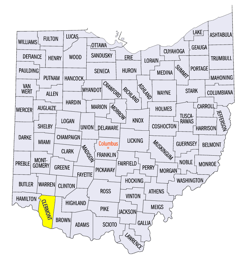
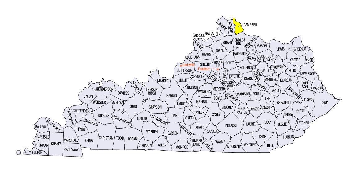
Damaging severe weather continued overnight into the early morning hours of March 1 across Indiana, Ohio and Kentucky. An EF-2 tornado touched down near Ireland, IN (Dubois County). A home in Amelia, OH (Clermont County) had its roof lifted off from an EF-1 tornado. Straight-line winds of 60-90 mph were also common. A series of microbursts were surveyed in Washington and Clark Counties, IN as well as in Campbell County, KY. Read more about this event from these summaries by local National Weather Service Offices:
Drought Expands in Missouri
Conditions in Missouri worsened for drought as nearly two-thirds of the state was classified in moderate drought in the February 28 US Drought Monitor (Figure 18). Less than two percent of the state is not considered abnormally dry or in drought. Abnormally dry conditions also expanded in Indiana. More than half the state is considered abnormally dry.
-BJP-