January 8-14, 2017
Midwest Weekly Highlights - January 8-14, 2017
Cold North, Warm South
Temperatures were split across the Midwest this week, with below-normal temperatures across Minnesota, Wisconsin and northern Iowa, and above-normal temperatures across the southern half of the region
(Figure 1). Average temperatures in Minnesota and northern Wisconsin were in the single digits above zero, with below-zero temperatures in northern Minnesota (Figure 2). These areas were 8-11°F below normal. The warmest areas were in the far southern fringes of the region. Kentucky and southern Missouri was 3-6°F above normal. Most of Indiana and Ohio were 2-5°F above normal, while Illinois, southern Lower Michigan and central Missouri were 1-3°F above normal. Over 150 daily high maximum temperature records were broken during the period, with a majority of them occurring on January 11
(Figure 3) and January 12 (Figure 4) in Illinois, Indiana, Ohio and Missouri.
Wet Weather Continues
Wet weather was common in the Midwest during the week, with the eastern half of the region receiving an inch or more of precipitation
(Figure 5). Many areas in the Great Lakes as well as Iowa and central Minnesota had more than twice the normal amount (Figure 6). Parts of central Wisconsin received three to four times normal. Only northern Missouri and west-central Illinois were fairly dry and were a quarter inch or more below normal
(Figure 7). Snowfall was common across the Upper Midwest (Figure 8). Parts of northern Wisconsin and the U.P. of Michigan recieved 8-12 inches of snow during the period, and isolated areas in the U.P. of Michigan had more than 15 inches.
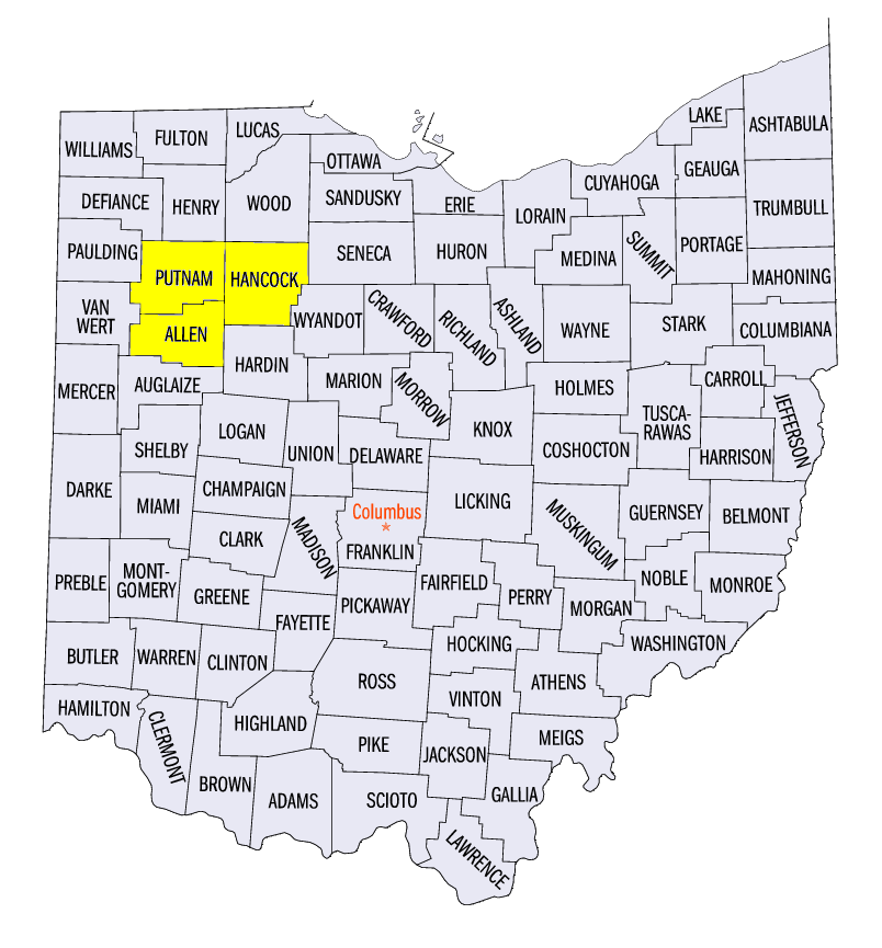
January 10 Strong Winds and Snowfall
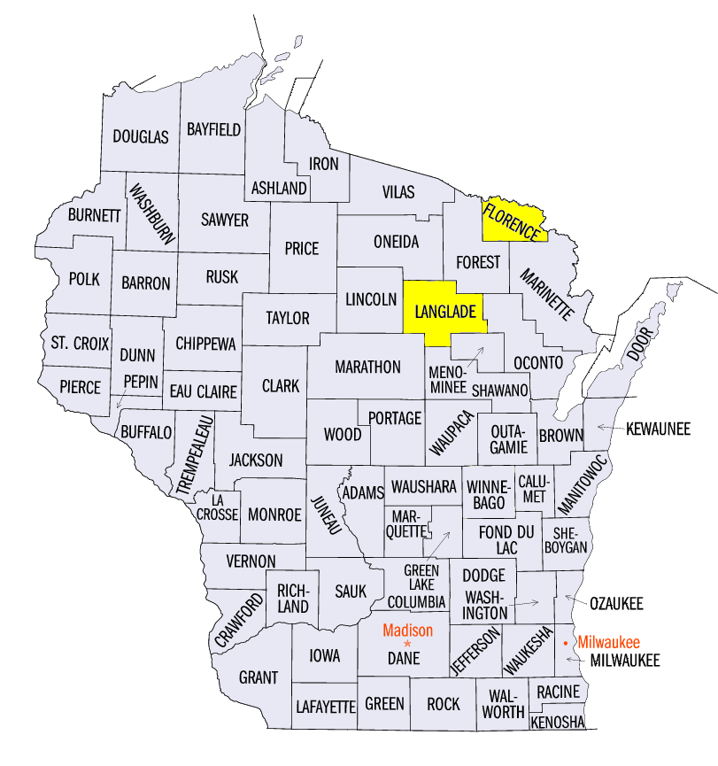
A winter storm on January 10 led to wind gusts of 50-65 mph across the Midwest. Many of these reports were found in southern Wisconsin, northern Illinois, Indiana, northern Ohio and northern Lower Michigan. Some of the strongest guests were in northeastern Ohio. A 70 mph gust was reported near Westminster, OH (Allen County), a 67 mph gust in Findlay, OH (Hancock County) and a 65 mph gust in Leipsic, OH (Putnam County). Dozens of 60 mph wind gusts were reported in northeastern Illinois and northern Indiana as well. Trees were downed from the strong gusts. The storm also produced heavy snowfall in Minnesota and northern Wisconsin. Totals of 4-6 inches were common, with higher amounts over 10 inches in Wisconsin
(Figure 9). Some of the heavier amounts included 11.5 inches in Florence, WI (Florence County) and 11.0 inches in Antigo, WI (Langlade County).
January 13-17 Ice Storm
A stationary boundary coupled with freezing surface temperatures helped lead to a widespread freezing rain event in the southern Midwest. Some of the worst conditions were in Missouri and southern Illinois, where a quarter- to half-an-inch of ice was common. Parts of southwest Missouri received up to three-quarters of an inch. Widespread damage to trees and powerlines were reported from the weight of the ice. An NFL playoff game in Kansas City was moved from early afternoon to the evening hours on January 15 for public safety and to clear ice from the stadium. Ice accumulation was common in Iowa, northern Illinois, southern Wisconsin and southeastern Minnesota on January 16-17 as the storm moved north. Accumulation of up to a quarter-inch was common in these areas. Schools were closed as a precaution due to slippery roads.
Drought Expands in Missouri
Drought area increased in Missouri in the January 10 U.S. Drought Monitor (Figure 10). Over 57 percent of the state was considered in drought, an increase of over 30 percent from one week earlier. A continued lack of precipitation was partly to blame from the increase in drought coverage. Outside of Missouri, abnormally dry and moderate drought areas in Iowa, Illinois and Indiana remained virtually unchanged. Nearly three million people were estimated to be living in drought areas in the Midwest.
-BJP-