November 15-21, 2018
Midwest Weekly Highlights - November 15-21, 2018
Widespread Cold
Temperatures remained well below normal across the entire Midwest during the week
(Figure 1). Most of Iowa, Illinois, Michigan and Minnesota were 8-12°F below normal, while Missouri, Indiana and Ohio were 4-8°F below normal. Both maximum (Figure 2) and minimum
(Figure 3) temperatures were very cold, and minimum temperatures averaged below freezing for most of the region (Figure 4). Several hundred daily low maximum and minimum temperature records were broken across the region from the cold
(Figure 5). Many of the low maximum records occurred in the Ohio River Valley, while the low minimum records were more common in the Upper Midwest. Wind chill temperatures were also quite cold, especially in Minnesota. Below-zero wind chill values were reported across the state on November 20, with single digits across most of the Upper Midwest (Figure 6).
Snowy, But Dry
Precipitation amounts across most of the Midwest were minimal during the period (Figure 7). Only areas in southeastern Ohio and eastern Kentucky had more than an inch of precipitation for the period. Portions of western Missouri, central Wisconsin and central Minnesota had less than a tenth of an inch of liquid equivalent precipitation. Most of Missouri, Illinois, Iowa, Wisconsin and Minnesota had less than half the normal amount (Figure 8).
Snowfall, however, was plentiful as temperatures were below freezing during most of the week
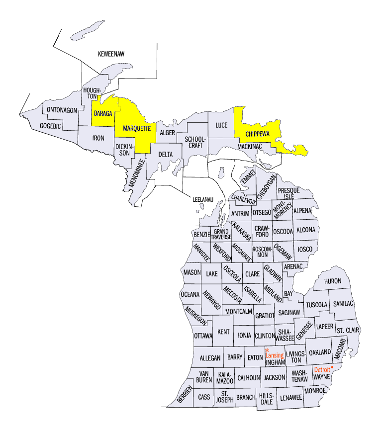
(Figure 9). More than three inches of snow fell in parts of Iowa, Minnesota, Illinois and Missouri, with some areas in Illinois and Missouri receiving heavier amounts. Lake-effect snow continued in the U.P. of Michigan, with totals of over a foot in some areas. Some of the heaviest totals for the week in the U.P. of Michigan included 18.5 inches in Marquette (Marquette County), 14.0 inches in Herman (Baraga County) and 12.3 inches in Paradise (Chippewa County). Across the region, more than 200 daily snowfall records were broken (Figure 10).
November 14-15 Winter Storm
An unusual winter storm for mid-November in the southern Midwest led to widespread impacts from Missouri through the Ohio River Valley. A strong upper-level low pressure system moved into the region late in the evening of November 14. Cold Canadian air kept both maximum (Figure 11) and minimum (Figure 12) temperatures near to below freezing through the morning of November 15, setting up a major snow and ice storm.
Snow Storm
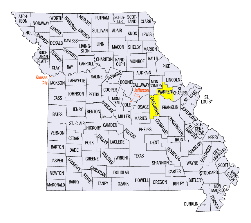
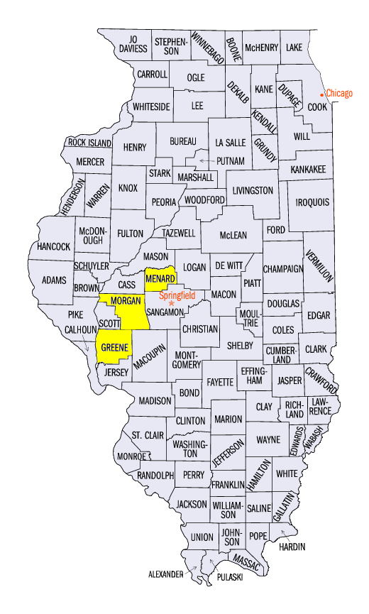
Heavy snow was observed in eastern Missouri through central and southern Illinois. Most of this snowfall fell through the morning of November 15 (Figure 13), with isolated amounts of up to an inch through the morning of November 16(Figure 14). Amounts of 4-6 inches were reported in east-central Missouri through west-central Illinois. Some of the heaviest amounts for the two-day period in Missouri included 8.1 inches in Rosebud (Gasconade County), 8.0 inches in Hermann (Gasconade County) and 7.5 inches near Warrenton (Warren County). In Illinois, amounts included 8.0 inches near White Hall (Greene County), 7.0 inches near Jacksonville (Morgan County), and 6.0 inches near Petersburg (Menard County). In these areas, a six-inch snowfall is a once a snow season event on average, with only a handful of events occurring in November.
Ice Storm
Further east, temperatures below freezing at the surface but above freezing in the lower atmosphere led to a widespread glaze of ice in Indiana, northern Kentucky and Ohio. Ice accumulations of 0.20 to 0.30 inches were common around tree branches and power lines. Many trees were felled from the extra weight of the ice, while hundreds of thousands of people were left without power.
-BJP-