September 17-23, 2018
Midwest Weekly Highlights - September 17-23, 2018
Summer Heat
While meteorological summer ended at the end of August, summer-like temperatures were widespread across the Midwest during the week
(Figure 1). Average temperatures in Missouri, Illinois, Indiana, Ohio and Kentucky were 6-9°F above normal. Minimum temperatures were a major contributor, as most of the Ohio River Valley was 9-12°F above normal (Figure 2). Maximum temperatures in the southern half of the region also routinely reached the upper 80s and 90s
(Figure 3). Some spots in Kentucky and Missouri reached the upper 90s on September 20 (Figure 4). More than 500 daily high maximum and minimum temperature records were broken across the region during the week
(Figure 5), with another 100 more from when the heat began during the previous period (Figure 6).
Heavy Rain in Iowa, Minnesota, Western Wisconsin
While drier conditions were prevalent across the Midwest, heavy rain sat over northern Iowa, southern Minnesota and western Wisconsin during the period
(Figure 7). Rainfall began in these areas through the morning of September 18 (Figure 8) and continued through September 19
(Figure 9). However, the heaviest rainfall occurred through the morning of September 20 (Figure 10). A wide area from northwestern Iowa through southwestern Wisconsin received more than three inches of rain. Precipitation continued to fall through the morning of September 21
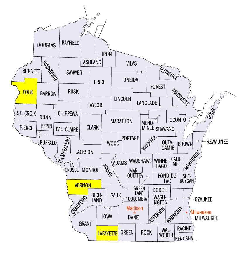
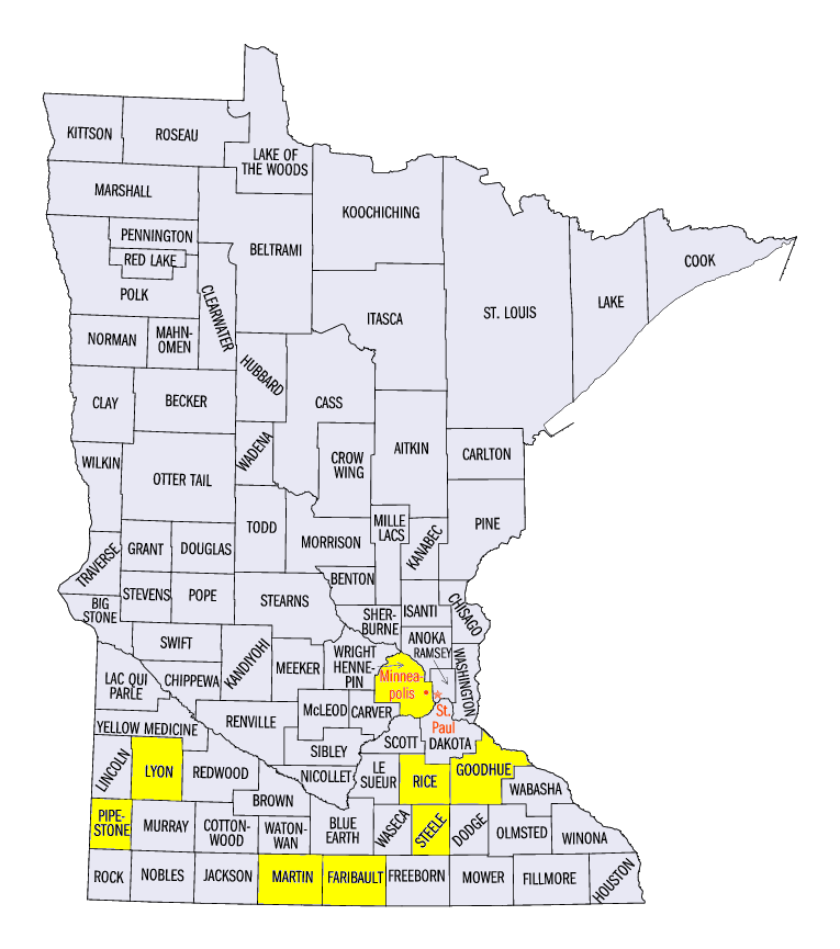
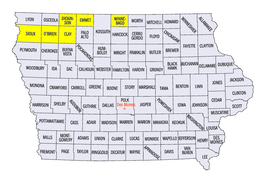
(Figure 11), with more than an inch in many areas. Totals for the week in Wisconsin included 5.14 inches in St. Croix Falls (Polk County) and 4.97 inches in Argyle (Lafayette County). Minnesota totals included 6.08 inches in Minneota (Lyon County), 5.86 inches in New Hope (Hennepin County) and 5.60 inches in Pipestone (Pipestone County). In Iowa, amounts were even higher, including 8.23 inches near Everly (Clay County), 8.02 inches near Forest City (Winnebago County) and 7.33 inches in Primghar (O’Brien County). More than 100 daily precipitation records were broken during the period (Figure 12).
Flooding in Iowa, Minnesota, Wisconsin
A vicious cycle of continued heavy rain led to more flooding in northern Iowa, southern Minnesota and southwestern Wisconsin (Figure 13). Very heavy rainfall on September 19 through the morning of September 20 brought many rivers to flood stage. The worst of the flooding occurred along the Big Sioux (Figure 14) and Little Sioux (Figure 13). Very heavy rainfall on September 19 through the morning of September 20 brought many rivers to flood stage. The worst of the flooding occurred along the Big Sioux (Figure 15) and Little Sioux rivers in northwestern Iowa, as well as the Cedar River (Figure 16) in eastern Iowa. Major Flooding was reported at many gauges along these rivers. A train derailed near Alton, IA (Sioux County) while crossing a bridge. No injuries were reported while no hazardous material spilled into the river.
In southwestern Wisconsin, soaked soils due to flooding in previous weeks led to mudslides along the bluffs of the Driftless Area as more rain fell. From August 15 through September 23, three separate stations in Vernon County, WI, Hillsboro, Ontario and Westby, have received more than 22 inches of rain. The normal annual precipitation total for Westby is 33.97 inches.
Strong Winds and Tornadoes
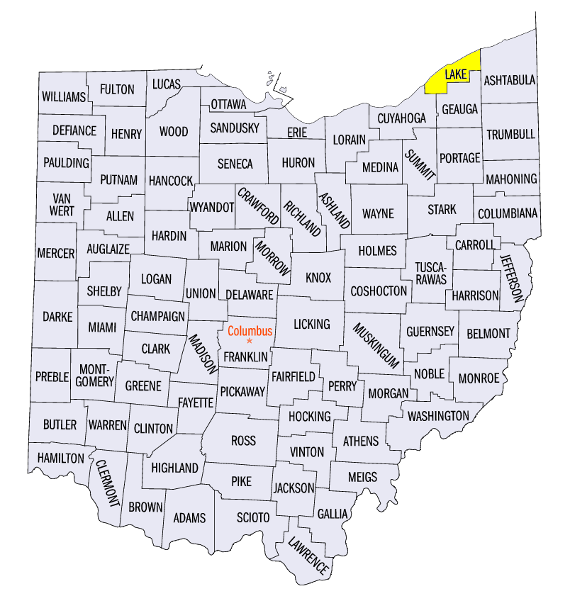
Flooding rain in Iowa and Minnesota was accompanied by strong winds and tornadoes during the week (Figure 17). Most of these severe reports occurred on September 20 (Figure 18). Several tornadoes were reported in southern Minnesota, including a preliminarily rated EF-2 storm near Morristown (Rice County). As the storm moved east, the Faribault Airport (Faribault County) was directly hit by the tornado. Winds were estimated to be 110 mph. Other EF-1 one tornadoes were reported near Granada (Martin County) and Medford (Steele and Goodhue counties). An EF-1 tornado was also reported near Superior, IA (Dickinson County). Strong thunderstorm winds of 55-65 mph were also reported. A wind gust of 75 mph was also reported near Gruver, IA (Emmet County) at the Estherville Municipal Airport. As the system moved east, strong winds were reported in eastern Ohio on September 21. Trees and power lines were felled by the storms, and a weak tornado was also reported in Willoughby, OH (Lake County) near Lake Erie.
-BJP-