September 1-9, 2018
Midwest Weekly Highlights - September 1-9, 2018
Warm Nights
Well above-normal minimum temperatures led to above normal average temperatures across the Midwest
(Figure 1). Minimum temperatures in Illinois, Indiana, Ohio and Kentucky were 7-9°F above normal for the period, while Wisconsin, Missouri, Iowa and Michigan were 3-6°F above normal (Figure 2). Maximum temperatures were much cooler
(Figure 3), especially across the western half of the region, where increased clouds and heavy rain kept daytime temperatures lower. Average temperatures were near to slightly above normal in Minnesota, Iowa, Wisconsin and the U.P. of Michigan as a result.
Extreme Precipitation
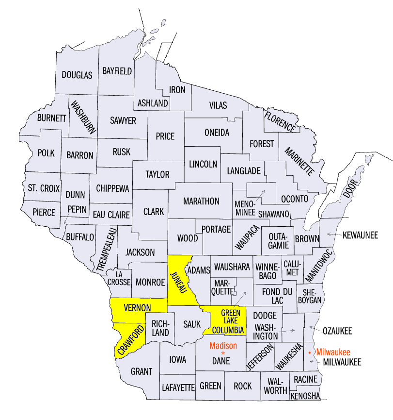
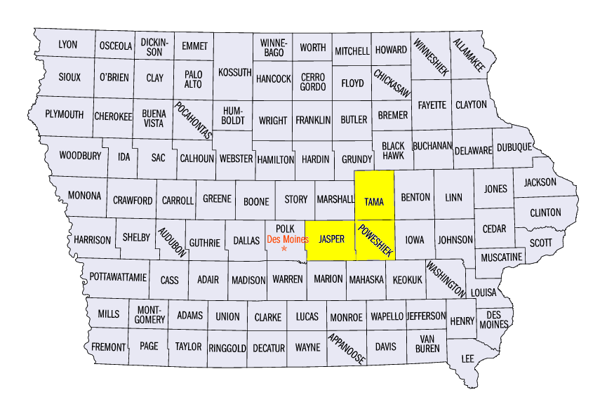
A strong frontal boundary collided with the remnants of Tropical Storm Gordon and dumped heavy rain across the Midwest (Figure 4). More than three inches of rain fell in many areas along the Ohio Valley and the Upper Midwest, with some areas receiving more than six inches. Amounts were two to five times the normal amount in many cases (Figure 5). Some of the wettest areas exacerbated flooding that began the final week of August in southern Wisconsin. Some of the wettest areas in Wisconsin included 8.76 inches near Mauston (Juneau County), 8.61 inches at the Lynxville Dam (Crawford County) and 8.55 inches in Readstown (Vernon County). In Iowa, 10.94 inches fell in Newton (Jasper County), 10.57 inches near Montezuma (Poweshiek County) and 10.35 inches Clutier (Tama County).
While heavy rain was persistent throughout the week, several days were much wetter. Very heavy rainfall was observed in Iowa, Wisconsin and Minnesota through the mornings of September 4 (Figure 6), September 5
(Figure 7) and September 6 (Figure 8). As the boundary slowly moved east, the remnants of Tropical Storm Gordon moved into the southern Midwest and dumped inches of rainfall through the mornings of September 8
(Figure 9) and September 9 (Figure 10). Eastern Kentucky and Ohio continued to receive 1-3 inches of rain during the day on September 9
(Figure 11) as the storm finally moved out of the Midwest. More than 450 daily precipitation records were broken during the period (Figure 12).
Wisconsin and Iowa Flooding
Flooding continued to be a major issue in southwestern Wisconsin into the first week of September
(Figure 13). Major Flooding surged back on the Kickapoo and Baraboo rivers after heavy rain on September 4-6. Schools were canceled for the first week of September in flood-affected areas. Crop damage was reported along with blue-green algae blooms from runoff in the water. The Wisconsin National Guard was tasked with sandbagging around Portage (Columbia County) to keep Interstate 90/94 open as waters rose. Meanwhile, amounts of over 6 inches in eastern Iowa also led to Moderate and Major Flooding on the Wapsipinicon River (Figure 14), Iowa River
(Figure 15) and Mississippi River (Figure 16). Minor and moderate flooding was forecast to continue into the following week along the Mississippi River.
Scattered Severe Weather
Reports of large hail, strong thunderstorm winds or tornadoes were reported on seven of the nine days in the period
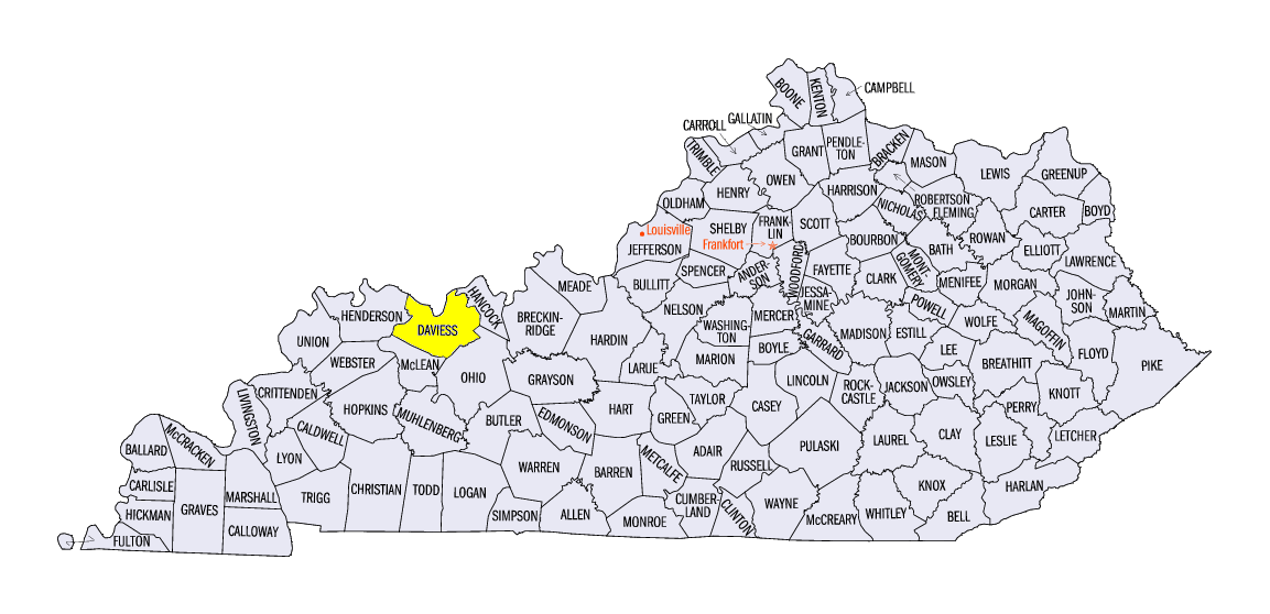
(Figure 17). Several reports of two-inch hail were reported in Polk County, IA on September 1. Several tornadoes were confirmed in Benton and Linn counties in Iowa on September 3. The strongest of these was an EF1 tornado near Cedar Rapids during the nighttime hours. An EF-0 tornado was also observed on the west side of Chicago, IL, with damage to trees. An isolated storm tracked along the Ohio River on September 8, which produced an EF-1 tornado near Stanley, KY (Daviess County). Several other EF-0 tornadoes spawned along the storm’s path.
Heavy Rain Aids in Drought Relief
Missouri received much-needed rainfall during the first week of September. The result was a significant improvement of drought conditions according to the September 4 U.S. Drought Monitor (Figure 18). Extreme Drought coverage was halved in Missouri, while Exceptional Drought was virtually eliminated
(Figure 19). A significant decrease in Severe Drought was also observed, along with a slight decrease in moderate drought. More than half of Missouri remained in drought, however. Meanwhile, rain Lower Michigan led to the elimination of Severe Drought in the state (Figure 20). Moderate drought remained in northern and southeastern Lower Michigan.
-BJP-