August 22-31, 2018
Midwest Weekly Highlights - August 22-31, 2018
A Few Hot Days
Temperatures started and ended cooler with a blast of summer heat in the middle of the period
(Figure 1). Average temperatures were largely within a few degrees of normal, with parts of western Iowa and Minnesota 2-3°F below normal, while Lower Michigan and Ohio were 2-4°F above normal. Temperatures began to heat up on August 25, where temperatures in the upper 80s and 90s moved into Missouri, Iowa and Illinois. Heat Index values over 100°F were observed in central Illinois and Missouri on August 26-28. Some stations reported values over 105°F on August 26 (Figure 2). Maximum temperatures in the 80s and 90s were widespread on August 27 (Figure 3). A cold front moved through the region during the remainder of the period and led to cooler temperatures from August 28-31.
Heavy Rain
Very heavy rain fell on areas of Wisconsin, eastern Minnesota, eastern Iowa, Missouri and western Illinois during the week as a system stalled over the Upper Midwest (Figure 4). Many of these areas received more than three inches of rain, with some areas in central Wisconsin receiving more than eight inches. In most cases, this was more than twice the normal amount
(Figure 5). The heaviest rain fell through the mornings of August 27 (Figure 6), August 28
(Figure 7) and August 29 (Figure 8), with totals of more than a foot of rain at multiple stations in central Wisconsin. Meanwhile, areas in the Ohio River Valley were much drier, receiving less than an inch for the week. Western Kentucky had less than half the normal amount.
Record Flooding in Southern Wisconsin
Historic and record flooding devastated parts of southern Wisconsin on August 27-29 (Figure 9). Rainfall amounts of more than 8 inches were observed from the Iowa and Minnesota border through Lake Michigan. The situation was particularly dire in west-central Wisconsin, where the topography of the Driftless Area caused flood waters to rise quickly. Evacuations were ordered in Coon Valley (Vernon County) as waters quickly rose. Mudslides were also reported as water loosened soils on the bluffs. The Kickapoo River quickly reached major flood stage after rising more than 13 feet at LaFarge (Vernon County) in 12 hours before the gauge went offline (Figure 10). The Baraboo River also rose more than 12 feet in 24 hours at La Valle (Figure 11, Sauk County). Official rainfall amounts for the August 27-29 period included 12.86 inches near Cashton (Monroe County), 12.03 inches near Westby (Vernon County), 11.40 inches near Mauston (Juneau County) and 11.16 inches near Hillsboro (Vernon County). Many other unofficial reports of more than 8 inches were reported. This amount of rainfall was similar to the normal amount of rainfall for the months of July and August combined (Figure 12).
Impacts were felt across southern Wisconsin. Six counties were initially declared into a state of emergency before a statewide state of emergency was declared on August 29. Amtrak service was stopped temporarily due to the flooding in central Wisconsin. Schools in flood-affected areas were preemptively canceled for the start of September. Many roads were closed and remained impassible for days. Areas that dealt with flash flooding on August 20-21 in Dane County continued to have issues as more rain exhaserbated high water levels on Madison area lakes. A record high level was reported on Lake Monona
(Figure 13) while the Tenny Locks between Lake Mendota and Monona were forced to increase flow to decrease flooding in Madison. At least $44 million of public infrastructure was damaged according to Wisconsin Emergency Management.
Severe Weather August 26-28
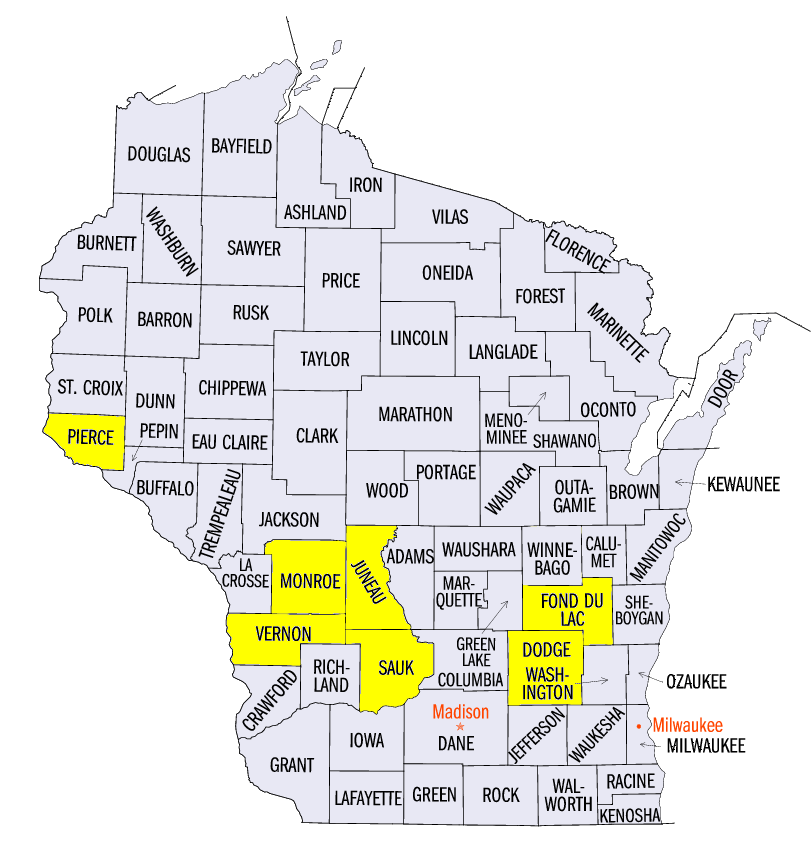
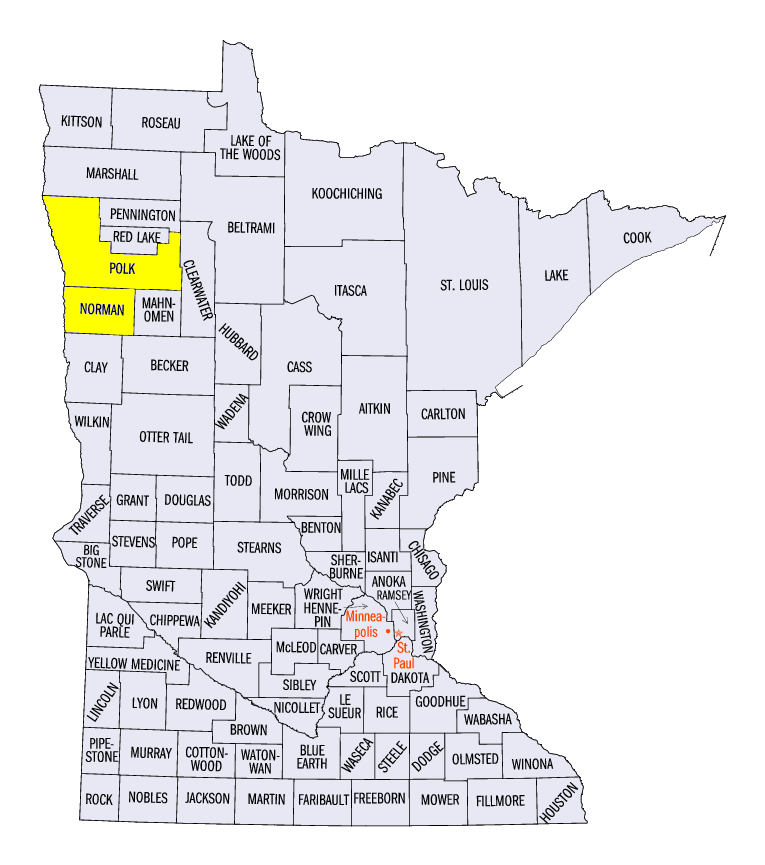
The slow-moving system that led to Major Flooding in Wisconsin also brought severe weather to the Upper Midwest. On August 26, strong winds were reported in northwestern Minnesota, southern Wisconsin and western Lower Michigan (Figure 14). Two EF-1 tornadoes were reported in Minnesota near Winger (Norman County) and near Fosston (Polk County).
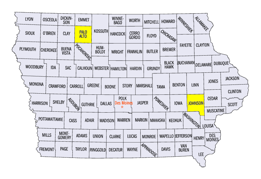
On August 27, strong winds stretched from eastern Minnesota through Lower Michigan (Figure 15). Several small tornadoes were reported in southeastern Minnesota, along with an 82 mph wind gust at the Red Wing Airport (Pierce County, WI). Large hail was also reported in northwestern Minnesota, including a 3-inch hailstone near Ayrshire, IA (Palo Alto County).
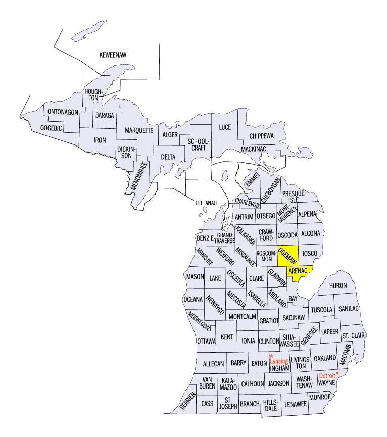
On August 28, many reports of intense winds, large hail and tornadoes were reported from Iowa and Missouri through Wisconsin and Lower Michigan (Figure 16). Two- to three-inch hail was reported from a long track storm across northern Iowa, while wind reports of 60-80 mph were reported in northern Missouri and southeastern Iowa. An 83 mph wind gust was reported at the Iowa City Airport (Johnson County). In Michigan, 75-85 mph winds were reported in west-central Lower Michigan. Several tornadoes were reported in northeastern Lower Michigan as well, including an EF-1 tornado near Branch (Ogemaw County) and near Au Gres (Arenac County). More than a dozen tornadoes were also reported in Wisconsin.
Wisconsin Tornadoes August 28
On August 28, 17 tornadoes were reported in southeastern Wisconsin. Only one of these tornadoes was rated EF-2, while the rest were rated either EF-1 or EF-0. The EF-2 tornado tracked through northern Brownsville (Dodge County) with estimated peak winds of 125 mph. Several other EF-0 and EF-1 tornadoes spawned around that tornado in Dodge and Fond Du Lac counties. All 17 tornadoes reported were on the ground for less than five miles. No injuries or fatalities were reported.
Drought Slightly Improves
Moderate amounts of rainfall fell in Missouri, which led to slight improvements in drought coverage in the August 28 U.S. Drought Monitor
(Figure 17). Most of this improvement came in northeastern Missouri, where more than three inches of rain fell (Figure 18). Slight improvements were also made in southwestern Missouri
(Figure 19). Meanwhile, Lower Michigan also saw slight improvement from heavy rain (Figure 20). However, areas in severe drought remained the same. Overall, more than six million people were estimated to be living in drought areas in the Midwest, with more than five million located in Missouri and Michigan.
-BJP-