July 1-10, 2018
Midwest Weekly Highlights - July 1-10, 2018
More Heat
Temperatures were above normal across the Midwest during the first ten days of July
(Figure 1). Only a few areas in Iowa were near normal. Michigan was the most above normal, with areas in the eastern Upper Peninsula more than 7°F above normal. Most of Kentucky, Ohio, southern Indiana and southern Missouri were 3-5°F above normal. More than 190 daily high minimum temperature records were tied or broken across the region (Figure 2). Many of these records occurred during the first five days of the period. Some areas in Illinois and Missouri had minimum temperatures in the upper 70s on the morning of July 1
(Figure 3).
Dry for Many
Lower amounts of precipitation fell across most of the Midwest during the period (Figure 4). Large areas of the Midwest were drier than normal, including less than a quarter of the normal amount in Missouri, southern Lower Michigan, and central Wisconsin
(Figure 5). Most of the Ohio River Valley also received less than half the normal amount. Much wetter conditions were observed in southwestern and northeastern Minnesota however. Amounts over three inches were reported with locally heavier amounts. Some of the heaviest amounts included 9.32 inches in Redwood Falls (Redwood County), 5.16 inches in Marshall (Lyon County) and 4.54 inches in Two Harbors (Lake County). A large amount of the precipitation in southwestern Minnesota fell through the mornings of July 3 (Figure 6) and July 4
(Figure 7) and through the morning of July 9 (Figure 8) in northeastern Minnesota. Iowa also endured a wet day through the morning of July 1
(Figure 9). More than 70 daily precipitation records were broken during the period (Figure 10), with more than half of these coming from Iowa and Minnesota.
Extreme Drought Added in Northern Missouri
The continuation of a dry summer across northern Missouri contributed to further degradation of conditions in the July 10 U.S. Drought Monitor
(Figure 11). Parts of seventeen counties in northern Missouri were classified as in Extreme Drought (Figure 12). Nearly a quarter of the state was classified in either Severe or Extreme Drought. A large portion of northern and southwestern Missouri received less than half the normal amount of precipitation since June 1
(Figure 13). In addition, the entire state has been subject to hotter than normal temperatures (Figure 14). Calculated water balance from a CoCoRaHS observer in northwestern Missouri showed a deficit of more than four inches between precipitation and evapotranspiration in the 30 day period ending July 11
(Figure 15). Flash drought has also become a concern in northeastern Lower Michigan. Abnormally dry conditions expanded across northern Lower Michigan, while moderate drought was introduced in several counties bordering Lake Huron. Region-wide, drought covers nearly eight percent of the Midwest.
Severe Thunderstorms
Severe thunderstorms caused wind damage on and hail on several days during the period (Figure 16). Storms on July 1 caused wind damage in eastern Wisconsin and western Lower Michigan
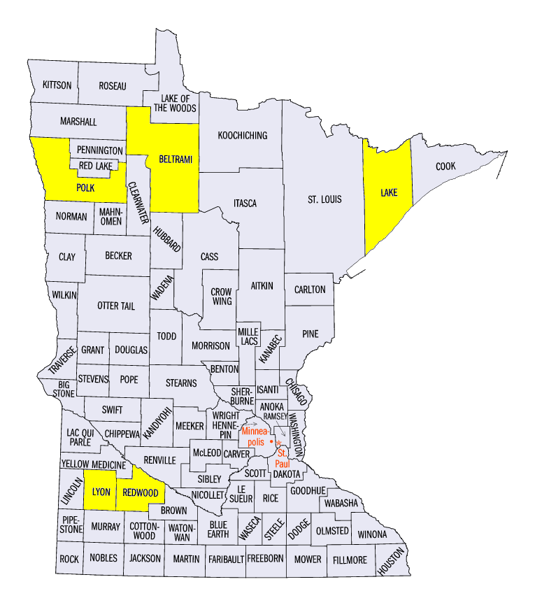
(Figure 17), with winds up to 65 mph. On July 3, strong winds were reported in northwestern Minnesota from a front in the High Plains (Figure 18), as well as an EF-1 tornado near Bemidji, MN (Beltrami County). Scattered wind reports were reported as this front moved eastward on July 4
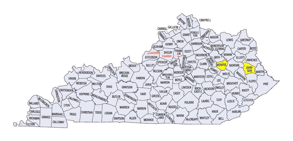
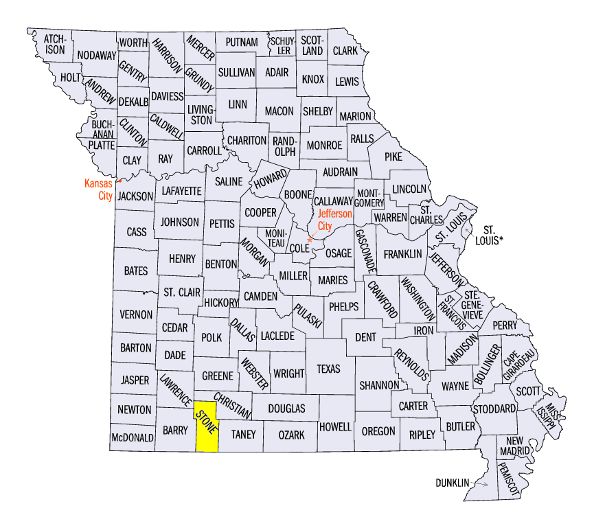
(Figure 19) and July 5 (Figure 20). On July 4, an 85 mph wind gust was reported near Paintsville, KY (Johnson County), downing several trees and blowing off a church steeple. On July 5, a wind report of 110 mph uprooted several hardwood trees and peeled back metal roofing near Frenchburg, KY (Menifee County), while a microburst with 75 mph winds near Kimberling City, MO (Stone County) blew over several buildings. Isolated reports occurred during the remainder of the period. A 90 mph wind gust was reported near East Grand Forks, MN (Polk County) on July 7, as roof panels were peeled from a shed and large tree branches were broken. In total, more than 315 severe reports occurred during the period, with more than 290 of them from strong winds.
-BJP-