July 2018
Monthly Overview - July 2018
Dry for Most
Precipitation was below normal in July across most of the Midwest
(Figure 1). Region-wide 3.24 inches of rain fell, which ranked 36th driest on record (1895-2018). This was about 80 percent the normal amount (Figure 2). Minnesota was the only state in the region with above normal precipitation. Six other states had between 70 and 80 percent the normal amount, with Missouri was much drier and Kentucky was closer to normal. Missouri’s 2.42 inches in July ranked as the 23rd driest on record. The Chicago-O’Hare Airport had its driest July in its 60-year period of record with only 1.14 inches of rain.
Hot and Cool
A hot first half of July and a cooler second half led to slightly warmer than normal temperatures across the region
(Figure 3). Average temperatures for July were 73.4°F which was 0.8°F above normal. Areas near the Great Lakes and southern Missouri were the only significant areas with above-normal temperatures. During the warm first half of the month, very warm overnight minimum temperatures played a large role (Figure 4), while very cool maximum temperatures played a similar role during the cool second half
(Figure 5). More than 250 daily high minimum (Figure 6) and 150 daily low maximum records
(Figure 7) were either broken or tied during the month as a result.
Severe Weather
July was an active month of severe weather in the Midwest, with more than 950 reports of tornadoes, strong thunderstorm winds and large hail (Figure 8). Nearly 400 of these reports occurred on July 19
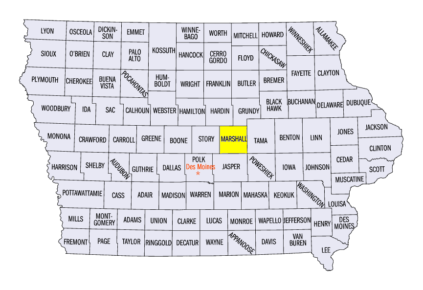
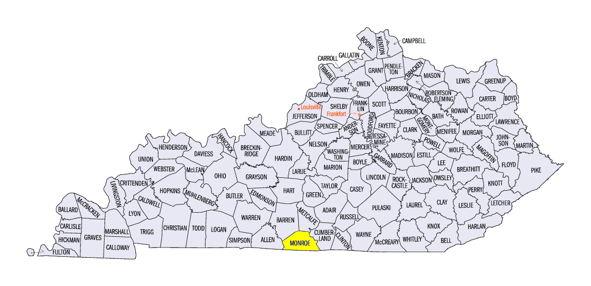
(Figure 9) through July 20 (Figure 10). Thirteen tornadoes impacted Iowa on July 19, with two of them rated EF-3. Extensive damage was reported in Marshalltown, IA (Marshall County) from one of these EF-3 tornadoes, as it tracked directly through the town. Zero fatalities and only six injuries were reported from the 13 confirmed tornadoes. In Missouri, strong winds on July 19 caused a duck boat to capsize near Branson, killing 17 people. Strong winds and hail impacted central Kentucky on July 20. A four-inch diameter hailstone was reported near Tompkinsville, KY (Monroe County), one of the largest ever recorded in Kentucky.
Missouri and Michigan Drought
Region-wide, abnormally dry conditions and drought more than doubled in July
(Figure 11). Drought significantly worsened in Missouri during the month. In the July 3 U.S. Drought Monitor, 17 percent of Missouri was in Severe Drought (Figure 12). By the July 31 U.S. Drought Monitor, more than 32 percent of the state was in Severe Drought, with more than 17 percent in Extreme Drought
(Figure 13). Agriculture was severely impacted, as cattle were being sold due to lack of feed, while crops were being abandoned. Meanwhile, flash drought rapidly developed in Michigan. Less than ten percent of the state was considered abnormally dry at the beginning of the month (Figure 14). By the end of the month, more than a quarter of the state in moderate drought with nearly 70 percent of the state abnormally dry
(Figure 15).
-BJP-