June 17-23, 2018
Midwest Weekly Highlights - June 17-23, 2018
Flooding Rain
A cut-off low pressure system stalled over the High Plains throughout the week, dumping inches of rain to the east over the Midwest
(Figure 1). This heavy precipitation event began on June 16 (Figure 2) in northern Minnesota, northern Wisconsin, and the U.P. of Michigan before slowly moving south. Two inches of precipitation was reported in at least one location each day during the period. Three or more inches were reported on multiple days as well, including June 17
(Figure 3), June 18 (Figure 4), June 19
(Figure 5) and June 21 (Figure 6). Many of these areas received two to four times the normal amount of precipitation
(Figure 7), and flash flooding and river flooding were reported in many of these areas. Meanwhile, Lower Michigan, southern Kentucky and most of Missouri were drier than normal.
Northern Wisconsin, U.P. of Michigan Flooding June 16-19
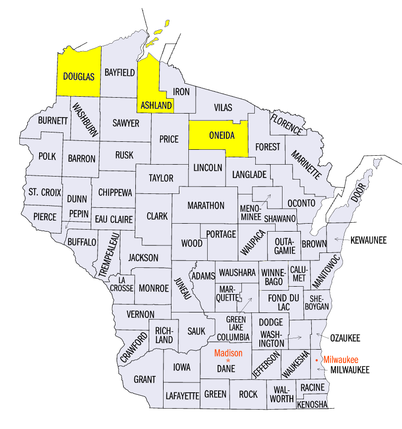
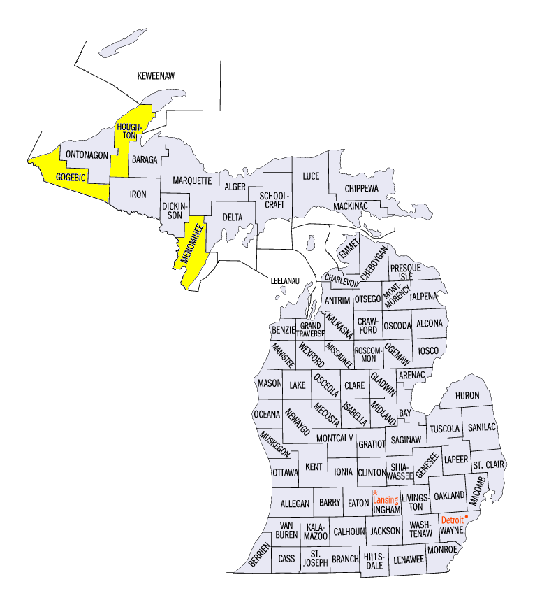
A dire river and flash flooding event unfolded from June 16 through June 19 in northeastern Wisconsin and the western U.P. of Michigan. Amounts of 6-8 inches were reported with locally heavy amounts up to 12 inches (Figure 8). Some of the four-day totals from National Weather Service Coop observers in Wisconsin included 7.81 inches near Ashland (Ashland County), 7.13 inches in Gordon (Douglas County) and 6.66 inches in Minocqua (Oneida County). In the U.P. of Michigan, amounts included 7.77 inches in Quincy Hill (Houghton County), 6.26 inches at the Hancock Houghton County Airport (Houghton County) and 6.25 inches in Ironwood (Gogebic County). Many roads were washed out or damaged due to flooding. A state of emergency was issues for five Wisconsin counties and while Houghton and Menominee counties in Michigan were declared a State of Disaster. One person was killed in Wisconsin after he was found in a flooded ditch next to a pickup truck. Aerial footage of the damage showed bridges and roads washed away along with flooded homes and farms. Many of the same areas were affected by a similar event in July 2016.
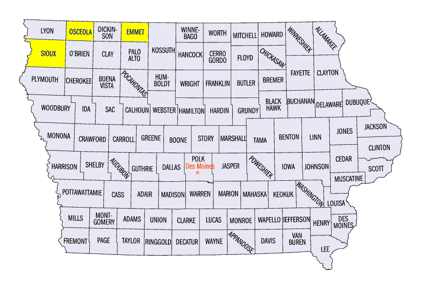
Northwestern Iowa Flooding June 20-21
A widespread area of more than 3 inches of rainfall across southwestern Minnesota and northwestern Iowa led to moderate and major flooding on multiple rivers
(Figure 9). Most of this rain fell through the morning of June 21 (Figure 10). Some of the heaviest two-day amounts included 4.92 inches in Sibley (Osceola County), 4.76 inches in Ringsted (Emmet County) and 4.69 inches in Rock Valley (Sioux County). The Big Sioux
(Figure 11), Little Sioux (Figure 12) and Ocheyedan
(Figure 13) rivers all reached major flood stage during the period, with several gauges rising from no flooding to major flood stage very quickly. A train carrying oil derailed near Rock Valley, IA (Sioux County), where flooding may have contributed to the derailment. Spilled oil into flood waters led to a shut off of the town’s water, along with a mandatory evacuation of some residents and a travel ban for others due to rising water. Four Iowa counties were named in a disaster proclamation from the flooding.
)
More Summer Heat
Temperatures were above normal for most of the Midwest (Figure 14). Increased cloud cover and precipitation in southwestern Minnesota and western Iowa kept temperatures near normal, however, while the Great Lakes also moderated temperatures. Ohio and northern Minnesota were 3-5°F above normal, while most if Indiana, Illinois, Kentucky and Missouri were 2-4°F above normal.
Strong Winds and Tornadoes
Severe weather was observed on each day during the week, with scattered strong winds and isolated weak tornadoes
(Figure 15). At least one tornado touched down in five different Midwest states. Many of these tornado reports came on June 20 in Iowa. Wind reports were also common in Illinois on June 19 (Figure 16), as large tree branches were broken.
Severe Drought Expands
Northern Missouri and southeastern Iowa saw further degradation of drought, as areas in severe drought more than doubled in the June 19 U.S. Drought Monitor (Figure 17). Most of this severe drought is in northern Missouri, which covers more than 14 percent of the state
(Figure 18). Meanwhile, heavy rain in northern Minnesota and Wisconsin significantly reduced abnormally dry conditions. This led to a nine percent drop region-wide of abnormally dry and drought conditions compared to June 12 (Figure 19).
-BJP-