May 15-21, 2018
Midwest Weekly Highlights - May 15-21, 2018
Widespread Warmth
Temperatures were above normal across most of the Midwest for the week
(Figure 1). Only a few areas around the Great Lakes were near normal. The Ohio River Valley was the warmest, with temperatures 7-10°F above normal. Most of Iowa, Wisconsin and Minnesota were 3-6°F above normal. Minimum temperatures were a large contributor in the Ohio Valley, as some areas were 12-15°F above normal (Figure 2). More than 100 daily high maximum and minimum temperatures were broken during the period
(Figure 3). Many of these were reported on the mornings of May 15 (Figure 4) and May 16
(Figure 5), where maximum temperatures in the southern third of the region were in the upper-80s to low 90s.
Dry for Many, Wet in Missouri
Little precipitation fell across the Upper Midwest during the period (Figure 6). Most of Minnesota and northern Wisconsin had less than a quarter inch, while Iowa, central Illinois, Indiana and northern Michigan had less than half an inch. In Minnesota, Wisconsin and the U.P. of Michigan, rainfall was less than half the normal amount
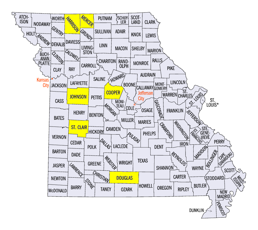
(Figure 7). However, southern Missouri received more than two inches of rain during the period. Some of these areas received more than three inches. Locally heavier amounts of 4-5 inches were reported. Some of the heaviest totals for the week in Missouri included 5.85 inches near Warrensburg (Johnson County) 5.59 inches near Appleton City (Saint Clair County) and 5.21 inches near Otterville (Cooper County). Most of this precipitaiton fell through the mornings of May 20 (Figure 8) and May 21
(Figure 9).
Severe Weather
Strong thunderstorms were limited to the southern Midwest during the week (Figure 10). More than 150 reports of strong winds and hail occurred in Missouri, Illinois, Kentucky, Indiana and Ohio. Many of these were on May 19 in Missouri. Hail of two or more inches in diameter was reported in multiple areas. A 2.75 inch hail stone was reported near Mount Moriah, MO (Harrison County) and near Modena (Mercer County). A 2.5 inch hail report also occurred near Squires, MO (Douglas County). A brief tornado also touched down near Pleasant Hope, MO. Isolated severe reports occurred throughout the remainder of the week. Several weak tornadoes and land spouts were reported as well, with no significant damage.
Drought Remains Isolated
As of the May 15 U.S. Drought Monitor, only two areas of the Midwest in northern Missouri/southern Iowa and northern Minnesota are in moderate drought
(Figure 11). These areas represent less than five percent of the region. Abnormally dry conditions were expanding across northern Minnesota, Wisconsin and the U.P. of Michigan, however. About one quarter of the region was considered abnormally dry.
-BJP-