May 1-7, 2018
Midwest Weekly Highlights - May 1-7, 2018
Finally Warmer
After one of the coldest Aprils on record, the Midwest was significantly warmer during the first week of May
(Figure 1). Temperatures were above normal across the entire Midwest. Many in the central Midwest, Wisconsin and southeastern Minnesota were 7-10°F above normal. Maximum temperatures were a major factor, as most of the region averaged 70°F and above (Figure 2). However, many of the more than 200 daily records were high minimum temperature records
(Figure 3).
Wet for Iowa, Wisconsin and Michigan
Several days of wet weather across Iowa, Wisconsin and parts of Michigan led to more than two inches of rainfall during the period (Figure 4). In many cases, this was two to five times the normal amount
(Figure 5). Most of this precipitation fell through the mornings of May 2 (Figure 6), May 3
(Figure 7) and May 4 (Figure 8). More than 150 daily precipitation records were recorded during the period
(Figure 9). Meanwhile, most of Minnesota, Illinois, Indiana, Ohio and western Missouri were much drier. Parts of Minnesota, northern Wisconsin and the western U.P. of Michigan had less than a quarter of the normal amount, while central Indiana and west central Ohio had less than half.
Severe Weather
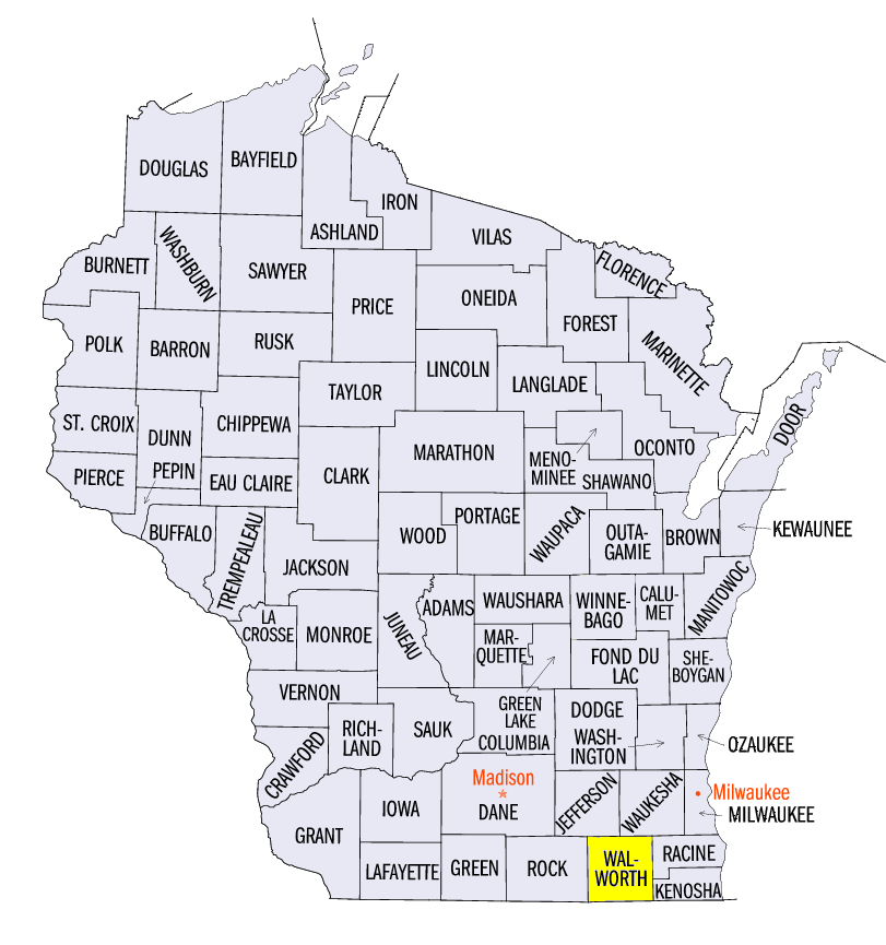
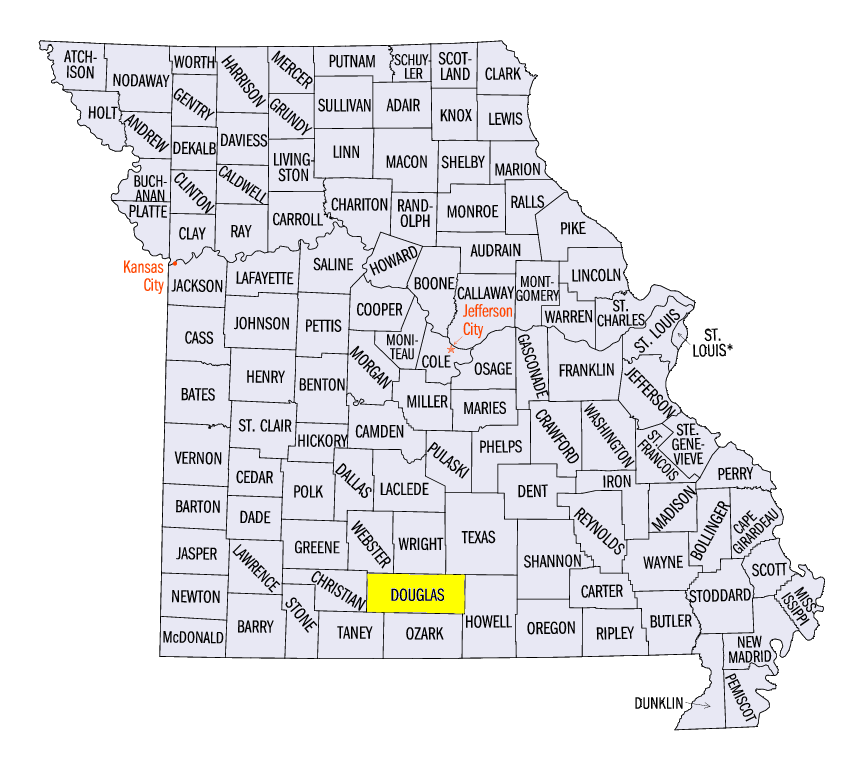
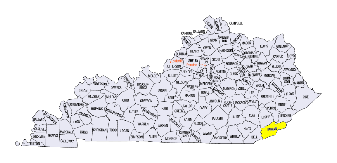
At least one report of severe weather occurred on each day of the period (Figure 10). Hail reports were common in western Iowa from several long-track storms on May 1. Strong winds and large hail pummeled northern Illinois, southern Wisconsin, southern Lower Michigan and western Missouri on May 2. Two-inch and larger hail was reported, including a 2.50-inch report near Rockford, IL and near Williams Bay, WI (Walworth County). Several tornadoes were also reported in Missouri, including an EF-1 tornado near Squires (Douglas County). Several weak tornadoes were reported in central Iowa on May 3. Strong winds were reported along Lake Erie on May 4 on the western edge of severe storms in the northeast. Several isolated reports occurred along the Ohio River Valley on May 5-7, including a 2.50-inch hail stone near Harlan, KY (Harlan County) on May 5.
Mississippi River Flooding
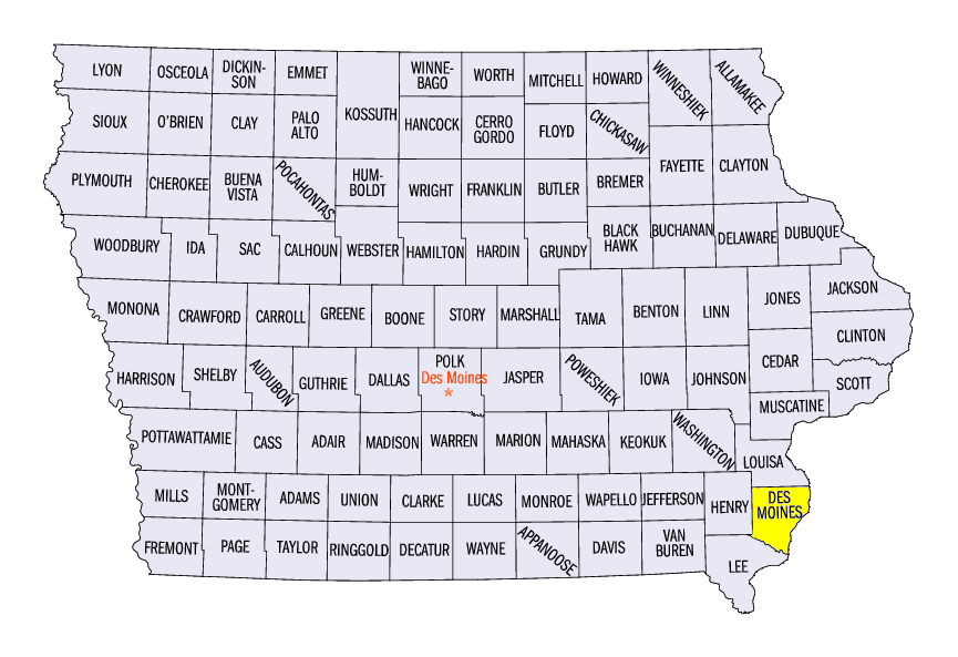
Rapid snowmelt in the Upper Mississippi River Valley led to minor and moderate flooding along the Mississippi River from southeastern Minnesota through northeastern Missouri. Moderate flooding occurred from Dubuque, IA
(Figure 11) through the Quad Cities (Figure 12) and as far south as Burlington, IA (Figure 13, Des Moines County). An accident near Dubuque, IA led to multiple barges becoming loose against Lock and Dam 11 on the river. Flooding and stronger than normal flow made retrieving these barges difficult. No damage was reported to the dam.
-BJP-