April 17-23, 2018
Midwest Weekly Highlights - April 17-23, 2018
Continued Cold
Temperatures remained well below normal across the Midwest (Figure 1). The coldest areas were in southern Minnesota, northern Iowa and southern Wisconsin, where temperatures were 8-12°F below normal. Most of Illinois, Indiana and Ohio were also 6-8°F below normal. Northwestern Minnesota was the only part of the region that was near normal. Temperatures have been below normal across a majority of the region since the first week of March. Since March 8, the entire Midwest has been 2°F or more below normal, with southern Minnesota and northern Iowa 6-9°F below normal (Figure 2).
Nearly 800 daily low maximum and minimum temperature records were broken across the region this week
(Figure 3). Many of these records occurred due to very cool maximum temperatures on April 16 through the morning of April 17 (Figure 4), and April 18 through the morning of April 19
(Figure 5). Maximum temperatures through the morning of April 17 struggled to reach freezing across Wisconsin, southern and eastern Minnesota, northern Iowa, northern Illinois, and the U.P. of Michigan.
Dry, But Snowy
Drier weather was common in the region during the week (Figure 6). Most of Minnesota, northern Wisconsin and northern Missouri had little to no precipitation for the period. Only areas in southern Missouri, extreme southern Illinois and western Kentucky had more than an inch of precipitation. These were the only areas that above-normal precipitation
(Figure 7). However, cold temperatures across the region led to heavy snowfall in southern Minnesota, northern Iowa, southern Wisconsin and northern Michigan (Figure 8). Most of this snowfall occurred during a strong winter storm on April 18-19
(Figure 9). A streak of measurable snowfall in at least one location in the Midwest this April ended on April 20 after 19 consecutive days to begin the month.
April 18-19 Winter Storm
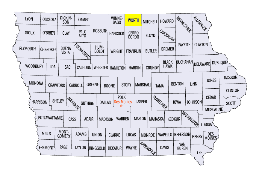
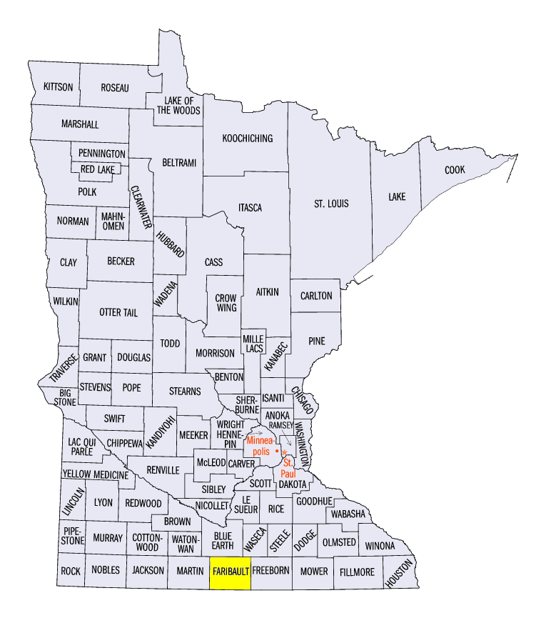
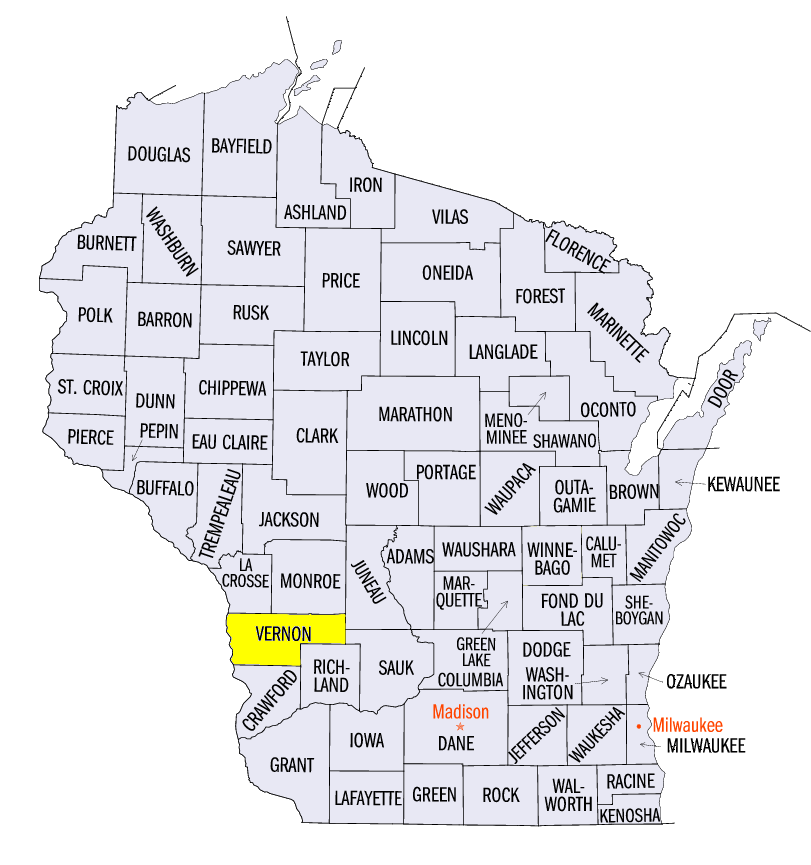
Yet another major winter storm impacted Iowa, Minnesota and Wisconsin on April 18 through the morning of April 19 (Figure 10). Areas in northern Iowa, southern Minnesota and southern Wisconsin received 4-8 inches of snowfall, with isolated amounts up to 10 inches. Some of the heaviest amounts included 11.2 inches in Northwood, IA (Worth County), 9.8 in Bricelyn, MN (Faribault County) and 9.5 inches in La Farge, WI (Vernon County). This was the twelfth day in April 2018 where at least four inches of snowfall was reported in the Midwest.
Spring Planting Behind Schedule
A very cold start to spring has caused farmers to wait on planting across the Midwest. As of April 22, corn planting in Iowa, Missouri, Minnesota, Illinois and Kentucky were more than ten percent behind the five-year average (Figure 11). Soil temperatures in these areas have been too cold in many cases for safe germination. The northern half of the Midwest largely had 4 inch soil temperatures below 50°F (Figure 12).
-BJP-